Mount Katahdin with Snow Cap from T8 R9 on the Pinkham Road (May, 2015) @ This township is bisected, northeast to southwest, by Pinkham Road beginning in T9 R9 WELS and exiting to T8 R10 WELS in the southwest. This well maintained dirt road is one of…
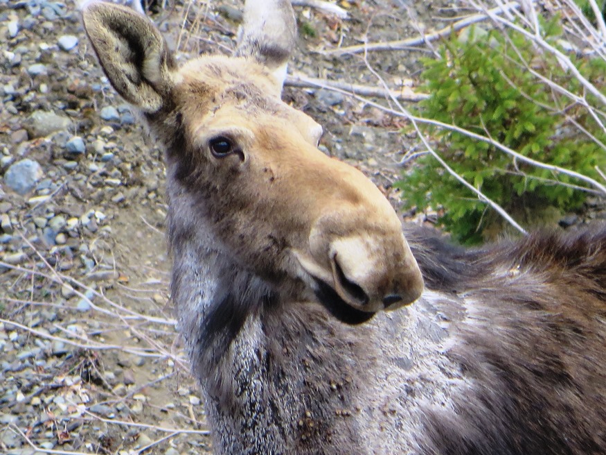
Moose in the Gravel Pit off the Pit Road in T9 R8 WELS (2015) Roads Pinkham Road is the main artery in this township from northeast to southwest. Craigville Road joins Pinkham from the east, just south…
Maine Forest Service on the Pinkham Road (2015) @ A Maine Forest Service Station on the Pinkham Road in the south of the township, is adjacent to Brown Brook which crosses the road there. It seems to be a remote outpost with no other station for many miles. Presumably the brook would provide water for…
Area of TA R10 Township as represented in the 1952 Topographic Map. This township is immediately adjacent to T1 R11 WELS, host to the next northerly section of the AT. The trail generally tracks east-west, except for a short northwest-southeast section between Mud Pond and Lower…
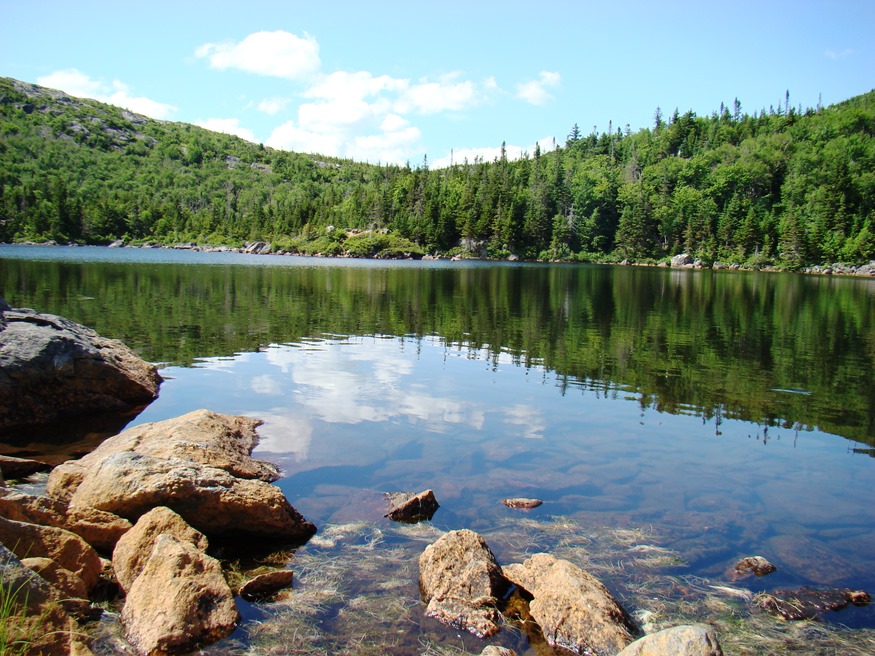
View from Little Boardman Mountain (2007) The township is immediately west of TA R10 WELS, host to the next northerly section of the Appalachian Trail. Heading south, the AT follows Cooper Brook to Crawford Pond, the to the East Branch of the Pleasant River. Two AT shelters may be found in the township, one in…
The township is immediately adjacent to T1 R11 WELS, host to the next northerly section of the AT. The Appalachian Trail cuts briefly through the southeast corner of the township, also known as Shawtown. Shawtown is a very watery township, with four of the Roach Ponds and First, Second, Third, and Fourth West Branch Ponds.…
Talmadge, and Waite on its eastern boundary, are small towns that have functioned often as a single community. The Waite post office serves Talmadge; the “dump” and cemetery in Talmadge served both towns. U.S. Route 1 passes by in the town of Waite to the east, crossing only a small section of Talmadge in the northeast.
A view from the Appalachian Trail on ridges in TB R11 WELS (2007) This township, in Piscataquis County, is immediately southeast of TA R12 WELS, host to the next northerly section of the Appalachian Trail. The AT briefly (about two miles) passes through the northwest corner of the township as…
At the western terminus of Maine Route 43, Temple, with its cluster of small mountains and small ponds, lies just northwest of Farmington. Settled in 1796, it was the site of an early and strong community of Quakers. In the 19th century, though largely a farming community, it was home to three sawmills, an excelsior and stave mill, a grist mill, and a carriage factory.
is a village in the Town of St. George in Knox County, incorporated on February 7, 1803 from a portion of Cushing. In 1865 it ceded some land to South Thomaston. Maine Route 131 from Thomaston runs along the eastern portion of St. George and passes through Tenants Harbor village, about halfway to the tip…
Just southwest of Rockland, the community lies at the point where the St. George River broadens into a long narrow bay. Ship building and shipping were the basis of its fortune and that of the two millionaires (of seven in the whole country) who lived there in 1840. Thomaston has many surviving fine homes, developed by financially successful residents, on its main street.
Settled in 1772, the town lies southeast of Unity on Maine Route 139. See photos. While once a farming community, as most Maine towns, Thorndike counted the railroad as a major element in its economy. The remains of that era are obvious in the village. The Belfast and Moosehead Lake Railroad was the latest to use the line.
The village is at the intersection of north-south U.S. Route 1 and east-west Maine Route 6. Logging and hunting are major activities in this rural community. Topsfield has substantial resources in the long shoreline of Baskahegan Lake and the two smaller lakes: East Musquash and Farrow.
Recently the downtown (see photos) has witnessed a renewal with modern buildings. Topsham has been a very rapidly growing community both in population and in commercial development.The area of the Topsham Fair Mall is located adjacent to Interstate 95. Pejepscot Village was once an active community when the Pejepscot Paper Mill was in full production. Falls in the Androscoggin River between Topsham and Brunswick encouraged the development of paper and textile mills which dominated the economy into the 20th century.
Annual Report of the Superintending School Committee and Superintendent of Schools I herewith submit my second annual report as Superintendent of the Schools of the town of Topsham. This is the twenty-first report since the organization of the Brunswick-Topsham District. It is designed by a report of this kind to bring to the attention of…
Here are sample town warrants, school and health reports from a variety of times and places. Many more are available at the Maine State Library and the Maine State Archives in Augusta. Such documents give an insight into the concerns about, and responses to, the problems faced by local communities. School Report from Topsham Annual…
Detail of 1940’s Township C Topographic Map This oddly shaped, [click Location Map for red location] trapezoidal township, not to be confused with the triangular C Surplus, is immediately west of Township D, host to the next northerly section of the Appalachian Trail. The trail travels about one mile in the township’s southeast…
Beaver Pond on Route 17 in Township D 1940’s Township D Topographic Map This township is immediately west of Township E, host to the next northerly section of the AT. The Trail enters at the northeast corner…
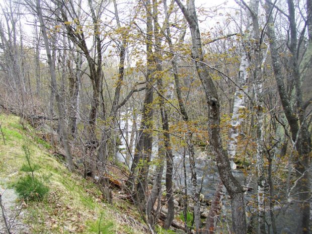
Sandy River at Smalls Falls and Roadside Picnic Area on Route 4 (2007) Township E is south of Sandy River Plantation, host to the next northerly section of the AT after Township D. (E Township is a different township in Aroostook County.) Township E, almost triangular in shape, extends eight miles from Long Pond in…
Townships is the designation of minor civil divisions that have no organized local government, such as a plantation, town or city.
School Bell Commemorating the Maine Unorganized Territory School System (2001)
Bell Recalling the Unorganized Territory School System (2001)
Townships in Maine are administered directly by the State government. Taxes are due directly to the State Bureau of Taxation, with funds disbursed to support township services such as schools. They have names or may simply be designated by a township and range identification, such as T3 R4 WELS or T5 ND BPP. T stands for township, and R indicates a range. More abbreviations are here.
 N46° 23")
 N46° 23")


 N45° 19")

")