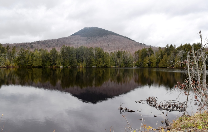
Mount Katahdin TWP

Baxter Peak, Mount Katahdin, January 1, 2012)

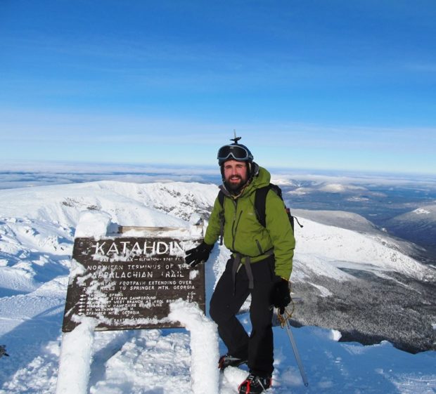
After a trip of four to six months, depending on interests, style, and luck, the north-bound Appalachian Trail “thru hiker” finally arrives at Mount Katahdin’s summit in Mount Katahdin Township in Baxter State Park. Mid-October is the deadline for unrestricted permission to climb the mountain. In 2007 an early snow and resulting ice delayed the…

T3 R10 WELS

      APPALACHIAN TRAIL – ABOL BRIDGE TO DAICEY POND Abol Bridge is located on the Golden Road over the West Branch of the Penobscot River in township T2 R10 WELS. A private campground and general store sits just outside the boundaries of Baxter State Park and is a major destination for those hiking to…

T2 R10 WELS

Nesowadnehunk Falls on the Penobscot West Branch (2018)

Nesowadnehunk Falls on the Penobscot West Branch (2018)     Three Routes This township, officially known as T2 R10 WELS, is the crossroad of two major “highways” in Maine: The Golden Road and the Appalachian Trail. Both travel the Abol Bridge over the West Branch of the Penobscot River. The Golden Road From east of…

T1 R11 WELS

Detail of 1952 Jo-Mary Mountain, Quadrangle Topographic Map

The township is completely within a tract of Maine Public Reserve Land and lies immediately south of Rainbow Township, host to the next northerly section of the Appalachian Trail. Traveling south, hikers encounter Nesuntabunt Mountain and Nahmakanta Lake that reaches back into Rainbow Township. According to a 1960 survey, Nahmakanta (Abenaki for “plenty of fish”)…

T1 R10 WELS

1952/1949 Topographic Map of T1 R10 WELS

The township is immediately adjacent to T1 R11 WELS, host to the next northerly section of the AT. Traveling south, hikers continue along the southern shore of Nahmakanta Stream and Pemadumcook Lake. The trail then turns south, skirting the eastern edge of steepest portion of Potaywadjo Ridge to the shore of Lower Jo-Mary Lake.  The…

TA R10 WELS

Area of TA R10 Township as represented in the 1952 Topographic Map.

                  Area of TA R10 Township as represented in the 1952 Topographic Map. This township is immediately adjacent to T1 R11 WELS, host to the next northerly section of the AT. The trail generally tracks east-west, except for a short northwest-southeast section between Mud Pond and Lower…

TA R11 WELS

View from Little Boardman Mountain

View from Little Boardman Mountain (2007) The township is immediately west of TA R10 WELS, host to the next northerly section of the Appalachian Trail. Heading south, the AT follows Cooper Brook to Crawford Pond, the to the East Branch of the Pleasant River. Two AT shelters may be found in the township, one in…

TA R12 WELS

1952 TA R12 Topographic Map

The township is immediately adjacent to T1 R11 WELS, host to the next northerly section of the AT. The Appalachian Trail cuts briefly through the southeast corner of the township, also known as Shawtown. Shawtown is a very watery township, with four of the Roach Ponds and First, Second, Third, and Fourth West Branch Ponds.…

TB R11 WELS

A view from the ridges in TB R11 WELS 2007

          A view from the Appalachian Trail on ridges in TB R11 WELS (2007) This township, in Piscataquis County, is immediately southeast of TA R12 WELS, host to the next northerly section of the Appalachian Trail. The AT briefly (about two miles) passes through the northwest corner of the township as…

Gulf Hagas

Long view of Gulf Hagas with Forested Cliffs

Gulf Hagas and The Hermitage are both located in the Bowdoin College Grant East, T7 R10 NWP, an unorganized township east of Greenville and northwest of Brownville. The area is part of the Appalachian Trail corridor owned by the National Park Service. Approaches from each town are over a private logging road on which control…

T7 R9 NWP

Historic Topographic Map of T9 R9

This township is immediately south of the Bowdoin College Grant East, host to the next northerly section of the AT. The Trail (red dots on the maps) runs from East Chairback Pond, over Chairback Mountain, past West Chairback Pond to Third Mountain and Fourth Mountain in the western edge of the township. In the 1940’s…

Elliottsville Township

Little Wilson Stream

Incorporated as a town, February 19, 1835,its incorporation was repealed May 26, 1858. Later reorganized as a plantation, January 3, 1887, it was deorganized March 31, 1983. Elliottsville is home to more than a dozen small ponds and the three-mile long Lake Onawa. The lake and southern portion of the township is accessible on the…

Monson

Monson Birdseye View 1889

The Appalachian Trail runs along the northwestern portion of Lake Hebron, then veers north toward the Doughty Ponds. See photos. In Maine, “Monson” often means “slate” to those who know that its high quality products have been shipped worldwide.

Bowtown Township

Pierce Pond in

Pierce Pond in Autumn (2007)   Bowtown Township is bound by the Kennebec River on the east for six miles, across the river from The Forks, and by the Dead River on the north. Dead River Mountain and Otter Pond Mountain reside within the township. Known as T1 R4 BKP WKR township, it was organized…

Pierce Pond Township

An Appalachian Trail Hiker Savors the Colorful Fall View

             An Appalachian Trail Hiker Savors the Colorful Fall View [PEERCE POND] a township in Somerset County, is home to all but a small portion of Pierce Pond, all of Upper Pierce Pond, Grass Pond and half of Kilgore Pond, which it shares with Bowtown Township to the east. Pierce…

Wyman Township

The Horns Pond on Bigelow Mountain (2003)

The Bigelow Public Reserve Land tract is located in Wyman Township, Bigelow Township, and Dead River Township in Franklin and Somerset counties. All three townships are contiguous and lie just south of Flagstaff Lake. East of Stratton in the town of Eustis, about 40 miles north of Farmington, it holds over 36,000 acres of public…