 Baxter Peak, Mount Katahdin, January 1, 2012)

The Knife Edge and Beyond

Chimney Pond in the Great Basin

Chesuncook Lake from the Peak

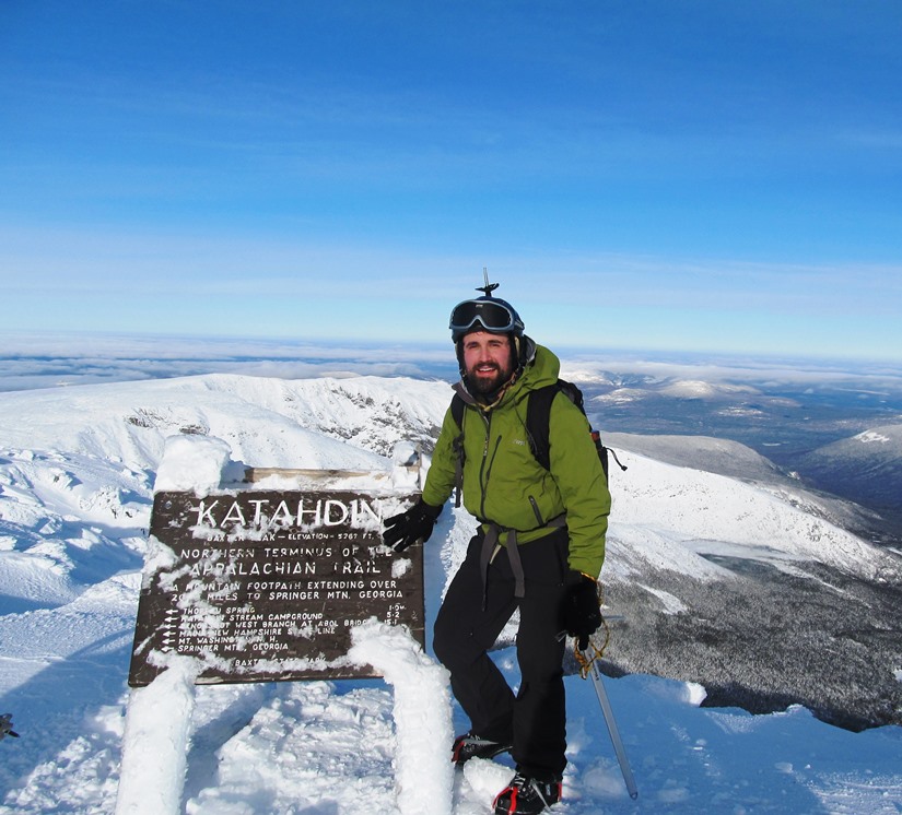
Hikers Atop Baxter Peak
After a trip of four to six months, depending on interests, style, and luck, the north-bound Appalachian Trail “thru hiker” finally arrives at Mount Katahdin’s summit in Mount Katahdin Township in Baxter State Park.
Mid-October is the deadline for unrestricted permission to climb the mountain. In 2007 an early snow and resulting ice delayed the ascent until October 17th. During the wait for the peak to open, a substantial number of trekkers assembled expectantly in at the base of the Hunt Trail, the final extension of the AT.

West from the Edge of the Tableland
In any season, the ambitious “summiteer” is rewarded with spectacular views and a thorough aerobic workout. Enjoy these images of the October 17, 2007 ascent of Maine’s “greatest mountain” – Katahdin. Where has all the lush green gone?
The Hunt Trail is only one of several routes to the top, but this is the only official Appalachian Trail path. It travels for over three miles through a spruce forest and up the steep, rocky “Camel Hump,” before breaking out on the “Tableland,” a flat, often windswept, moonscape-like expanse that leads to Baxter Peak – the summit.

East from the Tableland
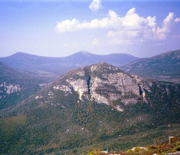
On the way to the peak, one passes Thoreau Spring (named for Henry David Thoreau who climbed the mountain in 1846). A sign announces the location and frequently water is present. Views from the top identify the many features of the mountain, such as the Knife Edge and Chimney Pond.
Finally, the peak sports an official AT sign announcing “Katahdin, . . . Northern Terminus of the Appalachian Trail.” Here is where the photos are taken and backs are slapped in congratulations for surviving the miles, the months, the weather, and the terrain between Springer Mountain and Mount Katahdin. See more in the Katahdin Winter gallery.

The Tableland

East from the Tableland

Tableland, Baxter & So. Peaks
![]() <= South Appalachian Trail – click a boot North =>
<= South Appalachian Trail – click a boot North => ![]()
The Hunt Tail is named for William Hunt who built the Hunt Farm in the area in 1835. It became a source of supplies and lodging for woods workers and travelers alike. It was south of the confluence of the Wassataquiok with the East Branch of the Penobscot.
The Owl from Katahdin (2009)
At the time it was “the last outpost of civilization on the East Branch.”* In 1845 an early hiker noted that the Hunt Farm was “a large, rambling place, partly built of logs and partly of frame.” In a clearing was “grass and grain covered sweeping down the hill to the river” a position which “is for picturesque beauty unsurpassable.” Hunt Mountain is clearly visible from the East Branch downstream from the Lunksoos Camps.
Additional resources
*Hakola, John W. A Legacy of a Lifetime: The Story of Baxter Park. TWB Books. Woolwich, Me. 1981.p. 14-15.