Archives, Maine State

Maine State Cultural Building in Augusta (2004)

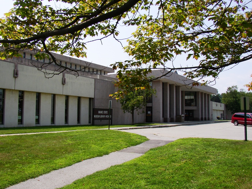
Maine State Cultural Building in Augusta with the State’s Archives, Museum and Library near the State House (2004) The Maine State Archives, located in Augusta, is the custodian of the permanently valuable records of state government, including early court records and vital records (births, deaths, marriages, etc.). According to its website, “The permanently valuable records…

Little Blue Heron

Little Blue Heron (2014)

A bird somewhat harder to find than the Great Blue Heron, the Little Blue Heron ranges from the Gulf of Mexico and along the Atlantic Coast to their northern most reach in Maine. They feed in marshes, tidal flats and even in some freshwater areas, nesting near wetlands. This one was observed in Winslow Park…

South Freeport

South Freeport is on the broad Harraseeket River leading to Casco Bay. Once a shipbuilding center, it now hosts the town’s public wharf, a marina, a boatyard, and the Harraseeket Yacht Club. Winslow Park on the Bay provides recreation and camping opportunities.

Stroudwater

Cumberland and Oxford Canal with Maine Historic Civil Engineering Landmark recognition

Stroudwater, a neighborhood in the City of Portland, lies west of the railroad tracks to the Westbrook border. Several locations of historical significance include the Tate House Museum, a portion of the Cumberland & Oxford Canal, and an old dam on the Stroudwater River. It is a highly developed residential and commercial area.

Black Bridge

????????????????????????????????????????????????????????????????????????????????????????????????????

The 1909, 318-foot long truss bridge was built by Pennsylvania Steel Company of Steelton, Pennsylvania, replacing an earlier double-decker bridge.  It spans the Androscoggin River between Brunswick and Topsham. According to the website HistoricBridges.org: This double deck bridge is one of the most unusual and unique bridges in Maine due to its suspended highway deck…

Mayfield Township

Incorporated as a town in 1892, it deorganized in 1937. This township is just north of Brighton Plantation, with Mayfield Corner being the intersection of Routes 16 and 151 and the site of a village in the 19th century. It has private frontage on Otter Pond, Mayfield Pond and Kingsbury Pond. According to a report…

Cathance River Preserve

The Cathance River Preserve is one of several preserves in Sagadahoc County.  Managed by the nonprofit Cathance River Education Alliance, it features summer camps, educational programs, and research.  Its Ecology Center is a learning facility that is itself a model of ecological sensitivity. Located in Topsham, the preserve offers several trails available from dawn to…

Bald Mountain Township T4 R3 NBKP

Mud Pond with view of Boundary Bald Mountain near the Bald Mountain Road in Bald Mountain Township (2014)

The township is north of Moose River in northwestern Somerset County. It should not be confused with Bald Mountain Township T2 R3 BKP EKR, which contains a section of the Appalachian Trail, in northeastern Somerset County east of Caratunk. The township apparently was once a Plantation. The U.S. Census reports four years of population counts:…

Johnson Mountain Township

Hill near the Cold Stream Mountain Road in Johnson Mountain Township (2014)

For travelers driving north from The Forks to Jackman, and maybe Quebec, Johnson Mount Township is probably just another strip of U.S.Route 201 through the woods. However, for the adventurous seeking a mountain to climb, waterfall or a primitive campsite by a stream, the rewards are nearby.  Johnson Mountain is accessible off the (unimproved) Enchanted…

Mud Brook Canoe Trip

April Canoe Launch site in August 2014

Mud Brook, with origins in Stacyville, flows south into Herseytown Township and then to Soldiertown Township in Penobscot County where it joins the Penobscot River East Branch. In April 2014 the brook was still at spring flood stage, making access from Route 11 an opportunity for a short trip.  Scout Brady Williams identified the spot…

EBEEMEE Township

Pleasant River East Branch, outlet of Lower EBEEMEE Pond in EBEEMEE Township (2014)

Just north of Brownville on Route 11, this township contains the East Branch of the Pleasant River which feeds the connected West Pond, Pearl Pond and Ebeemee Lake. Small year-round and seasonal cottages are located on the access roads and on the shorelines.                        …

T3 Indian Purchase Township

Bridge over Waterway linking Elbow Lake with Quackish Lake (2014)

The Township wraps around the southern, eastern and northern portions of Millinocket. T4 Indian Purchase Township is adjacent west of T3. The Golden Road and Route 11 from Millinocket are the two improved roads in the township. Bridge over Waterway linking Elbow Lake with Quackish Lake (2014) @ T3 encompasses all of Elbow Lake and…

Red Fox

The average weight of a male red fox is about 12 lbs; females are slightly smaller. They become sexually mature at 10 to 11 months. They breed annually from December through March. The average litter, born during March and early April, contains 5 pups. Both parents take part in raising the pups. Family groups stay…

Cold River Canoe Trip

Deer Hill Road Bridge (2014)

The Cold River Canoe Trip begins in the White Mountain National Forest in Stow, Maine, then to Fryeburg. The river has frequent twists and turns, channel blocking fallen trees, producing several “opportunities” for short portages. Follow Route 113 north from Fryeburg or south from Gilead to Deer Hill Road.  In less than a mile, the…

Prentiss, Somerset County

Location Map for Prentiss Township in Somerset County

an unorganized township in Somerset County, not to be confused with Prentiss Township T7 R3 NBPP in Penobscot County. As a result of the Maine Indian Lands Claim Settlement Act of 1980, the township is now Passamaquoddy Indian Territory. With few improved roads, access is from U.S. Route 201 in Sandy Bay Township from the Old Kelly Dam Road, which runs along the southern portion of Prentiss. several ponds provide fishing opportunities.

Maple Sugar

Maple Trees Tapped for Maple Syrup on Route 6 in Carroll Plantation (2014)

Maine has a significant portion of the maple sugaring and maple syrup industry with 14% percent of the U.S. production in 2014.  Vermont produced 40%, and New York, 18%. Big Six Township, in northern Somerset County, is said to account for roughly 23% of Maine’s maple sugar production and 4% of the U.S. total production.…