Orient

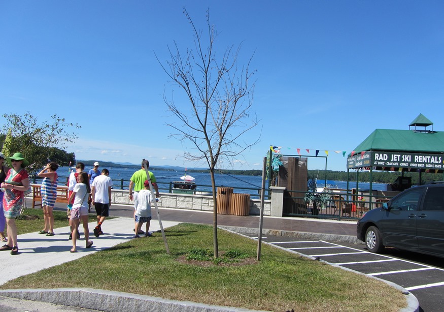
The name derives from its eastern location adjoining New Brunswick. Its eastern point lunges into Grand Lake and North Lake on the Canadian border, accessible by the Boundary Road. Sunset Park and other camping areas are attractive vacation locations. U.S. Route 1 runs north-south through the middle of the township. Orient village is just east of Route 1 on the Boundary Road.

Old Orchard Beach

See photos. Richard Boynthon settled the area in 1631 and hosted meetings of the councilors governing Sir Fernando Gorges‘ Province of Maine in the early 17th Century. Thomas Roger planted an apple orchard in 1638 that became known as “Rogers’ Garden by the Sea” by 1657. The Boston to Portland railroad passed within two miles of town in 1842 and the Grand Trunk Railroad connected Old Orchard Beach to Montreal in 1853, encouraging Canadians to visit the beach. By 1873 the Boston & Maine Railroad passed through the town, now served by Amtrak.

Ogunquit

Grand House on the Shore Road in Ogunquit overlooking Perkins Cove (2013)

Ogunquit, before 1980, was a village corporation and functioned for the most part as a town of its own, supporting its own police, fire, highway and sewer departments. The town is a well known actors and artists colony, featuring the historic Ogunquit Playhouse and beautiful beaches. Perkins Cove, south of the main village on Shore Road, combines a working waterfront, a restaurant, an art museum, and fine cottages.

Oakland

Waterville’s commercial strip that is Kennedy Memorial Drive continues into Oakland for about a mile before becoming a more scenic road. See photos. Here the village emerges as it sits at Messalonskee Stream. Long the home of the New England Music Camp, recreational opportunities include access to several of the Belgrade lakes.

Oakfield

Caboose near Oakfield Station on the Station Road in Oakfield (2012)

Originally settled in 1831 and organized for the assessment of taxes in 1866, the town itself was incorporated on February 24, 1897. See photos. The main village, is located on the Mattawamkeag River, just south of Smyrna Mills. Its mountainous terrain, known as the Oakfield Hills, earned it the name “Switzerland of the Aroostook” by one observer. Sam Drew Mountain is the highest point at 1,516 feet.

Northport

The modest Northport Music Theater features contemporary American musical theater. See photos. In addition to its long coastline facing Islesboro on Penobscot Bay, the town has frontage on the three-mile long Pitcher Pond and all of its Knight Pond. The historic Bayside village, of closely space summer cottages, lies off U.S. Route 1. St. Clair Preserve protects nearly all of unspoiled Knight’s Pond with 304 acres of mixed forest, bogs, swamps and fields has been home to black bears, bobcats, fishers, foxes, and deer.

Northeast Harbor

The Sunbeam at its Berth (2001)

is a community in Hancock County within the town of Mount Desert. Its namesake harbor sits at the northeast side of the entrance to Somes Sound, which splits the island of Mount Desert. Routes 3 and 198 serve the village, passing Upper Hadlock Pond in Acadia National Park.  The pond had been a source of…

North Berwick

Mill Buildings on the Great Works River (2002)

The North Berwick Woolen Mill is a historic landmark on the banks of the Great Works River that passes through the main village. See photos. More than a dozen National Register historic places testify to the town’s significant role in Maine’s early history.It is home to the historic Hussey Plow Company and a Pratt & Whitney defense plant.

Newry

Built in 1872, the Sunday River Bridge, called “he most painted and photographed covered bridge in the state,” crosses the river of the same name. See photos. The Sunday River Ski Resort is located here. On Maine Route 26, Newry is the gateway to the hiking trails, including the Appalachian Trail, of Grafton Township. Step Falls Preserve, the first preserve of the Maine Chapter of the Nature Conservancy, has 24 acres of cascades and pools.

Newport

Bird in its safe habitat near the Sebasticook River in North Newport (1014)

Newport features the six-mile long Sebasticook Lake, providing recreational opportunities for residents and summer visitors. Drought conditions in 2002 lowered the water level substantially. See photos. Prior to the opening of what became the Maine Central Railroad in 1855, Newport was a center of stage coach transportation. Newport is still a heavily traveled crossroads, now of Interstate 95, U.S. Route 2, and Maine Routes 7, 11, and 100. The area east of Sebasticook Lake is known as East Newport.

Newfield

The old center of Newfield village was destroyed by the great forest fire of 1947. See photos. The Willowbrook Historic District covers this area and the buildings that survived the fire. In 1984 the application to establish the historic district reported “Very little change in the buildings or landscape has occurred in the last one-hundred years so that the sense of time and place of a remote southwestern Maine rural community of the 19th century remains strongly present.” At the source of the Little Ossipee River, and dotted with ponds and streams, Newfield is a rapidly growing community about twenty miles northwest of Sanford

Newcastle

Deer Meadow Brook from Frank Steele Woods in South Newcastle (2011)

Damariscotta Lake is a major destination for adult alewives with intentions of spawning the next generation. The fishway near the dam at Damariscotta Mills in Newcastle provides access to and from the lake. See photos. Newcastle, located on U.S. Route 1 just west of the Damariscotta River, is home to Maine’s oldest Catholic Church, St. Patrick’s, completed in 1808. Several nature preserves in Lincoln County are in Newcastle. Nearby Great Salt Bay is protected by Maine legislation and is the state’s first marine shellfish protected area.

Newburgh

Small Waterfall on the West Branch of Souadabscook Stream (2014)

Settled in about 1794, the town is on the old stage route from Bangor through China to Vassalboro near Augusta. Newburgh Center village is on combined U.S. Route 202 and Maine Route 9. See photos. The Kennard Road hiking trail, originally developed by the Newburgh Heritage Trust, is a one-mile walk, with parking available.

New Sweden

Little Madawaska River, a tributary of the Aroostook River, crossing Jemtland Road in New Sweden (2016)

After the Civil War, Maine, like other states, was losing population to the great westward migration. A conscious public policy of encouraging Swedish immigration resulted in the very successful settlement of Swedes in New Sweden. Just northwest of Caribou on Maine Route 161, the town is just south of Stockholm.

New Sharon

1916 Bridge over the Sandy River in New Sharon (2003)

just east of Farmington, has been growing consistently in population over the past four decades. New Sharon village straddles the Sandy River, which winds through from Farmington on its way to Starks and then Norridgewock where it enters the Kennebec River. The 1916 steel bridge, now retired from service, crosses the river at the end of the main street.

New Portland

Bridge over the Carrabassett River in New Portland (2017)

North New Portland hosts Morton’s Country Store, the Community Church, and Chase Memorial Hall. This village lies at the junction of routes 146 and 16, with Gilman Stream, and its Dam, flowing through it. See photos. The Carrabassett River, with its spectacular rocky bed, passes through East New Portland Village and under an arch bridge.

New Gloucester

Pineland Farms near the Intervale Road in New Gloucester (2013)

home for Pineland Center from 1908 to 1996, that facility for the mentally retarded was known as the “Maine School for the Feeble-Minded” and later as the Pownal State School. See photos. It has been redeveloped as an office park. The multiple-use campus hosts professional, educational, and civic organizations, along with a conference facility. Pineland Farms and its Equestrian Center are major facilities nearby.

Naples

Long Lake on Route 302 in Naples (2013)

Blessed with ample access to Long Lake, Sebago Lake at the intersection of U.S. Route 302 and Maine Routes 11, 35 and 114, Naples has long been a vacation resort community. See photos. Henry Wadsworth Longfellow and Nathaniel Hawthorne have sung its praises. The Songo Lock, built about 1830 and now shared with the town of Casco, linked Long Pond and Brandy Pond with Sebago Lake

Mount Vernon

The village of West Mount Vernon, with a small church and fire department, is located at the north end of Echo Lake and the south end of Taylor Pond. See photos. In 1926, the novelist Erskine Caldwell moved to an old farmhouse in Mount Vernon, where he lived until the early 1930’s. The main village, Mount Vernon, is in the north of the town on Minnehonk Lake.