Raymond

Jordan Bay across Wetlands in Raymond (2003)

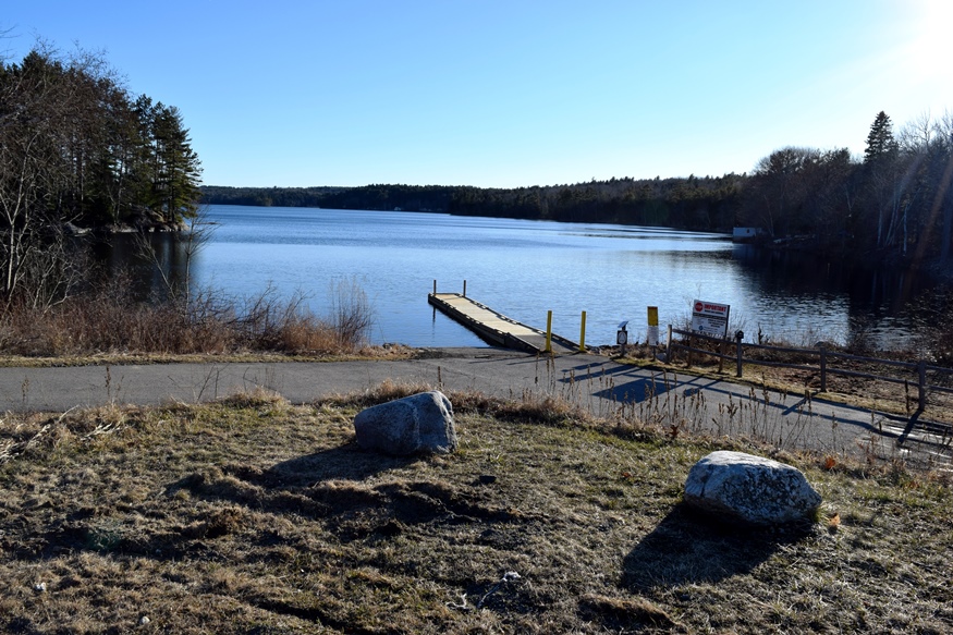
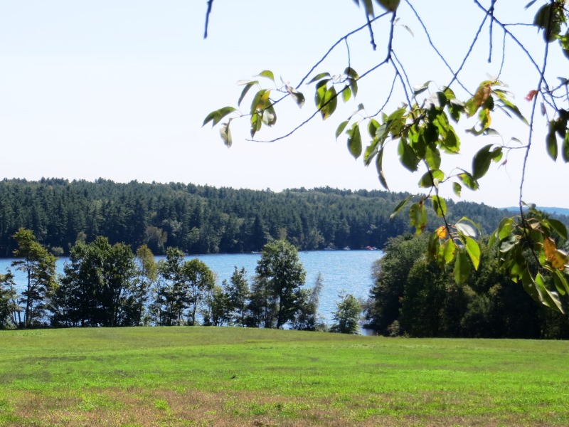
The main village is located at the head of the large, well protected, Jordan Bay on the shore of Sebago Lake. Adjacent Raymond Neck extends over four miles into the Lake to form the Bay. Raymond’s “welcome” sign entices fishing enthusiasts to the “Home of the Landlocked Salmon,” which inhabit the lake. Nathaniel Hawthorne spent summers at his mother’s home.

Rangeley

Rangely Lake (2001)

The town is at the center of the Rangeley Lakes Region with many hotels, campsites, boat launching facilities and recreational opportunities. See photos. The region was the setting for Louise Dickenson Rich’s 1942 book We Took to the Woods. It hosts Hunter Cove nature preserve and Bald Mountain public reserved land.

Prospect

on the west bank of the Penobscot River, across from Bucksport, the main village is at the junction of Maine Route 174 and U.S. Route 1A, near the South Branch of the Marsh River. Prospect is home to Fort Knox, built in 1844 with Mount Waldo granite from Frankfort and named for Henry Knox, the first U.S. Secretary of War.

Presque Isle

Presque Isle Birdseye View 1894

With many fine houses and a historic downtown, Presque Isle has its commercial strip like so many other communities. See photos. The University of Maine campus here provides educational and cultural opportunities for area residents. Aroostook State Park is located at the southern end of the town, on Echo Lake. The French presque isle means “almost an island,” based on the twists and turns of the Aroostook River and the Presque Isle Stream.

Pownal

Location Map for Portland

Bradbury Mountain State Park offers picnicking, a modest walk to the summit, and a historic cattle pound. See video and photos. “Pineland Center ” is a community of non-profits and local businesses. Most of the town is rural residential, with homes and a few farmhouses widely spaced along the local roads. The few commercial establishments are clustered in Pownal Center Village.

Porter

Ossipee River in Porter from Routes 25 and 160 (2014)

The main village, Kezar Falls, shares its name with the other half of the community located across the Ossipee River in Parsonsfield, York County. Built in 1876, the two-span 152-foot covered bridge above crosses the Ossipee River. The town, which borders New Hampshire, is served by Maine Routes 160 and 25 (also known as the Ossipee Trail).

Poland

The Spring House at Poland Spring (2003)

The Poland Spring Bottling Plant and Spring House are local landmarks. See photos. The town, just west of Auburn, has two other large lakefront areas and is served by Maine Routes 11, 26, and 122. One of water bodies is home to Range Pond State Park. The town, just west of Auburn, has two other large lakefront areas. One of water bodies is home to Range Pond State Park. The Maine State Building was built to represent the state at the Chicago World’s Fair, known as the Colombian Exposition, in 1893.

Pittsfield

Pittsfield 1889 "Bird

Maine Central Institute, founded in 1866 as a preparatory school for Bates College, is one of the “Big 10” private secondary schools in Maine that still serves the public school population as well. See photos. Downtown Pittsfield, on the Sebasticook River, was wiped out by a fire in 1881 and rebuilt immediately. As did many Maine communities, Pittsfield’s woolen mills provided steady employment during the first half of the 20th century, then literally “went South,” finding cheaper labor in the 1950’s.

Phippsburg

Dunes at Popham Beach in Phippsburg (2006)

Even before it was incorporated, the community had its church (see photos), which was organized in 1765 and built in 1802. The tip of Phippsburg at the mouth of the Kennebec River is the site of the first English attempt at settling New England: the Popham Colony of 1607-1608. Fort Popham and Fort Baldwin, rise as a guardians of land upriver. Coxes Head, which juts out into the Kennebec River.

Phillips

Mountain View from Route 4 in Phillips

The Sandy River-Rangeley Lakes Railroad, which transported people and forest products to and from the north woods, was once headquartered in the town. See photos. As the Sandy River passes through the village, the river bed appears as frozen sand, almost bone-like in its strange shapes. A canoe trip from here to Farmington begins well below the bridge. Outdoors woman, columnist, and promoter of outdoor sports in Maine, Cornelia “Fly Rod” Crosby was born here.

Indian Reservation, Penobscots

Indian Island in the Penobscot River (2005)

The Reservation in Penobscot County, is the home of the Penobscot Tribe of Maine’s Native American population, and is located on Indian Island in the Penobscot River and within the boundaries of the community of Old Town. See photos. The Penobscot Nation Council, headquartered on the Island, is composed of elected members, lead by a Chief and a Vice Chief. It is the birthplace in 1871 of Cleveland Indians baseball player Louis Sockalexis. Dancer and entertainer Molly Spotted Elk was born here in 1903.

Pembroke

"The Square Pembroke, Me." (postcard c. 1905)

The town was noted for its shipbuilding, which began in 1825. By 1860 Pembroke had seven shipyards, though only two survived by the late 19th century. Pembroke’s Leighton Neck extends into Cobscook Bay and is bounded by the broad expanses of the Dennys River and the Pennamaquan River. Reversing Falls State Park is nearby. Beginning in Charlotte’s Pennaquam Lake and extending through Pembroke along the Pennaquam River is the Pennaquam Wildlife Management Area.

Patten

The Village from Route 11 Looking North (2006)

has continued its focus on lumbering since early settlement, including its informative Lumberman’s Museum on the Shin Pond Road. The Stetson Memorial United Methodist Church anchors the southern end of the main street. See photos. The small community has witnessed a dwindling population over the past several decades with the loss of jobs in farming, lumbering, and the paper industry. Patten is the northern gateway from Interstate 95 to Baxter State Park.

Passadumkeag

Passadumkeag River from the Railroad Bridge (2012)

The current village of Passadumkeag includes a small residential area east of U.S. Route 2. A community center (in a Quonset building), fire station, historical society, town office, post office, and the Passadumkeag Baptist are all on or near Pleasant Street in this small village.

Parsonsfield

Porter-Parsonsfield Covered Bridge over the Ossipee River (2014)

Kezar Falls, a village on the Ossipee River named for George Kezar, is the largest in the area at the junction of Maine Routes 25 and 160. The community is split between Parsonsfield and Porter across the river, and is governed and taxed separately by the two towns. An early 20th century sanatorium, Maple Crest, was “located among the beautiful Limerick hills, the wild and picturesque outlines of which may be seen in every direction from the building. The view is in itself enough to stimulate the interest and mental activity so important to the cure of all diseases.

Palermo

Boat Launch at Sheepscot Pond in Palermo (2016)

The town has three villages. Palermo, at the south end of Branch Pond, spills over into China and was once known as Branch Mills. Greely Corner is on Route 3 just west of Sheepscot Pond. East Palermo is on the same highway just east of Sheepscot Pond. Palermo is dotted with numerous ponds and streams, providing an attractive escape from business life in the Augusta and Belfast areas.

Oxford

Field Overlooking Thompson Lake in Oxford (2012)

Routes 26 (the commercial strip) and 121 serve the community. See photos. The Oxford Casino is on Route 26 in the south of town. Oxford village, at the north end of Thompson Lake, hosts the town office, post office, and a small veterans memorial park. The Congregational Church was established in 1806 and is listed on the National Register. Though famous for auto racing at Oxford Plains Speedway, the nearby Androscoggin River passes several sizable ponds and Thompson Lake abuts the main village.

Owls Head

The Knox County Regional Airport is located in Owls Head and is one of Maine’s busiest during the summer months. Owls Head State Park offers views of Penobscot Bay and the nearby Owls Head Transportation Museum contains vintage aircraft frequently flown over the Bay. Owls Head Light Station marks the southern entrance to Rockland Harbor.