Abandoned

Abandoned Farmhouse in Westfield (2003)

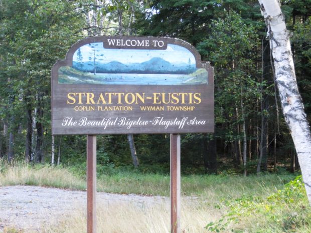
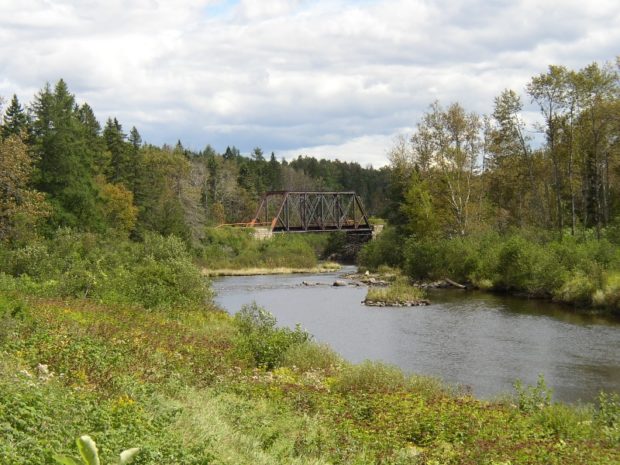
Relics of farmhouses hint at the glory days of Maine’s agricultural tradition. In remote villages, scenes of abandoned homes, churches, and vehicles mark changes in communities as populations ebb. The landscape is littered with these ghosts of Maine’s past, recalling a lost civilization but evoking questions of their secrets.            …

Harpswell Center

Widgeon Cove Trail in Harpswell Center (2014)

During Harpswell’s early settlement and before a bridge connected it to the rest of the town, Harpswell Neck was the site of several small villages.  Harpswell Center hosted a church, the 1759 meetinghouse (later the town office), a 200-year plus old cemetery, and a 1793 cattle pound. The cemetery is  the site of “The Witch…

Pittston Academy Grant

Pittston Farm Sign on the Northern Road (2008)

This township is mostly south of the Golden Road where the Northern Road turns down toward the Pittston Farm, established by the Great Northern Paper Company. According to John Gould, In lumber camp lingo a “farm” is a depot and base of operations serving a considerable area of working timberland.  Pittston Farm had storage sheds,…

Stratton

Stratton is a village in the town of Eustis. It is the main village with a small commercial area and civic facilities, including the town office, fire department, library, and post office. The Oramendal Blanchard House, home to the local sawmill owner in the late 19th century, is on the National Register of Historic Places.

Gould, Samuel W.

Samuel Wadsworth Gould (1852-1935) a U.S. Representative, was born in Porter on January 1, 1852. He moved with his parents to Hiram, attended the public schools and North Parsonsfield Seminary, was graduated from the University of Maine in 1877. He studied law, was admitted to the bar and began his practice in Skowhegan in 1879.…

York

1787-1794 John Hancock Warehouse and Wharf in York (2018)

Most of the town’s inhabitants are located between U.S. Route 1 (inland) and U.S. Route 1A which runs along the coast. Its population has more than doubled in the past thirty years, and grew by nearly 31 percent between 1990 and 2000. Beaches and cottages characterize the coast.

Willimantic

Location Map for Willimantic

Located on the western end of Sebec Lake, the town offers many camping and fishing opportunities. Packard Landing was the location of Packard’s Camps in the late 19th and early 20th centuries. Maine Route 150 runs north from Guilford and terminates at the village of Sebec Lake, not to be confused with the town of Sebec at the far eastern end of the Lake.

Westbrook

Immediately west of Portland but part of the Portland metropolitan area, Westbrook is home to industrial, professional, and commercial enterprises, as well as to a campus of Husson University. Flowing through the city is the Presumpscot River, whose name means “many rough places river. ” Now the 12th largest community in Maine by population, it was edged out of its 1990 11th largest position by Saco in the 2000 Census.

Port Clyde

Port Clyde (2005)

Port Clyde is a village in St. George at the southern tip of its long peninsular. Port Clyde has long been an attraction to artists, including N. C. Wyeth, and tourists, who can take the ferry to Monhegan Island, visible in the distance. It is a base for lobster fishing and fin fishing. The village…

Togus

National Home for Disabled Soldiers (Eastern Branch) c. 1880

                                                                    The National Home for Disabled Soldiers (Eastern Branch) Togus c. 1880 The Togus Veterans Administration Medical and Regional Office Center, as…

Thomaston

Just southwest of Rockland, the community lies at the point where the St. George River broadens into a long narrow bay. Ship building and shipping were the basis of its fortune and that of the two millionaires (of seven in the whole country) who lived there in 1840. Thomaston has many surviving fine homes, developed by financially successful residents, on its main street.

Sumner

Increase Robinson Library (2013)

East-west Maine Route 219 serves Pleasant Pond and the villages of West Sumner and East Sumner on its way from West Paris to North Turner. See photos. After booming for decades, the town was crippled by the Great Depression and eventually by the loss of the railroad in 1952. From Buckfield to Turner, the river is a corridor for canoe trips.

Stockholm

Named for the Swedish capital, the village lies on the Little Madawaska River, just off Maine Route 161 and just north of New Sweden, also part of the Colony. The village, essentially off the main highways, is not “on-the-way” to anywhere. This small community, with a continued significant reliance on agriculture and a declining population, still supports three churches: Catholic, Baptist, and Lutheran.

Southwest Harbor

Location Map for Southwest Harbor

It lies on the southwest entrance to Somes Sound, diagonally across from Northeast Harbor, a village in the town of Mount Desert. Southwest Harbor has been both a fishing and summer resort community from its earliest days as a town. See photos. Maine Route 102 begins at entrance to Mount Desert Island and leads directly south to the main village of Southwest Harbor. Here the Wendell Gilley Museum celebrates the life and work of Gilley, a pioneer of decorative bird carving. South of the harbor, the small villages of Manset and Seawall face the entrance to Somes Sound and the Cranberry Isles.

South Berwick

Counting House Day Lily Memorial Park at the Salmon Falls River (2018)

Maine’s oldest educational institution, Berwick Academy, was established here in 1791 when the town was part of Berwick. See photos. South Berwick is the birthplace of Sarah Orne Jewett, who attended Berwick Academy for four years — her only formal education. The town is accessible to the coastal communities of York and Kittery via Maine Routes 91 and 236.

Sedgwick

The Deer Isle Bridge over Eggemoggin Reach between Sedgwick and Deer Isle (2003)

Eggemoggin Reach is a long stretch of water between the mainland and Deer Isle and Little Deer Isle. See photos. The Benjamin River provided tidal power to a grist mill near Sedgwick village. In addition the town had another grist mill, some saw mills, and two silver mining companies. Shipbuilding was yet another industry. Other villages are North Sedgwick, Sargentville, Black Corner, and Grays Corner.

Searsport

Albert V. Nickels House, now A. V. Nickels Inn, on south side of East Main Street, U.S. Route 1, in Searsport (2015)

The town has two areas with industrial potential on Penobscot Bay. See photos. In addition to substantial resources of the Penobscot Marine Museum, Searsport has recreational opportunities at Moose Point State Park on Penobscot Bay, and frontage on Swan Lake inland at the northwest corner of the town.

Sanford

Sanford, with Springvale Village, is the seventh largest town or city in Maine by population according to the 2010 Census, up from a ranking of ninth in 1990. Traditionally an industrial town, primarily with textile mills and shoe making, Sanford has diversified and continues to be a growing community.

St. Agatha

Farmland and the Village at Long Lake (2005)

Settled by Acadians, the name derives from the parish church that was established in 1890. Farming and lumbering have been this St. John Valley area town’s historic economic base. Located on the northwest shore of Long Lake, Maine Route 162 from Frenchville passes through the main village, then hugs the lake shore and continues along nearby Mud Lake.

Robbinston

Henrietta Brewer House, now Redclyffe Motel (2013)

has as its eastern border is the scenic St. Croix River and Passamaquoddy Bay. The main village is on U.S. Route 1 along the shore, where most of its population is located. Most of the western portion is undeveloped, with unimproved roads and several lakes and ponds.