Chester
a town in Penobscot County, settled 1823, incorporated 1834, its small population grew by almost 19 percent in the decade ending in 2000, and maintained its growth through 2010. See photos.
"Those seeking cold, hard statistics on Maine communities won't be disappointed." —Bangor Daily News
a town in Penobscot County, settled 1823, incorporated 1834, its small population grew by almost 19 percent in the decade ending in 2000, and maintained its growth through 2010. See photos.
in Franklin County, incorporated 1802, contains the Chesterville Wildlife Management Area featuring canoeing and hunting. The village of Farmington Falls is partly in Farmington and partly in Chesterville. See photos.
in Kennebec County near Augusta, incorporated 1818, is the birthplace of a member of Congress and a Quaker educator-author. China Lake, around which Quakers and Baptists settled in the early 19th century, dominates the community and its history as a recreational center. See photos.
in Penobscot County, incorporated 1848, settled in 1815, and recently growing in population, Clifton provides recreational opportunities, at the southeast end of Chemo Pond and Peaked Mountain, for the greater Bangor area. Fitts Pond in the southwest corner provides water access for Boy Scout Camp Roosevelt. See photos.
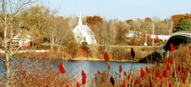
is a town in Kennebec County, incorporated under the name Maine in 1848. The following year, the confusing address “Maine, Maine” was changed. Across the Kennebec River from Hinckley lies the Pishon Ferry area, now served by a modern bridge. A small white church overlooks the river. See photos.
is a plantation in eastern Washington County organized in 1871. Recent population losses may threaten its ability to survive. Maine Route 6 links it to Vanceboro on the Canadian Border. This heavily forested area is subject to the “Eastern Interior Region Management Plan” of the Maine Department of Conservation. See photos.

in Washington County, incorporated 1796, is home to the “Great Heath” and the Pleasant River as it winds itself toward Columbia Falls. Natural resources drove the economy: logging, saw mills, fishing, boat building, bean farming and blueberries. See map and photos. U.S. Route 1 cuts the southeast corner of this small but growing community, bucking the trend of population loss in much of Washington County.

Year Population 1970 367 1980 517 1990 552 2000 599 2010 560 Geographic Data N. Latitude 44:40:23 W. Longitude 67:42:49 Maine House District 138 Maine Senate District 6 Congress District 2 Area sq. mi. (total) 24.7 Area sq. mi. (land) 24.5 Population/sq.mi. (land) 22.9 County: Washington Total=land+water; Land=land only [kol-UM-bee-ah FALLS] is a town in…
 N44° 57")
in Washington County, incorporated in1822. See photos. Blueberries are one of three fruits native to this area, the others are cranberries and grapes. Only blueberries are a commercial crop. Their fields, currently about 1100 acres, give Cooper its fine open areas and scenic views. Forest products has been another staple of the economy.
a plantation in Franklin County, organized in 1893, is just south of Flagstaff Lake on Maine Route 16. See photo. The South Branch of the Dead River flows through on its way to the lake. Two sections of Maine’s Public Reserved Lands, in the Flagstaff Region, lie within the plantation.
Year Population 1970 1,700 1980 1,887 1990 2,196 2000 2,145 2010 2,198 Geographic Data N. Latitude 44:56:44 W. Longitude 69:15:23 Maine House District 100 Maine Senate District 10 Congress District 2 Area sq. mi. (total) 39.4 Area sq. mi. (land) 38.7 Population/sq.mi. (land) 55.4 County: Penobscot Total=land+water; Land=land only …

in Penobscot County, incorporated in 1811. In 1886 it had three saw-mills, three shingle, one stave, two planing and two grist mills, one cheese-factory, one carriage and sleigh factory. Recently, Corinth Wood Pellets mill has taken advantage of this new form of heating fuel. Its population has had steady growth 1970-2010.
in York County, incorporated 1794, probably named for settlers from Cornwall, England. The main street features tourist attractions such as lodging, eating, and antiques. Cornish village is located where the Ossipee River feeds into the Saco River. Little River enters the Ossipee just before its link to the Saco. See photos.
in Somerset County, incorporated 1798, this growing community in a rural setting is just north of Skowhegan on Route 150. Several mills and a tannery were established on the Wesserunset River in the 19th century. See photos.
")
in Hancock County, incorporated 1830, requires ferries or water taxis to access. The 200 acre cranberry marsh on Great Cranberry Island influenced Governor Bernard in 1762 to name the town as it is. Little Cranberry hosts the Islesford Historical Museum; The Baker Island and Bear Island light stations provide navigation assistance near Acadia National Park. See map.
in Washington County, incorporated 1828, is located on Maine Route 9, following the tracks of the old Airline Stage Route. Crawford Lake occupies the center of the town, an attraction for fishing and recreation. See photos.
 N45° 57")
in Aroostook County, organized as a plantation 1878 and incorporated 1901. Its Thousand Acre Bog is considered one of Maine’s “Focus Areas of Statewide Ecological Significance.” See map. A pedestrian trail from Patten to Sherman winds through the bog.
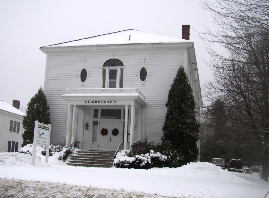
in Cumberland County, incorporated 1822, includes two islands in Casco Bay: Sturdivant and Basket. Basket Island, is a nature preserve of .9 acres of mixed forest and shell and gravel beaches. The town, a suburb of Portland, grew by almost 23 percent between 1990 and 2000, and continues its population growth. See photos.
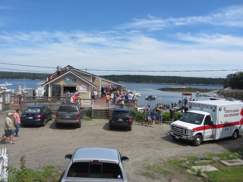
Cundys Harbor is a village within the town of Harpswell, in the area known as East Harpswell. It is located in the southeastern portion of this sprawling coastal town, on Sebascodegan Island. In 1985 the Maine Historic Preservation Commission described it thus: “Cundy’s Harbor is a small fishing village on a narrow peninsula of hilly…
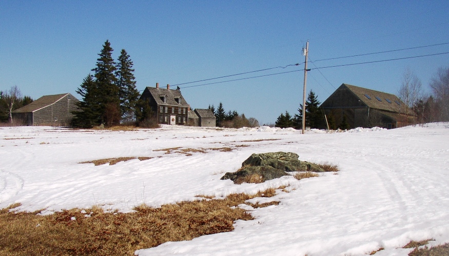
in Knox County, incorporated in 1789, is just south of Thomaston and lies on the western shore of the St. George River. It is famous as the home of Anna “Christina” Olson, Andrew Wyeth’s subject in his now classic “Christina’s World.” The weather beaten house overlooks the Georges River and the family cemetery.