Westmanland

Location Map for Westmanland

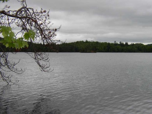
Located northwest of Caribou, this small community is accessible off State Route 161 that passes through nearby New Sweden. It was part of the “Swedish Colony” established in the 1870’s. The township is bisected with the Little Madawaska River flowing from southwest to northeast. A section of Maine Public Reserved Lands is a 965-acre original public lot, mostly covered by forest, near the southwest shoreline of lower Madawaska Lake.

Weston

Location Map for Weston

On the long shoreline of Grand Lake at the Canadian border, just north of Danforth, Weston has spectacular views with its extended coves, its adjoining Bracket Lake and nearby Longfellow Lake. About one-quarter of the town is covered by water.

Whitefield

Whitefield is west of Gardiner on Route 126 and north of Wiscasset on Route 218. See photos. The Sheepscot River flows through the town and is a popular canoe trip opportunity. As do many Maine towns with scattered villages, Whitefield has several volunteer fire departments: Coopers Mills, Kings Mills, and North Whitefield. St. Denis Catholic Church, west of North Whitefield on Maine Route 218, is on the National Register of Historic Places.

Whiting

The main village is located at the easterly end of the township where the Orange River flows into Whiting Bay at the Junction of U.S. Route 1 and Maine Route 189 to Lubec. A dam creates a pond on the river in the village. See photos. Cutler Coast Public Preserved Land, in Cutler and Whiting, contains almost five miles of dramatic cliff-bound ocean shore. Water abounds in Whiting’s the northern half, with many acres of lakes and ponds.

Whitneyville

Location Map for Whitneyville

On the west bank of the Machias River, it was the site where the vessel Margaretta was hidden from the British after her capture in 1775. Lumbering and blueberry growing have been the mainstays of the local economy over the years. See photos. The town is a long, narrow north-south mile-wide strip of land on U.S. Route 1A between Jonesboro and Machias.

Willimantic

Location Map for Willimantic

Located on the western end of Sebec Lake, the town offers many camping and fishing opportunities. Packard Landing was the location of Packard’s Camps in the late 19th and early 20th centuries. Maine Route 150 runs north from Guilford and terminates at the village of Sebec Lake, not to be confused with the town of Sebec at the far eastern end of the Lake.

Wilton

Location Map for Wilton

Located on the shore of Wilson Pond, the main village lies at the intersection of U.S. Route 2 and Maine Routes 4 and 156.. See photos. George H. Bass began making boots for farmers in 1876. For more than 100 years, the G. H. Bass company made footwear in Wilton.

Windham

The main village, North Windham, lies adjacent to Sebago Lake and on the shore of Little Sebago Lake at the junction of U.S. Route 302 and Maine Routes 35 and 115. See photos. While Route 302 is a long commercial strip, an old meeting house is adjacent to the Windham Union Church. Young adult offenders are held at the Maine Correctional Center in South Windham.

Windsor

Location Map for Windsor

Windsor’s village center clusters around the town office, the fire station, the Post Office, and Hussey’s General Store at the intersection of Maine Routes 32 and 105. The Windsor Fair attracts crowds each fall to this once agricultural, but increasingly residential, community east of Augusta.

Winn

Location Map for Winn

Winn village is on U.S. Route 2 between Lincoln and Mattawamkeag on the east bank of the Penobscot River. See photos. During the 19th century, International Paper Company harvested wood to supply its pulp and paper mills. Winn is an agricultural community slowly losing its small population as are many northern Maine towns.

Winslow

Winslow is on the east side of the Kennebec River, across from Waterville, on Routes U.S. 201 and Maine routes 32, 100, 100A, and 137. See photos. A reconstructed blockhouse of Fort Halifax, which incorporates many original timbers, stands on the fort’s original site.

Winthrop

Maranacook Lake in Winthrop (2013)

n addition to its recreational attractions, the town is a suburban community serving both the Augusta and Lewiston-Auburn areas. See photos. Winthrop is the birthplace in 1899 of Delphia Louis “Del” Bissonette, who played for the Brooklyn Dodgers.

Wiscasset

is on U.S. Route 1 and the Sheepscot River. See photos and videos. With many historic structures, the town was host to “The Greenland Expedition of 1925,” which included explorers Richard Byrd and Donald McDonald. Since 1918 Camp Chewonki has been offering outdoor programs here. The town was once best known for its Maine Yankee Atomic Power plant.

Woodland

Long view in Woodland on the Colby Siding Road (2003)

With little in the way of a central village, the town lies west of Caribou served by Maine Routes 161 and 228. See photos. Unable to find enough land in New Sweden, members of the Swedish Colony were granted 100 acre lots in Woodland. This northern community, in the heart of potato and forest product country, is not to be confused with the village of Woodland in the town of Baileyville.

Woodstock

Not the site of the 1960’s rock concert (that was New York), Woodstock’s major village is Bryant Pond, named from the adjacent water body. The Pond outlet is the source of the Little Androscoggin River. See photos. South Woodstock is home to the small South Woodstock Meetinghouse and is the site of an old mill pond and mill on Andrews Brook.

Woodville

Woodville Town Office on Route 116 in South Woodville (2020)

The town dominates the west side of the great bend in the Penobscot River just south of Medway where the East and West branches combine. Maine Route 116 leaves the River in Chester and cuts through Woodville to Medway.

Woolwich

Woolwich Shore on the Kennebec River from Thorne Head in North Bath (2010)

Woolwich, across the Kennebec River from Bath and with long shores on Merrymeeting Bay, is home to two nature preserves. Settled in the 1600s, it has several historic buildings. Alewives have been a historic part of the community.

Yarmouth

Yarmouth is a coastal town northeast of Portland on I-295 and U.S. Route 1. See photos. It is home to the Delorme Mapping Company and North Yarmouth Academy. Cousin’s Island is home to a large, oil fueled electric power plant known as Wyman Station. The Island has ferry terminal for Chebeague Island.