Berwick
")
a town in York County on the New Hampshire border, incorporated in 1713, named for an old English town in Dorsetshire. Settlements were made as early as 1624. In the mid-1600’s substantial lumbering began and a sawmill was built. In 1660 a group of Friends or “Quakers” sought refuge from persecution and settled here.

")
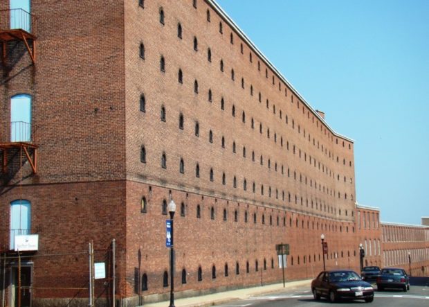
![Fine House and Barn on the Storer Road [Route 155] in Bradford (2014)](https://maineanencyclopedia.com/wp-content/uploads/140129189-Copy-2.jpg)
")