Wallagrass

Fish River at Soldier Pond Village in Wallagrass (2018)

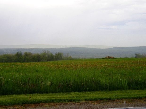
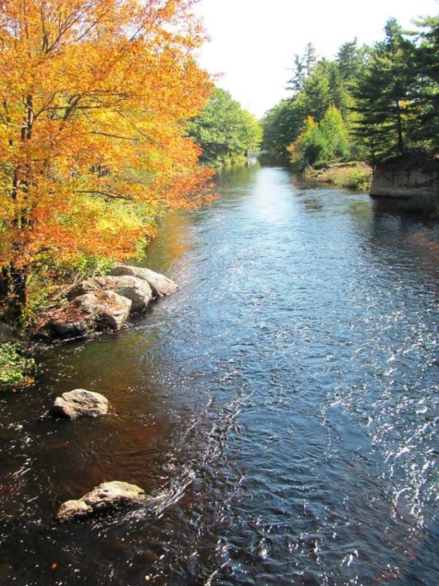
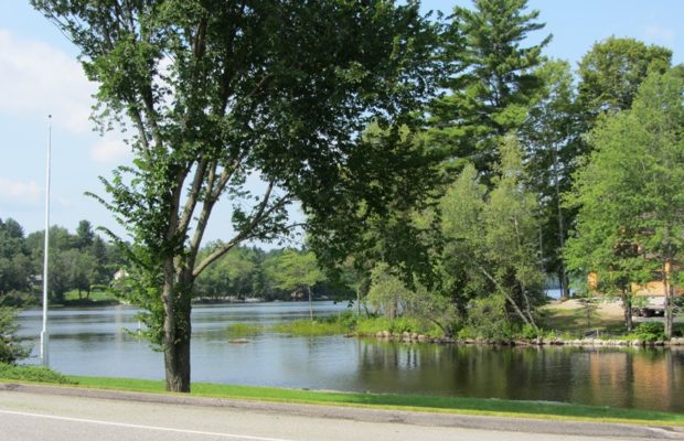
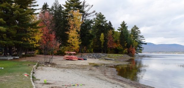
Settled by Acadians, the town lies just south of Fort Kent on the Fish River, whose Eagle Lake outlet is in the southern portion of the township. See photos. Wallagrass Station village is located at the southern end of the town, where Station Road leads to the shore of Eagle Lake.

Waltham

Maine Route 179 parallels the east side of Graham Lake. The frontage on this nine-mile lake, which also touches Ellsworth, Mariaville, and Fletchers Landing, has encouraged some developers to consider creating subdivisions near its shores. Route 200, also known as Cave Hill Road, connects the community to Eastbrook.

Warren

Farm on Route 235 on the shore of Seven Tree Pond (2003)

The village lies off the heavily traveled highways: U.S. Route 1 and Maine Routes 90, 131, and 235. See photos. Adjacent to Thomaston, long a synonym for “State Prison,” Warren is now the site of its replacement. Meadow Mountain is a 259 acre town forest that serves as a nature preserve.

Washburn

Location Map for Washburn

Long a potato growing and processing area, it lies northwest of Presque Isle on Route 164, which curves through the town and links it with Caribou to the northeast. See photos. Washburn’s main village is in the southwest near the Aroostook River, which crosses its southern portion. The villages of Bugbee, Crouseville, and Adeline are along the river on Route 164.

Washington

The 550-acre, four mile long Washington Pond is a major attraction for summer recreation. Also known as Medomak Lake, it is home to the Madomak Family Camp, started in 1904 as a boys camp. See amateur film. Razorville is a village on the southwest end of Washington Pond. The main village is near the eastern shore of the lake.

Waterford

Crooked River in East Waterford (2003)

The main village (see photos) lies on the shore of Keoka Lake, and State Routes 35, 37 and 118 provide easy access to lakesides, and to the larger communities to the south. The Artemis Ward House commemorates the birthplace of Charles Farrar Browne, the 19th century humorist. North Waterford, at the junction of Routes 35 and 118, is home to the town’s fairgrounds. The general store there provides gas and basic groceries.

Waterville

Waterville is a regional service center for northern Kennebec and southern Somerset counties. See photos. Its downtown and the Kennedy Memorial Drive commercial strip provide business and professional services. It has been home to several U.S. Senators and Maine governors. Colby College is here.

Wayne

has been characterized as “composed primarily of residences, small farms, seasonal and vacation homes, and limited retail and commercial development.” See photos. The main village lies between Pocasset Lake and Androscoggin Lake on Maine Route 133. Other substantial ponds add to the town’s recreational attractions.

Webster

This sparsely populated plantation in Penobscot county is primarily marshlands and streams, with the exception of Tucker Ridge and Pickle Ridge where Tucker Ridge Road and Pickle Ridge Road serve the plantation’s residents. It contains a portion of the Mattawamkeag River System Wildlife Management Area and the “Webster Lot” of Maine’s Public Reserved Land.

Weld

Webb Beach Toys in Autumn (2017)

Webb Lake is the main attraction to this recreational area, with Mount Blue State Park located on both sides of the lake. The main village is located on the eastern shore of the lake, at the junction of Maine Routes 142 and 156. Weld is the gateway to Tumbledown Mountain and Little Jackson Mountain, both popular hiking destinations in Township 6 North of Weld.

Wells

Cottages along Wells Beach (2012)

in York County north of Ogunquit, Wells Main Street is a commercial strip, hosting some community facilities, including the Junior High and the Historical Society. See photos. Wells Beach is a destination for locals and tourists alike. In 2004 the town estimated its peak summer population at about 39,000, including seasonal homes, lodging houses, and recreational vehicle parks. That is four times the resident population.

Wesley

Blueberry Barrens on Route 9 (2013)

Blueberry production is a major industry in this Washington County town. See photos. The Jasper Wyman company is the primary employer and owner of the blueberry barrens in the area. Fishing and camping is available at Seavey Lake, Little Seavey Lake and the western shore of Long Lake. Maine Routes 9 and 192 pass through this sparsely populated, heavily forested area.

West Bath

West and mostly south of Bath, it is bounded by the New Meadows River on the west and has several deeply indented coves on its south end. See photos. Although the town’s rural tradition is still evident in its buildings and remaining farms, much of the community is influenced by its extensive coastline, which is well protected from open ocean storms. Between Bath and Brunswick on the “by pass” limited access highway, West Bath is easy to miss but has more to offer than meets the fleeting eye.

West Forks

West Forks Village at Cold Stream and the Kennebec River (2019)

West Forks lies north of the Dead River and west of the Kennebec just above where the two rivers combine at The Forks. See photos. The heavily forested area with a small and dwindling population is bisected by U.S. Route 201 on its way north to Jackman, then to the Province of Quebec.
Three sections of Maine Public Reserved Lands totaling 1,204 acres are located on the west side of U.S. Route 201.

West Gardiner

Its community center is on the Spears Corner Road where the town office, fire department, town garage, elementary school, and convenience store all lie in close proximity. See photos. West Gardiner is the site of one of the Maine Turnpike Authority’s service plazas, home to the Center for Maine Craft, which features a retail gallery and cultural tourism information.

West Paris

The community, north and west of Paris, though small, has experienced consistent population growth over the past thirty years. Its stone construction library is on the National Register of Historic Places. See photos. Snow Falls, a 40 foot waterfall, drops into a gorge created by the Little Androscoggin River about two mile south of the main village.

Westbrook

Immediately west of Portland but part of the Portland metropolitan area, Westbrook is home to industrial, professional, and commercial enterprises, as well as to a campus of Husson University. Flowing through the city is the Presumpscot River, whose name means “many rough places river. ” Now the 12th largest community in Maine by population, it was edged out of its 1990 11th largest position by Saco in the 2000 Census.

Westfield

Westfield village lies between U.S. Routes 1 and 1A, on the Prestile Stream, just north of Mars Hill in Aroostook County’s potato country. See photos. Aside from its palette and box factory, Westfield is primarily an agricultural area, except for the marshland in the western portion of the town.