")
Farm in Warren on Route 235 on the Shore of Seven Tree Pond (2003)

Location Map for Warren
| Year | Population |
|---|---|
| 1970 | 1,864 |
| 1980 | 2,566 |
| 1990 | 3,192 |
| 2000 | 3,794 |
| 2010 | 4,751 |
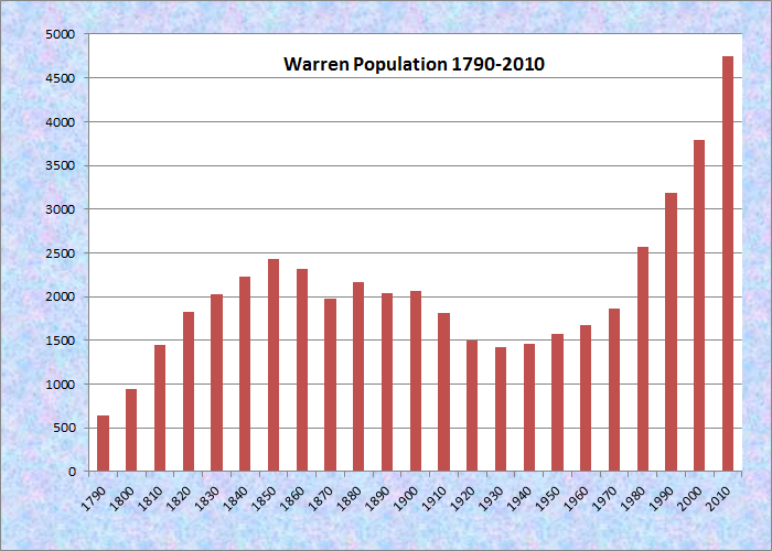
Population Trend 1840-2010
| Geographic Data | |
|---|---|
| N. Latitude | 44:07:45 |
| W. Longitude | 69:14:49 |
| Maine House | District 95 |
| Maine Senate | District 12 |
| Congress | District 1 |
| Area sq. mi. | (total) 48.7 |
| Area sq. mi. | (land) 46.4 |
| Population/sqmi | (land) 102.4 |
County: Knox
Total=land+water; Land=land only |
|
Clipper Ship Built Here
- Stephen Crowell–1855
")
St. George River in the Village with Mill (2003)
")
The Mill in the Village (2003)
 N44° 7' 34.95\" W69° 14' 22.27\"")
Community School (2013) @
[WAR-rehn] is a town in Knox County, settled in 1736 and incorporated on November 7, 1776 from a portion of St. Georges Plantation.
Warren original area has been reduced by ceding land to Thomaston (1777, 1798, 1864), Cushing (1807), and Camden (1836).
") The Powder Mill Locks date from 1793 and supported a canal system allowing water transportation inland up the St. George River.
The Powder Mill Locks date from 1793 and supported a canal system allowing water transportation inland up the St. George River.
Today that system has virtually disappeared, though one can understand the need for it, considering that the river is impassible at certain points without it. A portion is visible at Payson Park on Route 90.
")
St. George River at the Site
")
. . . of the Former Canal (2003)
The town is the birthplace in 1834 of Civil War General Ellis Spear.
Warren’s South Pond and North Pond provide fine recreational opportunities. The village lies off the heavily traveled highways: U.S. Route 1 and Maine Routes 90, 131, and 235.
 N44° 7' 35.69\" W69° 14' 23.63\"")
House and Barn (2013) @
")
Mathews Memorial Library (2003)
")
Old Commercial Block in Warren Village (2003)
Adjacent to Thomaston, long a synonym for “State Prison,” Warren is now the site of the new state prison: Bolduc Correctional Facility.
During the decade that included the move of the prison, Warren gained about 1,000 “residents” in the U.S. Census while Thomaston lost a similar amount!
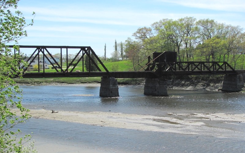
The St. George, dividing Thomaston from Warren (2010)
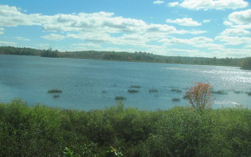
South Pond in Warren from the Eastern Railroad (2010)
Western areas of the town are home to twin ponds: the 338-acre North Pond and the 548-acre South Pond. Bass and perch, among others are found in each; brown trout are found in South Pond. Boat launches exist for each.
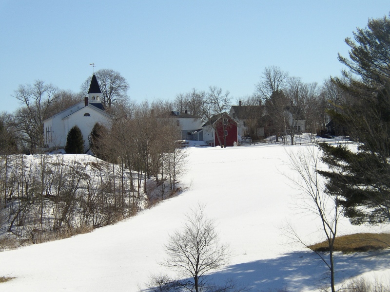
Church and houses from Route 90 (2005)
")
Warren Baptist Church (2003)
Meadow Mountain is a 259 acre town forest that serves as a nature preserve.
Form of Government: Town Meeting-Select Board-Manager.
Additional resources
From Warren to the Sea, 1827-1852; Letters of the Counce and McCallum Families. Middletown, N.Y. Whitlock Press. 1970.
Maine. Department of Inland Fisheries and Wildlife. Augusta, Me. 2002. “North Pond.” http://www.maine.gov/ifw/fishing/lakesurvey_maps/knox/north_pond.pdf; “South Pond.” http://www.maine.gov/ifw/fishing/lakesurvey_maps/knox/south_pond.pdf (accessed April 8, 2014)
*Maine. Historic Preservation Commission. Augusta, Me. Additional text and photos at National Register of Historic Places: http://pdfhost.focus.nps.gov/docs/nrhp/text/70000048.PDF, http://pdfhost.focus.nps.gov/docs/nrhp/photos/70000048.PDF
Old Warren, Maine: Photographs and Articles about Old Warren, Maine. Warren Historical Society. Warren, Maine. C1997. [University of Maine, Raymond H. Fogler Library, Special Collections; Maine State Library]
Porter, Lillian Russell. Warren Bi-Centennial Pageant: 1736-1936. Warren, Me. Warren Historical Society?. 1972? [University of Maine, Raymond H. Fogler Library, Special Collections]
Warren Historical Society. http://www.warrenhistoricalsociety.com/
")
Bridge over the St. George River in Warren (2005)
")
Blueberry barrens Seven Tree Pond and Barrett Hill (2007)
National Register of Historic Places – Listings
Georges River Canal
[Upper Falls, St. George River in Warren to Union town line, extending to Quantabacook Pond in Searsmont] Canals on Georges River, used for access to the forest in its watershed, were important for the development river valley. Mills were built at its lower falls. Charles Barrett of Hope secured a charter from the Massachusetts General Court in 1793 to build locks and bridges creating a canal. Major General Henry Knox, who retired as Secretary of War in 1794, purchased the locks from Barrett and redeveloped mills at Upper Falls. By the late 1790s, boats ran through the river and Seven Tree Pond to Union. At Knox’s death in 1806, the canal was abandoned. Without maintenance, a few years of decay and freshets destroyed the locks.
The new Georges River Canal was opened in the spring of 1847 with traffic between Quantabacook Pond above Searsmont and tidewater at the Lower Falls in Warren. The Canal used no horses or mules on a towpath. Boats were poled by men in shallow water, and provided with sails when crossing the ponds. Maintenance costs for the wooden locks and for repairing washouts by the turbulent river were expensive. With increasing financial and maintenance problems, the canal closed in 1850.* [See photos above.]
Thank you for providing this insight into the history of Warren, Maine