
Location Map for Webster Plantation
| Year | Population |
|---|---|
| 1970 | 56 |
| 1980 | 82 |
| 1990 | 95 |
| 2000 | 82 |
| 2010 | 85 |
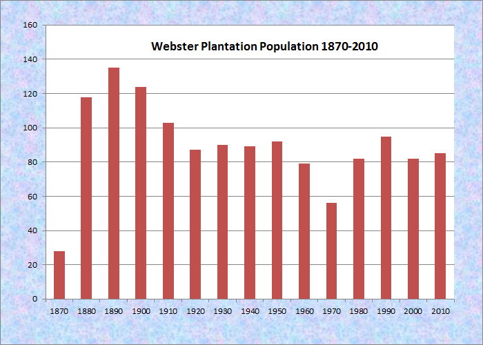
Population Trend 1870-2010
| Geographic Data | |
|---|---|
| N. Latitude | 45:28:33 |
| W. Longitude | 68:11:52 |
| Maine House | District 141 |
| Maine Senate | District 2 |
| Congress | District 2 |
| Area sq. mi. | (total) 39.5 |
| Area sq. mi. | (land) 38.9 |
| Population/sq.mi. | (land) 2.3 |
County: Penobscot
Total=land+water; Land=land only |
|
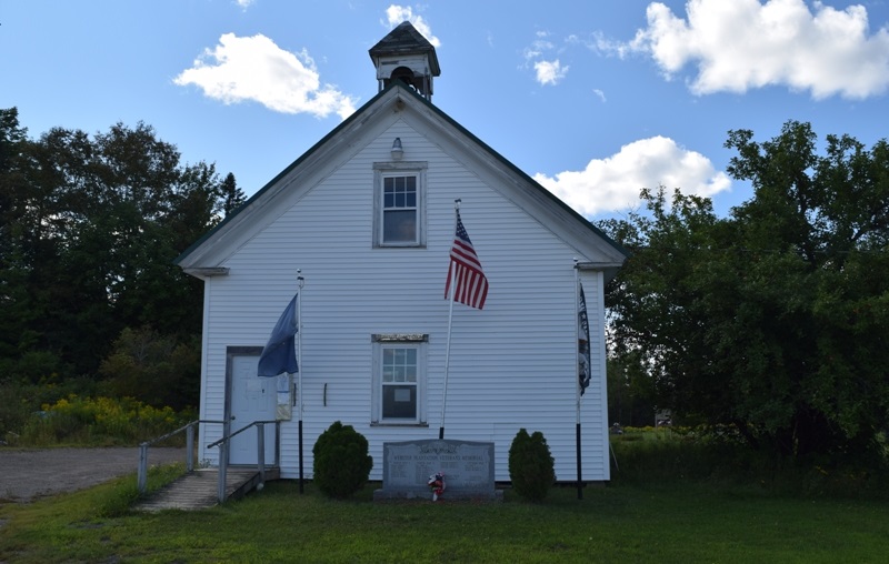
Webster Plantation Office and Veterans Memorial (2020)
[WEB-ster] is a plantation in Penobscot County, settled 1843 and organized September 1, 1856, from township T6 R3 NBPP.
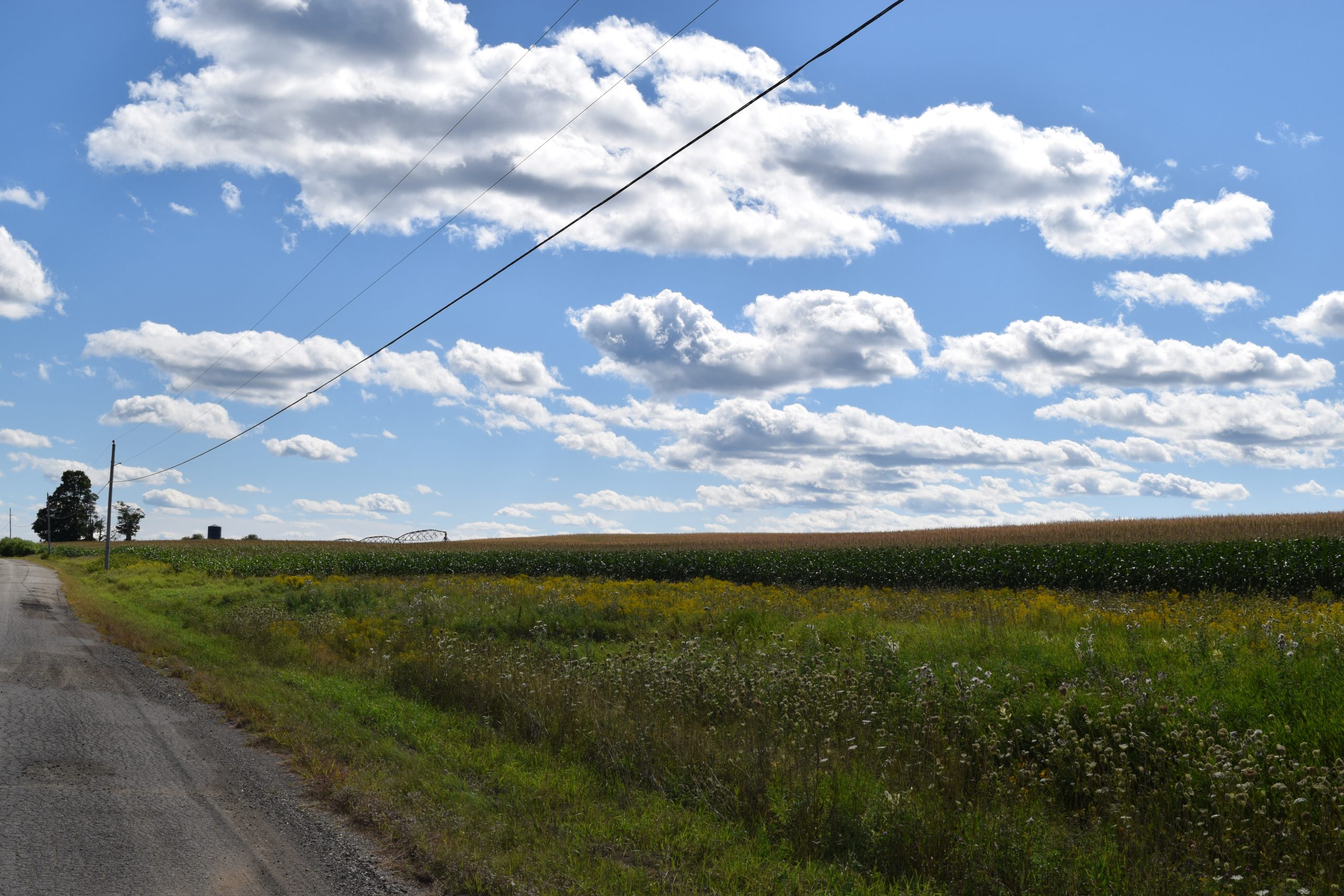
This sparsely populated area of 85 residents is primarily marshlands and streams, with the exception of Tucker Ridge and Pickle Ridge where Tucker Ridge Road and Pickle Ridge Road serve the plantation’s residents.
Tucker Ridge features an expanse of agricultural activity as seen below.
Christmas Tree Field on Tucker Ridge (2020)
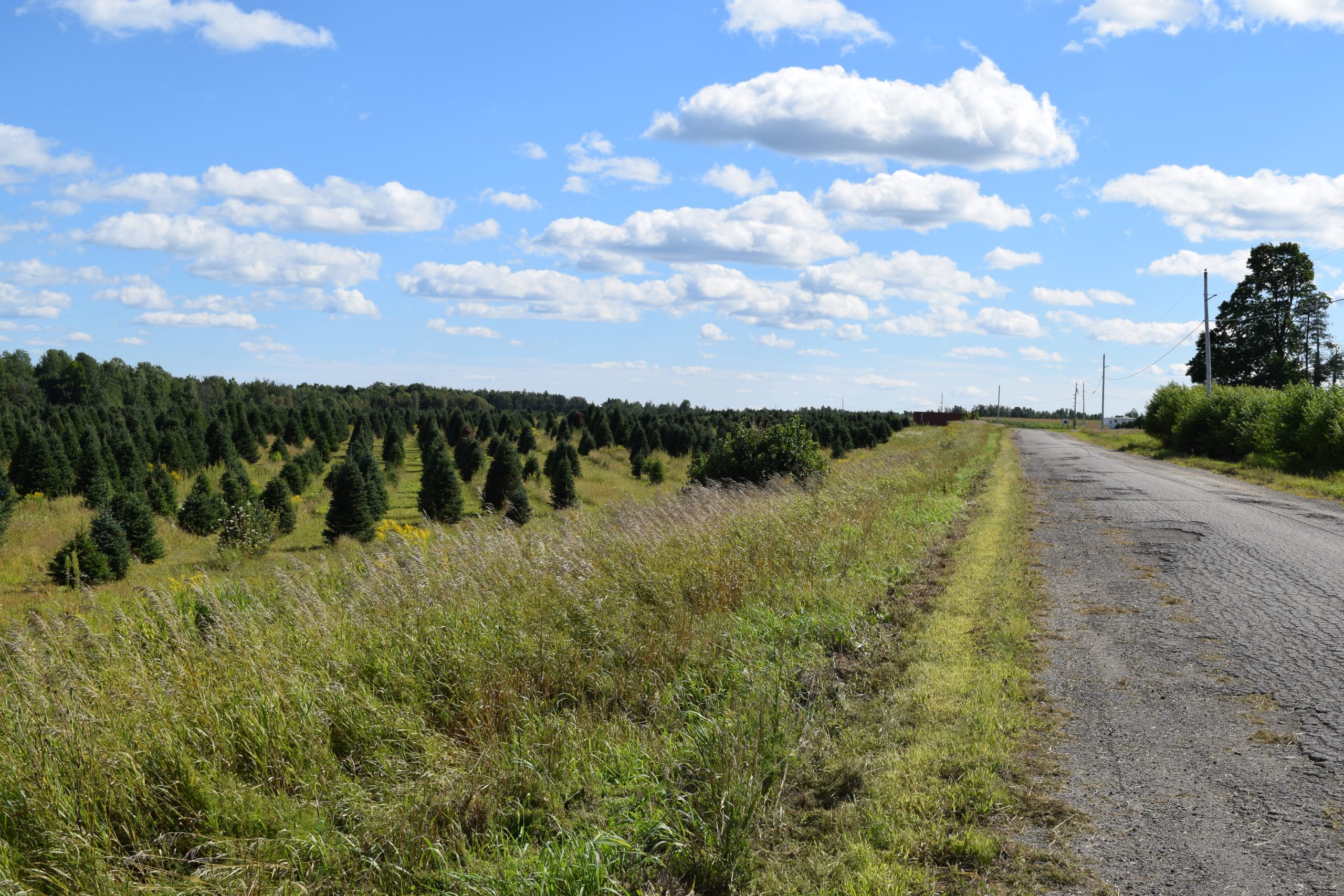
Christmas Tree Field on Tucker Ridge (2020)
Pickle Ridge Road runs through a public lot of Maine Public Reserved Lands that occupies the southeast corner of the township. The “Webster Lot” was described in 2009 as follows (condensed and edited from the Eastern Interior Region Management Plan):
This 794-acre lot on the southeast corner of the plantation is bisected by the Pickle Ridge Road that runs north/south on the height of land, which slopes gradually to wetlands on the east and west. The ridge-top is excessively drained with many ledge outcrops.
As a result of early settlements and resulting private land claims, the lot was reduced to its current size. Since most of the higher ground was cleared for pasture, minor remnants of stone walls give evidence to that settlement. Several abandoned fields, with scattered apple trees, are now designated for wildlife use.
Within the Mattawamkeag River watershed, the lot has extensive bog and marsh deposits in the wetlands on its easterly side. Wading bird and waterfowl habitat exits in the 45 acres of streams and wetlands. The lot includes 168 acres of forested wetlands and 20 acres of open wetlands. Current forest types are 41% hardwood, 41% mixed wood, and 18% softwood.
The Bureau conducted extensive harvests in 1982-83 to salvage budworm-damaged fir. The 2001 harvest targeted over-mature aspen and ice storm-damaged birch. Most current stands are two–aged, with the younger age class dominated by fir.
The two roads on the easterly side of the Ridge Road were built for winter timber harvesting. Both have been blocked to prohibit vehicle use. A short road on the westerly side of the ridge was built for summer timber harvesting, and is open for vehicle use.
Overall, 210 acres are reserved for wildlife and the remaining 583 acres for timber management. Recreation has consisted primarily of dispersed hunting. Route 170 follows an esker [A long narrow ridge or mound of sand, gravel, and boulders deposited by a stream flowing on, within, or beneath a stagnant glacier.]crossing the southeast corner of the Lot.
The small Webster Pond sits in the south. The northeast corner is occupied by a section of the Mattawamkeag River System Wildlife Management Area.
The Bureau of Public Lands describes the area: Mattawamkeag River System WMA (6,625 acres) is within Drew Plantation, Webster Plantation and Kingman Township and closely borders the Mattawamkeag River. It contains a mix of wetlands, lowland conifer, shrub and peatland habitats. It also contains forested uplands and various wetland types. Some of these wetland areas include rare calcareous fens. It is accessible by boat for its warm and cold water fisheries. Ice fishing and wildlife watching are also popular here.
There are six federal or state listed threatened or endangered species inhabiting or associated with the WMA. IF&W has documented the occurrence of the sedge wren, a state listed endangered species; Tomah mayfly, a state listed threatened species; Clayton’s copper butterfly, a state listed endangered butterfly; the bald eagle, a state and federally listed threatened species; the yellow lamp mussel, a state listed threatened mussel; and Atlantic salmon.
Residences are widely dispersed along several roads. Tucker Ridge Road includes a farmhouse and a few modest homes.
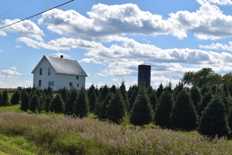
Farmhouse with Silo (2020)
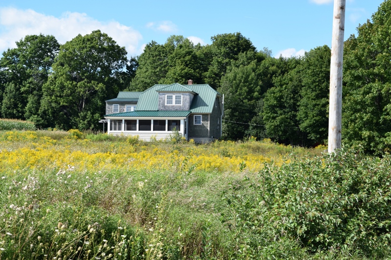
House on Tucker Ridge Road (2020)
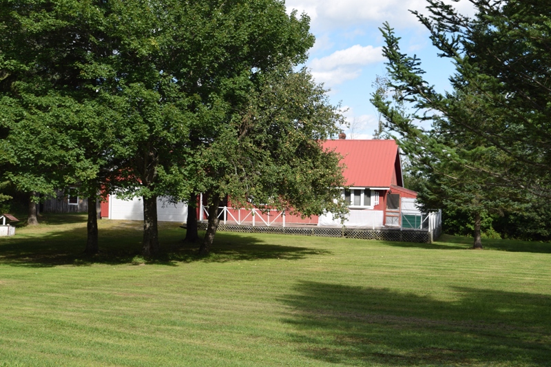
House on Tucker Ridge Road (2020)
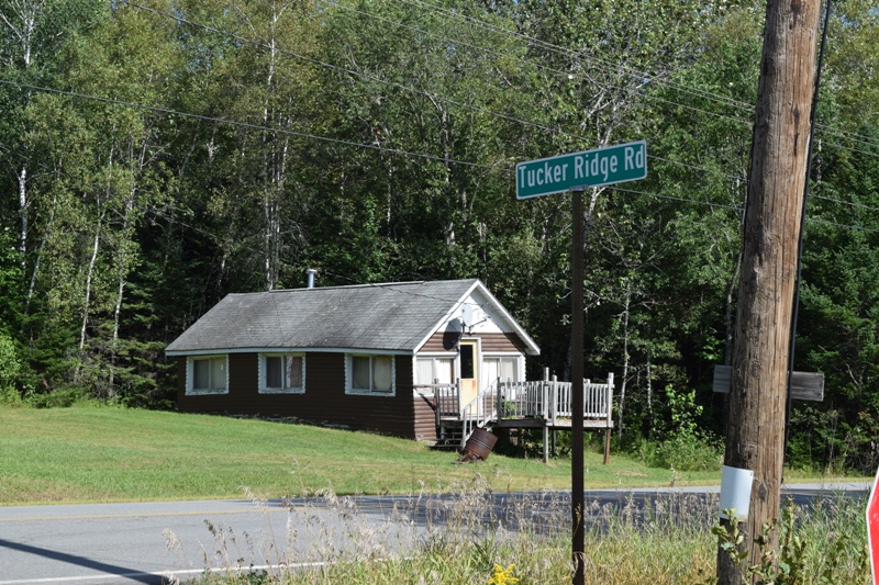
House Near Tucker Ridge Road (2020)
Form of Government: Assessors-Annual Meeting.
Additional resources
Maine. Department of Conservation. Bureau of Public Lands. Augusta, Me. July 1, 2009.”Eastern Interior Region Management Plan.” https://www.maine.gov/dacf/parks/get_involved/planning_and_acquisition/management_plans/docs/eastern_interior_plan_final.pdf (accessed April 9, 2014)
I grew up, as a Tucker, with my grandparents on the Tucker Farm on Tucker Ridge – built by my great grandfather in the early1800s – on Tucker Ridge, Webster Plantation. Grampa Roy was Maine Guide. – My great grandfather was raised on his father’s farm on what is now WEST Tucker Ridge in Springfield. They extended the road over the line into Webster Plantation and the Tucker Farm , straddling both townships, was originally 500 acres – cleared 100 for farming and left 400 in timber. –