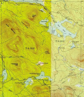
The township is immediately adjacent to T1 R11 WELS, host to the next northerly section of the AT. The Appalachian Trail cuts briefly through the southeast corner of the township, also known as Shawtown. Shawtown is a very watery township, with four of the Roach Ponds and First, Second, Third, and Fourth West Branch Ponds.
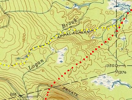
Black Pinnacle Mountain, in the center of the township, was the focus of a power generating wind farm proposal to the Maine Land Use Regulation Commission in 2007. It was rejected in 2008 at least in part because of its proximity to the Appalachian Trail. In the 1950’s, the Trail’s route (yellow dots) entered further to the west. The current, 2007, Appalachian Trail (red dots) in the southeast corner of the township joins the old trail just south of a small pond in the East Branch of the Pleasant River.
Detail of TA R12 Topographic Map
Topographic maps were created from the University of New Hampshire Dimond Library, Documents Department & Data Center, Historic USGS Maps of New England & New York, accessed 1/16/2008: Jo-Mary Mountain, ME Quadrangle (1952), http://docs.unh.edu/nhtopos/Jo-MaryMountain.htm. A virtual Appalachian Trail tour; click boot for next step.


