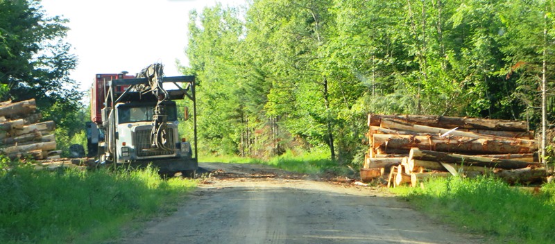
Logging Truck on 07-00-0, a dirt road in Silver Ridge off the 6000 Road (2014)

 Silver Ridge was, once a plantation from 1878 to the 1950s, in Aroostook County, immediately south of Sherman and east of Benedicta Township.
Its small and declining population was likely a major factor in surrendering its organization.
It is now an unorganized township. Township population counts are not usually separated from other nearby townships.
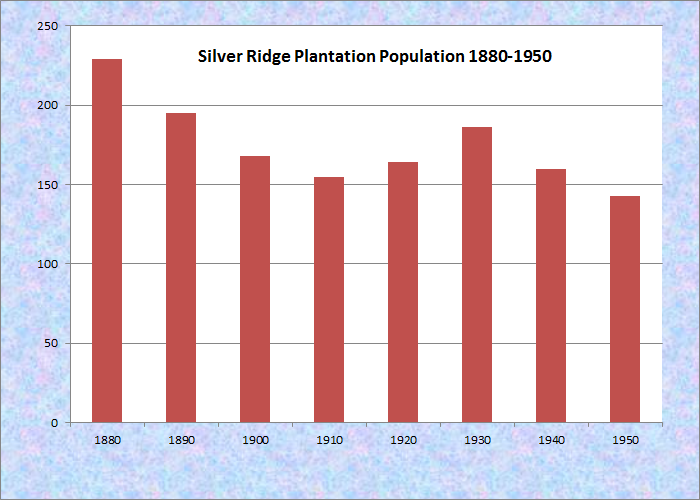
Population Trend 1880-1950
Both Benedicta and Silver Ridge are “half townships,” that is they split the traditional six-mile square making two three by six mile rectangles side by side.
 N45° 45' 0.51\" W68° 18' 37.82\"")
Woods Road off U.S. Rt. 2 (2014) @
Two very small villages, Silver Ridge and Monarda appear on U.S. Route 2 which runs north-south through this otherwise heavily forested township. The woods road at right doubles as an ATV trail, typical of many such roads.
The veterans memorial is near Silver Ridge village and the small Monarda Calvary Baptist Church sits alone near Monarda village. Both are on U.S. Route 2, which is known as the Silver Ridge Road in Silver Ridge. Continuing south it is known as the “Nine Mile Woods Road,” for the remaining distance to Macwahoc village.
Heavily forested, Silver Ridge contains species specific “tree plantations” along active logging roads.
")
Fraser Papers Plantation 1992 White Spruce (2003)
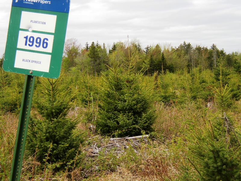
Fraser Papers Plantation 1996 Black Spruce (2003)
The township shares frontage on Plunkett Pond with adjoining Benedicta. Molunkus Stream, a favorite for fishing, flows south through most of Silver Ridge. The stream offers the opportunity for a canoe trip at the Pond Road bridge and downstream to a takeout at Macwahoc at U.S. Route 2A.
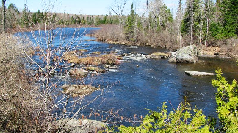
Upstream of Pond Road bridge (2016)
")
Downstream of Pond Road bridge (2016)
")
Monarda Calvary Baptist Church (2012) N45° 46′ 57.58″ W68° 19′ 13.5″
")
Veterans Memorial in Silver Ridge (2003)
")
9 Mile Woods Road South of Silver Ridge (2012) N45° 42′ 21.9″ W68° 17′ 32.3″
How did Silver Ridge get it’s name?