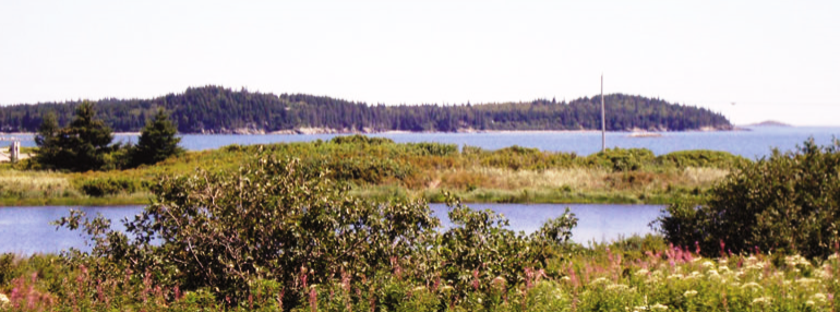
Roque Island right; Roque Bluffs in distance from Route 187 in Jonesboro (2004)

Location Map for Roque Bluffs
| Year | Population |
|---|---|
| 1970 | 153 |
| 1980 | 244 |
| 1990 | 234 |
| 2000 | 264 |
| 2010 | 303 |
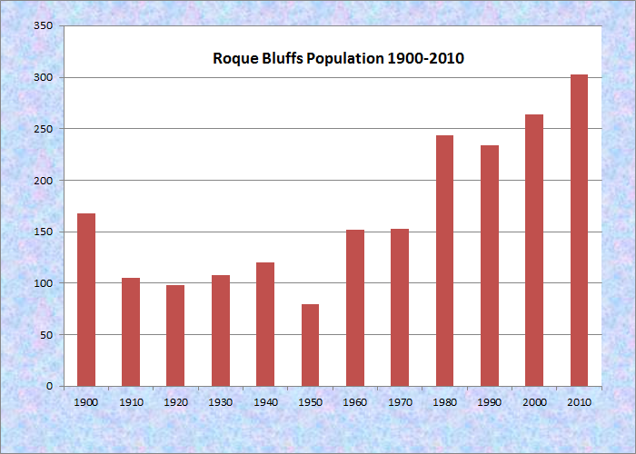
Population Trend 1900-2010
| Geographic Data | |
|---|---|
| N. Latitude | 44:37:24 |
| W. Longitude | 67:28:19 |
| Maine House | District 139 |
| Maine Senate | District 6 |
| Congress | District 2 |
| Area sq. mi. | (total) 19.5 |
| Area sq. mi. | (land) 10,7 |
| Population/sq.mi. | (land) 28.3 |
County: Washington
Total=land+water; Land=land only |
|
[roke BLUFS] is a town in Washington County, settled in 1763 and incorporated on March 12, 1891 from a portion of Jonesboro. Named for nearby Roque Island, the origin of the word “Roque” is uncertain.
Contrary to most towns in Washington County, this town has been adding population during the last two decades.
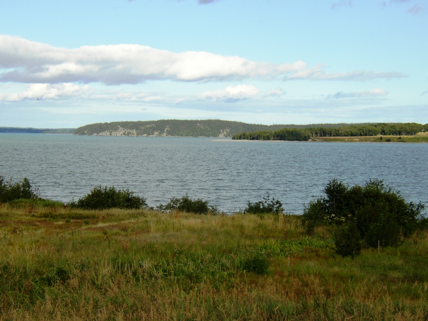
Located south of Machias, the community has a long coastline on its Great Cove, Englishman Bay and Little Kennebec Bay.
Roque Bluffs State Park occupies about two miles of the shore. Inland from the park is the Englishman River Wildlife Management Area along the eastern shore of that river. The Park has a diversity of coastal landscapes on Schoppee Point (south of Machias).
A beautiful, half-mile crescent of sand and pebbles along Englishman Bay is backed by the shallow waters of 60-acre Simpson Pond. Between the beach and the pond are several picnic areas and a play area.
A trail network inland from the shore leads through old orchards, fields and woods, with paths along the shores of Great Cove and Pond Cove. Diverse habitats support abundant wildlife, great for bird watchers. Bald eagles frequent the area and migrant species stop over during spring and fall. The Bay and Simpson Pond can be explored by canoe or kayak.
Virtually all of the town is considered one of Maine’s “Focus Areas of Statewide Ecological Significance.” The Maine Natural Areas Program has this overview:
This area, which includes Englishman River Marsh, the Black Head Bogs, Hanscom Heath, and Great Cove Heath, is generally in excellent condition. The peatlands are scattered to the east and west of the major feature of this focus area—the extensive Englishman River tidal marsh. The total area of the Englishman River Marsh is roughly 230 acres, making it one of the larger tidal marshes in the Downeast Region.
Englishman River Tidal Marsh The most interesting feature of the Englishman River tidal marsh is the extensive mixing zone where freshwater marsh converges with salt marsh. The resulting “brackish tidal marsh” supports an interesting assemblage of plant species with characteristics of both freshwater and saltwater tidal marshes.
It also notes the presence of rare plants, high quality wildlife habitat, and the economic impact on enhancing property values and attracting tourism.
Roque Bluffs State Park *
Form of Government: Town Meeting-Select Board.
Additional resources
Maine. Department of Agriculture, Conservation and Forestry. “Focus Areas of Statewide Ecological Significance Roque Bluffs.” https://www.maine.gov/dacf/mnap/focusarea/roque_bluffs_focus_area.pdf (accessed April 4, 2013)
* Maine. Department of Agriculture, Conservation and Forestry. “Roque Bluffs State Park Guide and Map.” https://www.maine.gov/dacf/parksearch/PropertyGuides/PDF_GUIDE/roquebluffsguide.pdf