
Location Map for Richmond
| Year | Population |
|---|---|
| 1970 | 2,165 |
| 1980 | 2,627 |
| 1990 | 3,072 |
| 2000 | 3,298 |
| 2010 | 3,411 |

Population Trend 1830-2010
| Geographic Data | |
|---|---|
| N. Latitude | 44:07:28 |
| W. Longitude | 69:49:36 |
| Maine House | Dist 53,55 |
| Maine Senate | District 23 |
| Congress | District 1 |
| Area sq. mi. | (total) 31.6 |
| Area sq. mi. | (land) 30.4 |
| Population/sq.mi. | (land) 112.2 |
County: Sagadahoc
Total=land+water; Land=land only |
|
Clipper Ships Built Here
- Peerless–1852
- Gauntlet–1853
- Pride of America–1853
- Strelna–1853
- Wild Wave–1853
- Wizard King–1854
")
[RICH-mund] is a town in Sagadahoc County, settled in 1725 and incorporated on February 10, 1823 from a portion of Bowdoinham. Fort Richmond (1719 – 1755) on the west side of the Kennebec was intended to provide security for early settlers and traders.
The fort may have actually acted as a provocation symbolizing continued white encroachment into Indian lands. It was a British wooden blockhouse and trading post, enlarged in 1723 and rebuilt in 1740.
The main village is located on the west side of the Kennebec River, just south of Gardiner on Maine Route 24, where the river splits to form Swan Island.
 N44° 5' 30.80\" W69° 47' 7.85\"")
Site of Fort Richmond (’13) @
Benedict Arnold’s expedition, having first landed at Swan Island in the river across from the town, passed by the remnants of Fort Richmond (see the landing site at the town landing below) on September 22, 1775.
During the nineteenth century, especially from 1835 to 1857 when shipbuilding was at its peak, the Greek Revival movement in architecture was very popular in the town. Many fine examples of that style, erected by sea captains, boat builders and merchants, still remain. Several are clustered on Baker Street near the downtown in the historic district.
 N44° 5' 8.81\" W69° 48' 4.69\"")
House on Baker St. (2014) @
 N44° 5' 8.71\" W69° 48' 5.17\"")
House on Baker St. (2014) @
 N44° 5' 9.25\" W69° 48' 6.12\"")
House on Baker St. (2014) @
 N44° 5' 9.12\" W69° 48' 6.51\"")
House on Baker St. (2014) @
")
Greek Revival House (2002)
Thomas J. Southard built two clipper ships in Richmond:
the Gauntlet in 1853 and the Wizard King in 1854.
The depression of 1857 ended the construction frenzy.
Ice harvesting provided a second boom in the late 19th and early 20th centuries. Shoemaking extended from before the Civil War until the late 20th century.
 N44° 5' 11.81\" W69° 48' 23.36\"")
Town Office & Police Department (2017) @
 N44° 5' 18.89\" W69° 48' 16.78\"")
Richmond Library on Maine Street (2017) @
 N44° 5' 18.37\" W69° 48' 17.83\"")
Veterans Memorial near the Library (2017) @
 N44° 5' 8.35\" W69° 48' 24.70\"")
Marcia Buker Elementary School (2017) @
Route 197 as it meets Route 24 in the village is Richmond’s Main Street. The older portion of the village, with its brickwork, is near the Kennebec River on Route 24 (Front Street). Main Street is essentially a commercial strip west of the river.
 N44° 5' 17.20\" W69° 48' 11.22\"")
Main Street (2014) @
 N44° 5' 17.39\" W69° 48' 9.99\"")
Main Street (2014) @
 N44° 5' 11.86\" W69° 48' 0.20\"")
1868 Southard Block (’14) @
 N44° 5' 14.88\" W69° 47' 57.79\"")
Downtown on Rt. 24 (’14) @
 N44° 5' 14.86\" W69° 47' 57.77\"")
Brickwork Downtown (’14) @
 N44° 5' 18.23\" W69° 48' 18.23\"")
Fire Dept/Town Off. (’14) @
 N44° 5' 19.61\" W69° 48' 23.69\"")
Post Office (2014) @
 N44° 5' 23.54\" W69° 48' 21.62\"")
Enterprise Grange (2014) @
The historic Kennebec Bridge between Richmond and Dresden on Route 197 was replaced in 2014.
Swan Island is a game preserve that extends south to Merrymeeting Bay. Home to the Steve Powell Refuge and Wildlife Management Area, it is accessible by state boat from Richmond. The historic island, with an early settlement in the Kennebec River, features migrating waterfowl, a bald eagle nest, and plentiful deer. Camping and visitation areas are tightly controlled to protect wildlife; walking in protected areas is prohibited.
")
Richmond Park and Landing, Swan Island across the Kennebec (2001)
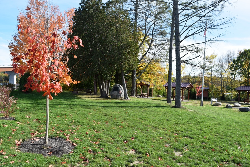
The town’s western boundary is formed primarily by Pleasant Pond and Upper Pleasant Pond, with campgrounds available just off U.S. Route 201. Peacock Beach State Park is nearby, across from the historic Peacock Tavern. In winter it is a site for cross country skiing with a view of Pleasant Pond.
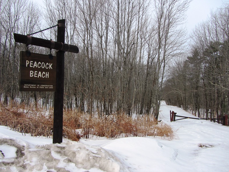
“Peacock Beach” (2014) @
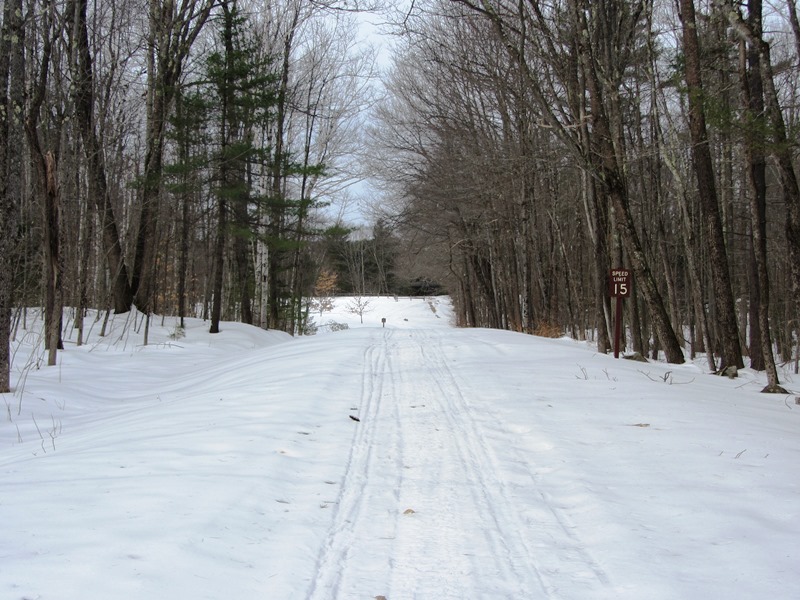
Peacock Beach Drive (2014)
 N44° 5' 15.60\" W69° 48' 40.61\"")
High/Middle Schools (’14) @
There is a modest Sugarhouse at Maine-iac Maple Farm on Mitchell Road, with the traditional wood-fired boiler and buckets attached to the tapped trees.
 N44° 8' 10.84\" W69° 52' 53.83\"")
Maine-iac Farm Sugarhouse (2014) @
 N44° 8' 11.44\" W69° 52' 56.86\"")
Tapped Trees with Buckets (2014) @
Benedict Arnold’s Expedition Route – click a Bateau

 <== To Quebec To Beginning ==>
Form of Government: Town Meeting-Select Board-Manager.
Additional resources
Bruzelius, Lars. http://www.bruzelius.info/Nautica/Shipbuilding/Shipyards/Clippers(ME).html (accessed 9/12/2007)
Dejevsky, Nikolai J. A Myth of Messina: Echoes of Russian Richmond. Solon, Me. Polar Bear. 2009.
Fleming, John Daly. Richmond On The Kennebec. Richmond, Me. Richmond Historical Committee. 1966.
*Maine. Historic Preservation Commission. Augusta, Me. Text and older photos from National Register of Historic Places: http://pdfhost.focus.nps.gov/docs/nrhp/text/xxxxxxxx.PDF and http://pdfhost.focus.nps.gov/docs/nrhp/photos/xxxxxxxx.PDF
Peacock Tavern: 86000675.PDF; and Town of Richmond Comprehensive Plan, Draft: for State Review February 2016. http://www.maine.gov/dacf/municipalplanning/comp_plans/Richmond_2016.pdf (accessed October 26, 2016)
Southard Block: 72000079.PDF
Robbins, John A. A Free Guide to Historical Richmond. Richmond. Robbins Historical Research, Inc. 1997.
Terrell, Carroll Franklin. Growing Up Kennebec: A Downeast Boyhood. Orono, Me. Northern Lights. 1993.
National Register of Historic Places – Listings
Peacock Tavern
 N44° 9' 33.66\" W69° 51' 42.10\" [GPS from front-facing perspective in 2014]") [US Route 201] This interesting public house, built during the Federal Period, is probably the oldest surviving structure in the town of Richmond. It has long been a landmark on this formerly heavily traveled road between Portland and Maine’s capital city, Augusta. It is one of the finest examples in the state of a typical roadside hostelry of the turn of the 18th century. It is protected by an historic easement.
[US Route 201] This interesting public house, built during the Federal Period, is probably the oldest surviving structure in the town of Richmond. It has long been a landmark on this formerly heavily traveled road between Portland and Maine’s capital city, Augusta. It is one of the finest examples in the state of a typical roadside hostelry of the turn of the 18th century. It is protected by an historic easement.
")
Entrance to Peacock Beach State Park (2018)
Built in 1807 by Benjamin Shaw, the tavern was acquired shortly thereafter by Edward “Uncle Ned” Peacock after whom it came to be named.
Located on what was in the 19th century known as “the Post Road” (now U.S. Route 201), the tavern was a busy and thriving establishment for many years. Since then it has been bypassed by Interstate 295 and exists as part of Peacock Beach State Park.*
The State Park on Route 201 at Pleasant Pond in Richmond is about 12 miles from Augusta, featuring a small beach and swimming area, picnic facilities, restrooms and a boat launch. The town of Richmond provides maintenance service to the park.
")
")
")
Peacock Beach State Park (2014)
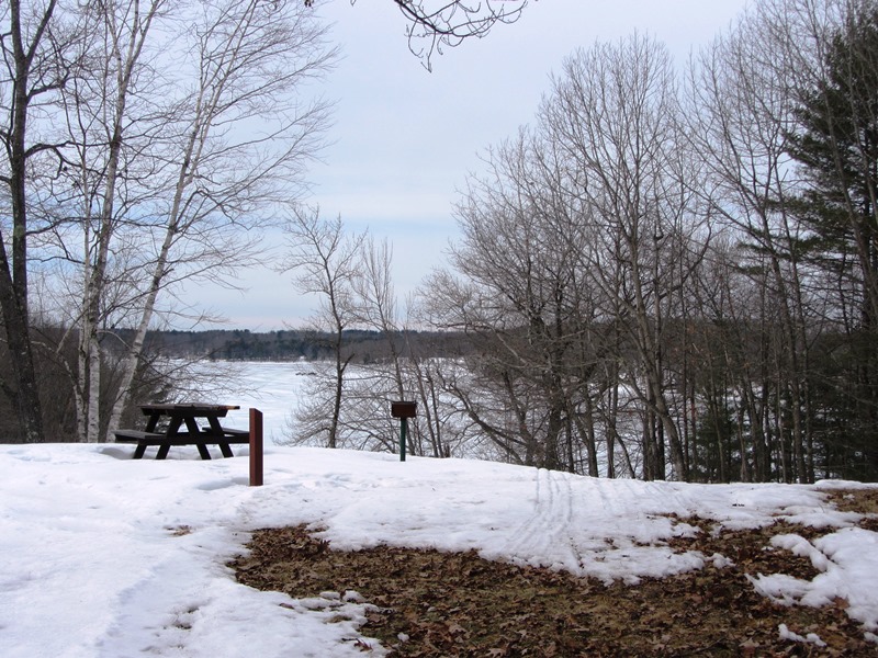
Pond & Picnic View (2014)
Richmond Historic District
[roughly bounded by South Street, High Street, Kimball Street, and the Kennebec River] The significance of the Historic District lies in its 19th century history when Richmond reached its peak of prosperity. Its architecture reflects this affluence both in quality and quantity of styles.
 N44° 5' 13.04\" W69° 48' 8.74\"")
St. Alexander Nevsky Russian Orthodox Church (2014) @
Richmond’s importance in the 19th century commerce of America cannot be disputed. Unfortunately, nothing physically remains of the shipyards and docking facilities. What does remain are the homes and other structures that reflect this great past. The buildings in this district represent the great architecture of the period in this small town.
For its size, Richmond has more surviving Greek Revival architecture (many on Baker Street- see photos above)) than any town in Maine, along with many other types of architecture. Those represented here are the most significant architecturally and historically. The great pieces of architecture in Richmond were built by the same men who built the ships in the yards along the river. They reflect the same quality of craftsmanship that must be built into a ship.
 N44° 5' 13.20\" W69° 48' 10.50\"")
House in the District (2014) @
 N44° 5' 8.40\" W69° 48' 7.50\"")
House in the District (2014) @
This small town, with its fine homes, commercial buildings, churches (the Alexander Nevsky Church above is in the District) and industrial buildings, represents a total picture of a small 19th century Maine town.
Southard Block
The 1868 Southard Block (2014)
[25 Front Street] The Second Empire Style Southard Block was the counting house (bank) for Thomas Jefferson Southard, a key developer in the history of Richmond.
In 1762, on the incorporation of the Town of Bowdoinham, the Richmond area, was placed under Bowdoinham’s protection, then annexed to it in 1779. In 1823 Richmond incorporated as a separate town. The lower Kennebec River here was the scene of early settlement, farming, lumbering, shipbuilding and small industry. Richmond Village was once named White’s Landing in honor of Brazille White, a lumberman and storekeeper.
Thomas Jefferson Southard had an early and long lasting influence on the town’s development. Born in Boothbay, he came to Richmond as a young man. While he worked as a shipsmith, he studied drafting and construction. At only twenty-eight he launched his first schooner, the Texas. He followed with a group of small coasters designed for the southern trade bearing the names familiar there: Savannah, Richmond, Wilmington, and others.
 N44° 5' 17.69\" W69° 48' 11.00\"")
Southard House (2007) @
He expanded, building larger ships with enviable reputations for reliability and trim lines. Besides supervising the work in his yards he ran a dry- and West Indies-goods store, was the village postmaster, managed a drugstore, operated a planing mill and a grist mill, became the leading promoter of the Southard Cotton Mill, and built several business blocks. He also served as an active director of various railroads, telegraph companies, towage corporations and banks. His eighty-eight years were full and his fleet bore at the masthead the Southard House flag displaying an anvil as its device.*
Swan Island Historic District
[Kennebec River, between Richmond and Dresden] See Swan Island.