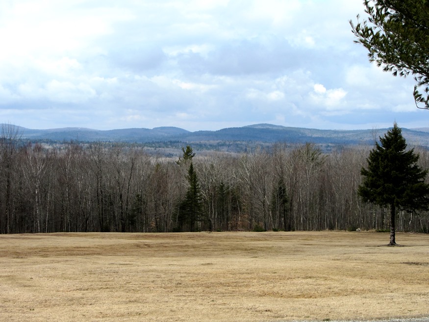
Panoramic View of Mountains looking West from Route 179 in Osborn (2013)

Location Map for Osborn
| Year | Population |
|---|---|
| 1970 | 33 |
| 1980 | 47 |
| 1990 | 72 |
| 2000 | 69 |
| 2010 | 67 |
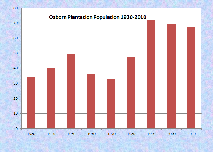
Population Trend 1930-2010
| Geographic Data | |
|---|---|
| N. Latitude | 44:46:02 |
| W. Longitude | 68:14:48 |
| Maine House | District 136 |
| Maine Senate | District 7 |
| Congress | District 2 |
| Area sq. mi. | (total) 38.4 |
| Area sq. mi. | (land) 35.6 |
| Population/sq.mi. | (land) 1.9 |
County: Hancock
Total=land+water; Land=land only |
|
")
North on Route 179 (2013)
[OZ-born] is a town in Hancock County, initially organized as a plantation for election purposes as 21 MD, BPP on October 23, 1840 and confirmed by the legislature in 1895.
Its name was changed to Osborn on April 4, 1923.
On February 11, 1976 it was incorporated as a town.
Spectacle Pond, through which the Union River flows, is a major asset of the town.
With few major roads, it is served only in its northwest corner by Maine Route 179, leading north to Route 9 in Aurora and south to Waltham.

Osborn Town Office, Rt. 179

Osborn Fire Dept. on Rt. 179
Osborn hosts two lots of Maine’s Public Reserved Lands. Maine Department of Conservation’s 2007 Downeast Region Management Plan describes them as follows: [condensed]
The Osborn lots are Original Public Lots located in the central portion of the Town of Osborn in Hancock County. The north lot, also known as the Weaver Ridge lot, contains 640 acres. The south lot, known as the Tallyhookus lot, contains 320 acres.
The parcels are situated on low, heavily forested ridges surrounded by swamps, with the primary forest cover being mixed wood to hardwood. . . . The principal features on these properties include a small bog in middle of the north lot, and Johns Brook and associated small bog in the northeast corner of the south lot.
The parcels support populations of deer, ruffed grouse, and snowshoe hare. Johns Brook, which flows into Spectacle Pond, supports high value eastern brook trout habitat. There is also an eagle’s nest east of the south lot on Spectacle Pond.
Cathance Stream supports high value wild eastern brook trout as well as important spawning and nursery habitats for landlocked salmon that help contribute to the Cathance Lake’s salmon fishery.
Hunting is the primary recreational activity, which is limited due to lack of road access. The logging roads in the north lot receive some snowmobile use.
The two lots hold good quality spruce and hemlock, and fair to poor quality hardwoods, though the hardwoods are of better quality here than on other lands in the regional plan area. Most acres hold trees well over 100 years old. The Osborn lots have a long history of timber management. The parcels currently contain an even-aged spruce overstory with beech (very diseased with Nectria fungus) predominant in the understory. A timber management lease with the Town of Osborn expired in 1996. Future timber agreements with the Town will need to include requirements that Forest Certification guidelines be met.
Form of Government: Town Meeting-Select Board.
Additional resources
Maine Department of Conservation. Bureau of Parks and Lands. Downeast Region Management Plan. March 2007. p. 74. http://www.maine.gov/doc/parks/programs/planning/downeast/Downeast%20Management%20Plan.pdf (accessed February 11, 2012)