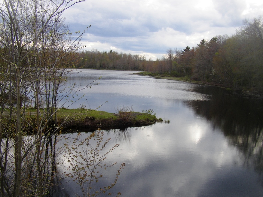
Smith Mill Pond on Route 131 in Morrill (2005)

Location Map for Morrill
| Year | Population |
|---|---|
| 1970 | 410 |
| 1980 | 506 |
| 1990 | 644 |
| 2000 | 774 |
| 2010 | 884 |
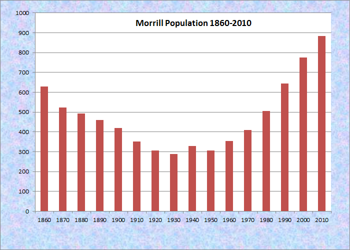
Population Trend 1860-2010
| Geographic Data | |
|---|---|
| N. Latitude | 44:25:41 |
| W. Latitude | 69:10:19 |
| Maine House | District 96 |
| Maine Senate | District 11 |
| Congress | District 2 |
| Area sq. mi. | (total) 17.1 |
| Area sq. mi. | (land)16.6 |
| Population/sq.mi. | (land) 53.3 |
| County: Waldo
Total=land+water; Land=land only |
|
")
Veterans Memorial (2005)
[MOR-il] is a town in Waldo County, incorporated on March 3, 1855 from a portion of Belmont.
Settled in 1790, the town was named for Governor Anson P. Morrill, in office (1855-1858) at the time of incorporation.
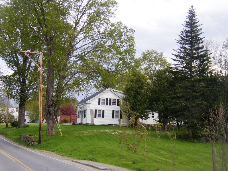
Houses along Route 131 in Morrill
According to a report by the Maine Department of Fisheries and Wildlife*,
“Cross Pond [in Morrill] is a picturesque body of water . . . . An extensive bog system is associated with this shallow pond, making it an interesting place for wildlife and plant enthusiasts. Small boats and canoes can be launched at an unimproved site off the Cross Road.”
“An old mill dam in the village of Morrill forms Smiths Mill Pond. This is a shallow, weedy flowage surrounded by farmland, woodland, and marsh. An unimproved landing suitable for launching canoes and small boats is located at the outlet near Route 131.”
")
Post Office (2005)
")
General Store in the Main Village (2005)
Located about six miles west of Belfast, this growing community is served by Maine Routes 3 and 131.
")
Smith Mill Pond (2005)
")
Morrill Community Center and Honesty Grange No. 83 (2005)
Form of Government: Town Meeting-Select Board.
Additional resources
History and Genealogy of the Town of Morrill, Maine: with New Every Name Index. Rockport, Me. Picton Press. 1998.
* Maine. Department of Inland Fisheries and Wildlife. “Smith Mill Pond.” http://www.maine.gov/ifw/fishing/lakesurvey_maps/waldo/smiths_mill_pond.pdf; “Cross Pond.” http://www.maine.gov/ifw/fishing/lakesurvey_maps/waldo/cross_pond.pdf (accessed March 26, 2014)
Morrill Historical Society. The Morrill Historical Society Presents Homes of Morrill, Maine: A Historical Perspective, with Current Photographs Taken from 1981-1987. Morrill, Me. Morrill Historical Society. 1987.
Robinson, Timothy W. History of the Town of Morrill in the County of Waldo and State of Maine. Belfast, Me. City Job Print. 1944. (Cataloger Note: Vol. 1 contains the history of Morrill from its first settlement 1794 to 1887.)
Is the History of Morrill by Timothy Robinson available for purchase?