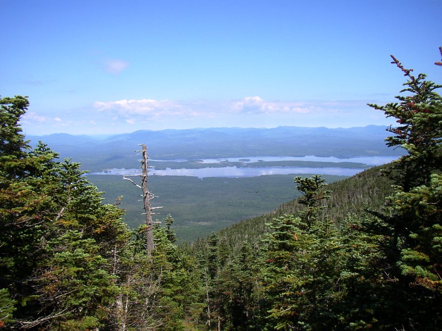
Portion of Flagstaff Lake in Flagstaff Plantation from Bigelow Mountain (2003)

Location Map for Dead River and Flagstaff Lake
[FLAG-staff] plantation was formally organized on March 5, 1895, though it had been organized for election purposes in 1851, 1865 and 1870.
Flagstaff and nearby Dead River Plantation were inundated with water from the Central Maine Power Company’s Long Falls Dam on the Dead River in 1949, after a planned and complete relocation of its population.
The name (Flag Staff, then Flagstaff) apparently derives from the raising of the newly adopted continental flag in 1775 by Benedict Arnold during his encampment there on his way to Quebec.
Here is a condensed version of the Gazetter of Maine‘s report on Flagstaff in its 1886 edition:
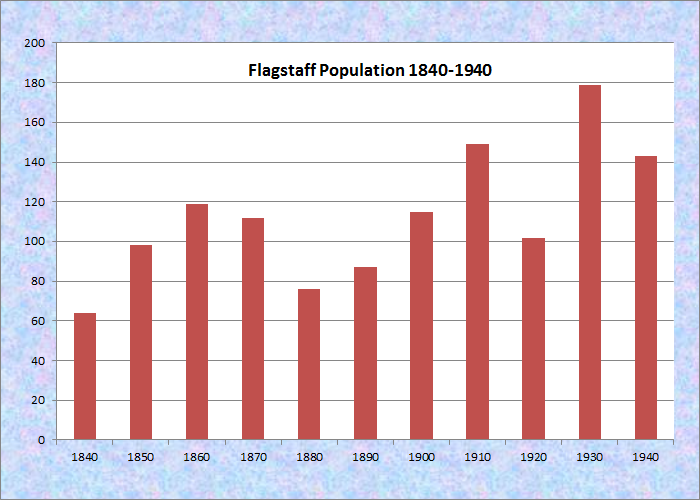
Population Trend 1840-1940
It is situated 48 miles north-west of Skowhegan, and is on the stage-line from North Anson to Eustis. There is much good interval land along Dead River (which flows from west to east through the township) and on the streams which enter Flagstaff Lake. The principal crop is hay. Hills mark the north-eastern and western angles of the town. Viles’s Hill is on the eastern side near Dead River, and near the middle of the town. The base of Mount Bigelow extends over the southern border. The latter is 3,300 feet high. The rock is chiefly granitic.
Flagstaff Pond, whose outlet furnishes the chief water-power of the plantation, has an area of 2.75 square miles. There are at this point mills manufacturing long and short lumber, and a gristmill. The roads in the plantation are in good condition. There are bridges across Dead River and Flagstaff Stream. This plantation furnished 20 soldiers to the Union army in the war of the Rebellion. Flagstaff has one public schoolhouse which, with its appurtenances, is valued at $300. The population in 1870 was 112. In 1880 it was 72.
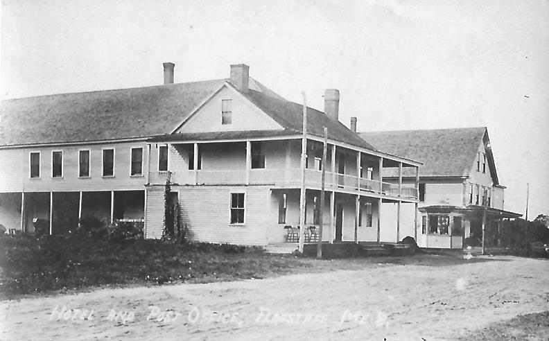
Flagstaff Hotel c. 1920
The last Plantation meeting occurred on May 7, 1949, 108 years after the first meeting in 1841. Flagstaff Cemetery was relocated to Eustis the following year before the village was flooded. Jim Eaton Hill and the high land to its northwest are both above water and are part of Maine’s Public Reserved Lands.
")
Flagstaff Plantation with the Village and Dead River (1932)
Additional resources
“Hotel and Post Office Flagstaff ME.” from the studio of Eastern Illustrating Co., Belfast ME. A postcard postmarked August 8, 1927.
Source of topographic map: University of New Hampshire Dimond Library, Documents Department & Data Center, Historic USGS Maps of New England & New York, from, http://docs.unh.edu/ME/strt32ne.jpg accessed 12/23/2017, northwest corner.