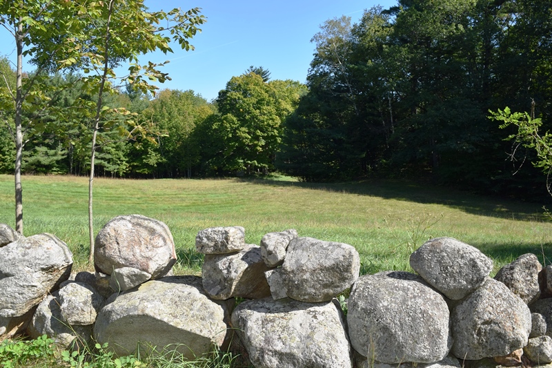
Field near Valley Lodge with a small cemetery in the woods (2018)

Location Map for Baldwin
| Year | Population |
|---|---|
| 1970 | 878 |
| 1980 | 1,140 |
| 1990 | 1,219 |
| 2000 | 1,290 |
| 2010 | 1,525 |
| Geographic Data | |
|---|---|
| N. Latitude | 43:50:29 |
| W. Longitude | 70:42:46 |
| Maine House | District 68 |
| Maine Senate | District 26 |
| Congress | District 1 |
| Area sq. mi. | (total) 36.3 |
| Area sq. mi. | (land) 35.3 |
| Population/sq.mi. | (land) 35.2 |
County: Cumberland
Total=land+water; Land=land only |
|
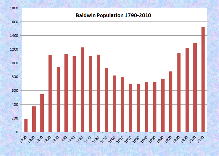
Population Trend 1790-2010
")
West Baldwin Grange (2012)
") [BALL-dwin] is a town in Cumberland County, incorporated on June 23, 1802 from the former Flintstown Plantation. From the half century 1821-1871 it ceded land to Sebago four times and Hiram twice before stabilizing its borders in 1871.
[BALL-dwin] is a town in Cumberland County, incorporated on June 23, 1802 from the former Flintstown Plantation. From the half century 1821-1871 it ceded land to Sebago four times and Hiram twice before stabilizing its borders in 1871.
Baldwin, named for Loammi Baldwin, one of the early proprietors,* is the only one of the seven towns surrounding Sebago Lake that has no frontage on that lake, being cut off by the town of Sebago.
Some abandoned track of the old Portland and Ogdensburg Railroad, popularly known as the Mountain Division, sweeps westward, then north along the Saco River. The railbed is developing as a recreational path for towns in the area.
")
Public Library (2012)
")
Baldwin Town Office (2012)
East Baldwin village is located in the southeast corner of the town, at the junction of routes 11 and 113, less than two miles from the village of Steep Falls in Standish.
")
East Baldwin Post Office
")
East Baldwin Fire Company
West Baldwin village is over five miles to the northwest on Route 113. It sits at the western edge of the Saddleback Hills, which span the width of the town.
Hiram Nature Study Area consists of 60 acres of woods along Saco River, just south of the Hiram town line in Baldwin, near the Central Maine Power Company dam, with self-guiding nature trails, nature tours, picnic area and fishing.
")
West Baldwin Fire Co. (2012)
")
West Baldwin Post Office
")
Baldwin Elementary School (2012)
Form of Government: Town Meeting-Select Board.
Additional resources
*See Glossary, source number 7.
Barnes, Jack. Sebago Lake, West Shore: Standish, Baldwin, Sebago, and Naples. Charleston, SC. Arcadia Publishing. 2000.
Daybook, 1843-1848. A daybook from an unidentified general store in Baldwin, Maine. Entries from 1843 to 1847 are identified as being from Baldwin; those from 1848 are headed Sebago. The volume records names of customers, their purchases, and prices paid. Goods purchased include tea, molasses, pork, candles, fish, flannel, tobacco, etc. [Orono, Me. University of Maine. Raymond H. Fogler Library. Special Collections.]
Geological Survey (U.S.). Augusta (Me.) District Report on storm of August 21, 1939, near Baldwin, Maine and resulting run-off and damage. 1939.
**Maine. Historic Preservation Commission. Augusta, Me. Text and photos from National Register of Historic Places: http://pdfhost.focus.nps.gov/docs/nrhp/text/xxxxxxxx.PDF and http://pdfhost.focus.nps.gov/docs/nrhp/photos/xxxxxxxx.PDF
Massachusetts. General Court Resolves relating to the grant of the township of Baldwin, Maine: with a Plan of Baldwin, Copied and Reduced from the Original in the Land Office. Boston, Mass. The General Court. 1815.
Mitchell, H. E. The Town Register: Standish, Baldwin, Cornish, Limerick, Limington. 1905. Brunswick, Me. The H. E. Mitchell Co. 1905.
Souvenir of Baldwin, Maine 1912. Brunswick, Me. Published by the Maine Map & Register Co. 1912.
National Register of Historic Places – Listings
Burnell Tavern
Burnell Tavern (1983)
[Maine Route 113 West Baldwin] This substantial 13-room house, the oldest structure in Baldwin, has been a well-known local landmark for many years. Built by Gideon Burnell in 1737, it was an early and popular stopover on the Pequawket Trail between Portland and Fryeburg on the way to central New Hampshire. A simple structure, its lines are clean and proportions true as a fine example of New England colonial architecture. Burnell was a prosperous farmer who became an entrepreneur, eventually owning a grist and a saw mill and running the local general store.** [Frank A. Beard photo]
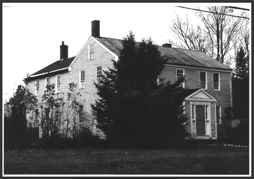
Valley Lodge
") [Saddleback Mountain Road Falls; N43° 49′ 44.38″ W70° 42′ 51.11″] Valley Lodge in Baldwin is an interesting example of an early homestead. Beginning as a simple Cape built in the wilderness, it was enlarged over the years into a sizable and attractive farmhouse. In 1788, Ephraim and David Brown came to Baldwin, then called Flintstown, from Concord, Massachusetts. Their father Captain David Brown (1733 – 1801) had fought in the Lexington-Concord battles and was one of Captain Flint’s Company given a land grant in the Baldwin area. Ephraim built the original 1 1/2 story cape he called Valley Lodge in 1792. David built a farmstead nearby that he called Saddleback Farm. That structure is no longer standing.
[Saddleback Mountain Road Falls; N43° 49′ 44.38″ W70° 42′ 51.11″] Valley Lodge in Baldwin is an interesting example of an early homestead. Beginning as a simple Cape built in the wilderness, it was enlarged over the years into a sizable and attractive farmhouse. In 1788, Ephraim and David Brown came to Baldwin, then called Flintstown, from Concord, Massachusetts. Their father Captain David Brown (1733 – 1801) had fought in the Lexington-Concord battles and was one of Captain Flint’s Company given a land grant in the Baldwin area. Ephraim built the original 1 1/2 story cape he called Valley Lodge in 1792. David built a farmstead nearby that he called Saddleback Farm. That structure is no longer standing.
")
Valley Lodge outbuildings (2018)
")
Valley Lodge (2018)
")
Prior to building Valley Lodge, Ephraim Brown had assisted his father in surveying and making the first plot plan for Flintstown. He was one of the pillars of the township, serving both as selectman and tax collector. He was also deeply involved in land speculation in the area. Within a very few years, the original Cape proved inadequate for Ephraim Brown’s growing family. He built a significant addition by enveloping the first building within a 2 1/2 story federal house with an entirely new facade several feet in front of the old front wall. In the early 1800s an upstairs dormer was added and the original ell containing the summer kitchen was remodeled and extended to include a shed.
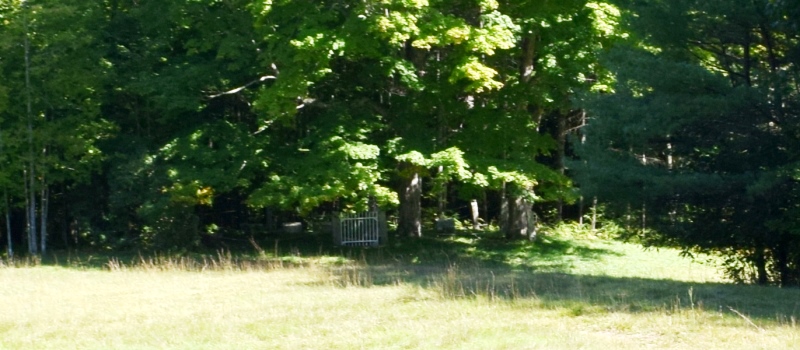
Small overgrown cemetery in the woods near Valley Lodge (2018)
Valley Lodge remained in the Brown family well into the 20th century and, though largely used as a summer house after 1880, was the scene of annual family reunions for many years. Attractively sited on the brow of a gradually sloping hill that runs down in a field from the front yard, Valley Lodge is once again a year round home though no longer used as a farm. It is one of the oldest structures in the sparsely settled sections of Cumberland County west of Sebago Lake.** [Frank A. Beard B&W photos, 1977]