
Location Map for West Bath
| Year | Population |
|---|---|
| 1970 | 836 |
| 1980 | 1,309 |
| 1990 | 1,716 |
| 2000 | 1,798 |
| 2010 | 1,877 |

Population Trend 1850-2010
| Geographic Data | |
|---|---|
| N. Latitude | 43:52:30 |
| W. Longitude | 69:51:35 |
| Maine House | Dist 51 |
| Maine Senate | District 23 |
| Congress | District 1 |
| Area sq. mi. | (total) 39.5 |
| Area sq. mi. | (land) 38.9 |
| Population/sqmi | (land) 159.1 |
County: Sagadahoc
Total=land+water; Land=land only |
|
")
Town Office (2009)
is a town in Sagadahoc County, incorporated on February 14, 1844 from a portion of Bath. In 1855 it returned some land to Bath.
Between Bath and Brunswick on the “by pass” limited access highway, West Bath is easy to miss but has more to offer than meets the fleeting eye.
")
Fire and Rescue (2010)
")
District Court (2002)
")
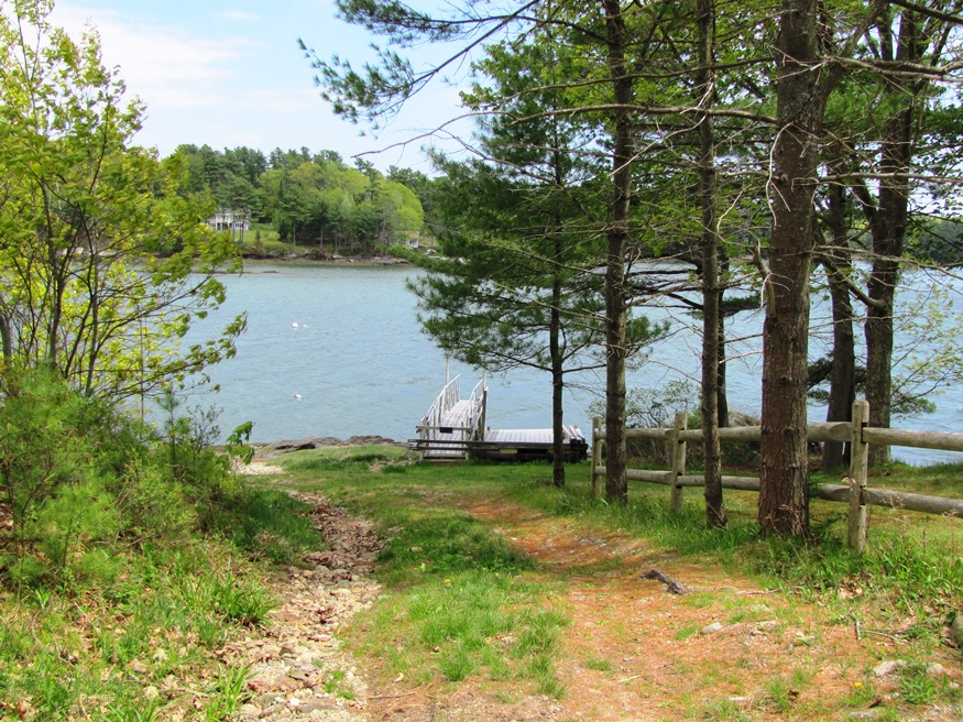
New Meadows River (2010)
West and mostly south of Bath, it is bounded by the New Meadows River on the west and has several deeply indented coves on its south end. The New Meadows was a virtual steamboat highway in the early twentieth century, serving Bath, West Bath, and beyond. It is the seat of a district court just off the highway.
 N43° 51' 59.70\" W69° 53' 17.88\"")
Maine Audubon Society’s Hamilton Sanctuary (2010) @
 N43° 52' 38.04\" W69° 53' 16.38\"")
Barn, Foster Pt. Rd (2010) @
Hamilton Sanctuary, a nature preserve on Foster Point Road, four miles from New Meadows Road, rests on a peninsula on the New Meadows River, providing views of the shoreline of Back Cove. A trail system connects meadows and forest. Frequented by migrating waterfowl, the sanctuary is managed by the Maine Audubon Society and is open to the public.
 N43° 51' 40.44\" W69° 53' 5.28\"")
House and Barn at the End of Foster Point Road (2010) @
 N43° 51' 42.18\" W69° 52' 9.42\"")
East Side of Foster Point, Williams Island right (’10) @
 N43° 51' 42.18\" W69° 52' 9.42\"")
“Ledges” end of Foster Point Road (2010) @
According to the West Bath Historical Society, Houghton Pond, at Sabino near the the
New Meadows River, was originally a swampy area and later dredged to create an ice pond in 1885.
When the ice business still flourished. Levi Warren Houghton bought the land and converted it to an 18 acre ice producing resource. Sabino, according to the Society, is named for a Native American sachem of the late 1500’s.
")
Bison at Walter Taggart Farm (2010)
Although the town’s rural tradition is still evident in its buildings and remaining farms, much of the community is influenced by its extensive coastline, which is well protected from open ocean storms.
Form of Government: Town Meeting-Select Board-Administrator.
More Videos!
Additional resources
Bath and West Bath. [pictorial, compiled by] Joyce K. Bibber. Dover, N.H. Arcadia Publications. c1995.
*Maine. Historic Preservation Commission. Augusta, Me. Text and additional photos are at the National Register of Historic Places: http://pdfhost.focus.nps.gov/docs/nrhp/text/00000763.PDF and http://pdfhost.focus.nps.gov/docs/nrhp/photos/00000763.PDF
See several editions of “Middle Ground,” the West Bath Historical Society newsletter at http://www.westbath.govoffice.com/
Purington, William C. A Look into West Bath’s Past. 1976.
Purington, William C. “Meadowsweet”: Its Rich Historical Environment. Brunswick, Me. 1973? [Maine State Library]
Register of Arrivals at Portledge Cottage, Pinehurst. 1896-1963. (Cataloger Note: [edited] Portledge Cottage at Foster Point in West Bath, was built for Major A. J. Holmes and his sons. The Holmes family was from Livermore Falls; the last visit to the cottage by a member of the Holmes family was on June 26, 1964. A register signed by guests at the cottage from 1896-1963, it also lists where each guest was from and includes notations on the weather and on various events in the life of the Holmes family. The register is accompanied by a history of the building of the cottage written by an unidentified person.) [University of Maine, Raymond H. Fogler Library, Special Collections]
Small, Alice R. West Bath 100th Anniversary. 1944.
National Register of Historic Places – Listings
Mill Cove School
[West Side of Berrys Mill Road, 0.1 mi South of the Junction with with Hill Road] Built about 1853, the Mill Cove School is the last recognizable one-room school in West Bath, where one-room schools existed from the 1770s through the mid-1940s. This modest Greek Revival style frame building is a typical mid-19th century school house. Between its permanent settlement about 1740 and 1946 (when it was decided to close the last one-room school house in West Bath), West Bath sent its pupils initially to private houses for instruction, and later to a series of rural one-room schools built. There were at least four school houses at one time. the Mill Cove School was sometimes referred to as the District #3 School and as the Littlefield School).
")
")
There was a community school established by 1772 in the Mill Cove District (or Berry’s Mills section) of West Bath, then a part of the Bath community. The custom then was for men to be teachers during the winter term when the older boys were not as busy on the farms, while the younger children were taught by the women during the summer term. Schoolmasters were paid around thirty dollars a month in the winter, while the schoolmistresses received two or three dollars weekly in the summer.
The Mill Cove School served as the first Town House for West Bath, after the town split from Bath in 1844. Presumably, the Mill Cove School was chosen because it was the most central of the West Bath schools, as well as located close to Berry’s Mills, the heart of the farming, tide-milling, shipbuilding, and salt-producing community. The original Mill Cove School building was replaced by the now existing school house about 1853. After 1869 the Mill Cove School continued to be called by its traditional name, even after Berry’s Mills tidal sawmills and shingle mills were last lost to fire that year. In 1975, Mrs. Doris Williams Clowes of Vassalboro recalled attending the school and noted how the Foster’s Point kids were picked up by the teacher in his horse-drawn beach wagon in the fall and spring, and his double runner sled in winter.*