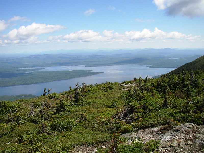
Flagstaff Lake from Bigelow Mountain (2003)
")
Flagstaff Lake, Blanchard Mt.
")
Flagstaff Lake SE Finger
")
West Peak on Bigelow Mountain (2003)
The township is immediately west of Carrying Place Town Township, host to the next northerly section of the AT. Little Bigelow Mountain, Myron H. Avery Peak, and West Peak challenge Appalachian Trail hikers. Bigelow Public Reserve Land, through which the Trail passes, is located in Dead River Township, Wyman Township, and Bigelow Township, in Franklin and Somerset counties.
Dead River TWP has approximately ten miles of shore frontage on Flagstaff Lake, the historic route of the Dead River itself. The eastern end of the lake dominates the center of the township. Dead River flows into the lake at its western end in Bigelow Township, then exits at its northeast extent, ultimately joining the Kennebec River at The Forks.
Click Image to Enlarge
")
Avery Peak from West Peak
")
The Horns from West Peak
")
Flagstaff Lake and Avery Peak
")
Little Bigelow Mountain
")
Stratton Brook and Pond
")
Flagstaff Lake
All of the trail hiking is done along the Bigelow Range averaging more than 2,000 feet in elevation. Scenic views never seem to end, since most of the trip is above the tree line.
In October 1775, Benedict Arnold’s expedition to Quebec slogged its way through the township as it sought to find the path of the then swollen Dead River. Col. Timothy Bigelow was in the expedition when it passed through Eustis. He later returned to the area and is reputed to be the first white man to summit the mountain that now bears his name.

Population Trend 1830-1940
Population counts were reported by the U.S. Census for the “Dead River Settlement” beginning in 1830 and ending in 1940. According to George Varney,
“A bridge of wood and iron, 300 feet in length, spans the river here. . . . Hurricane Falls on Dead River, near the northeastern part, present an attractive view and afford a good water-power. . . . The Methodists of the plantation hold meetings and employ a minister. There are two public schoolhouses.” . . . .
The area was identified as “Dead River Plantation” on USGS topographic maps of 1928 and 1944. The 1956 map identifies it as “Dead River” its current designation. The Settlement, and the adjoining town of Flagstaff, were obliterated in 1949 by the new Flagstaff Lake created by the Long Falls Dam. In 1905 the Dead River Township portion of Bigelow Mountain became the site of one of three fire lookout towers placed in the area by M. G. Shaw Company. The others were in Attean Township and Big Moose Township
More Videos!
Additional resources
Topographic maps: University of New Hampshire Dimond Library, Documents Department & Data Center, Historic USGS Maps of New England & New York, from http://docs.unh.edu/towns/DeadRiverPlantationMaineMapList.htm (accessed 11/23/2014)
Varney, George J. A Gazetteer of the State of Maine. 1886. pp. 192-193.
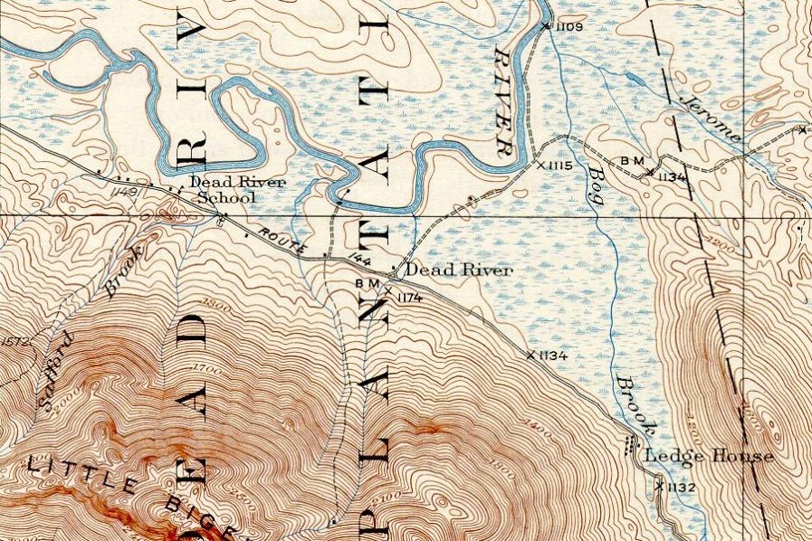
Dead River Settlement 1928
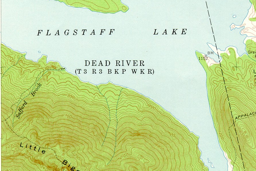
Dead River Township 1956
Brady Williams photos, August 2003 and September 2007.
![]() <= South Appalachian Trail – click a boot North
<= South Appalachian Trail – click a boot North ![]() =>
=>
Was there a Dead River Township in Aroostook County, ME, say, in 1851? I’m doing a DAR app referencing a patriot’s wife who was proven to die in Dead River, ME — but looking for proper county.
After a review of “Dead River Township” online, I see no reference to Aroostook County. Northern Somerset County is over 200 miles from Southern Aroostook. The plantation organization was surrendered in 1951.