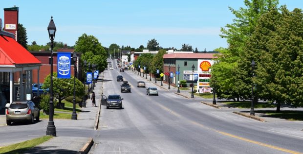
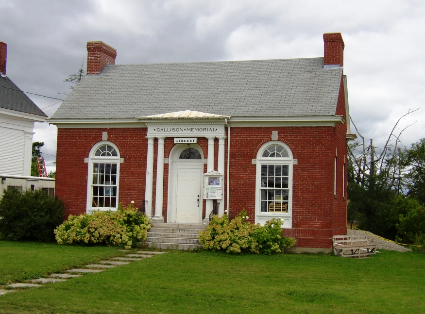
Kennebunk

The name means “the long cut bank” for a land formation near the sea. Shipbuilding and shipping were once staples of the economy, now oriented to tourism and light manufacturing. See photos. The conversion of historic buildings for contemporary use and the historic districts have enhanced Kennebunk’s attraction for visitors and new residents.

Jay

Main Street in Jay near the Mill and Androscoggin River (2013)

Both Jay and Livermore Falls, have been paper mill towns on the River since the 19th century. See photos. Jay’s town line cuts through Livermore Falls village with little obvious effect. The VFW Post is just a few hundred feet north of Livermore Falls. Jay was the scene of an extended and bitter strike of workers against the International Paper Androscoggin mill in 18987-1988. The white granite for President Ulysses S. Grant’s tomb came from North Jay

Island Falls

William Sewall became a wildlife guide and companion to Theodore Roosevelt in the 1870′s. The town has frontage on almost half of Pleasant Lake. See photos. The nearby Walker Settlement hosts a golf course and residential development near the lake. Several large homes recall the heady days when potato was king in the County. One of those was that of Governor Carl E. Milliken. Island Falls has had industry in the form of lumber mills, grist mills and a starch factory.

Houlton

In 1828 a military post was established and the military road to supply the post was completed in 1832. The garrison stayed until the Webster-Ashburton treaty was completed in 1842. See photos. Served by the New Brunswick and Canada Railway as late as 1886. By 1894 the new Bangor and Aroostook Railroad connected the town to central Maine. The “Houlton Band” of the Maliseet Indians has its tribal offices near the Canadian border.

Homer, Winslow

Boardwalk in woods in Prouts Neck, Scarborough (2002)

1836 Birth in Boston 1854? Lithography workshop 1857 Free-lancing, Harper’s Weekly 1859 National Academy of Design 1862 Artist for Harper’s 1863+ Civil War paintings, Harper’s 1866 Prisoners from the Front 1867 Homer returns to New York 1872 Snap the Whip. 1875 1st view of Prouts Neck 1881 Northumberland, England 1882 Homer returns to New York…

Hollis

Just 10 miles northwest of Biddeford-Saco, the town was the summer home of Kate Douglas Wiggin, author of Rebecca of Sunnybrook Farm among others. See photos. Her house is now the library. Wildfires of 1947 wiped out many historic homes, so only about 20% of all houses are older 50 years. The village with most commercial development is Hollis Center, with restaurants, gasoline stations, a food market and other service businesses. Poland Spring bottling plant was the only substantial industrial use in Hollis as of 2004.

Hartland

Horses Grazing near Starbird Pond in Hartland (2019)

About 19 miles northeast of Skowhegan, Hartland village lies on the Sebasticook River at the junction of Maine Routes 23, 43, 151, and 152. See photos. Built before the Civil War, the Academy Building ceased its educational function in 2001 when a new school was built.. It became the Town Hall, hosting town meetings and offices. Woolen mills and tanneries were 19th and early 20th century industries.

Harrington

In 1858 the Jefferson Davis trail was cut to haul supplies and instruments to the top of Humpback Mountain for the U.S. Coast Survey. An elegant old church, adjoins the Gallison Memorial Library on U.S. 1. See photos. The town has sustained its population base when others in Washington County have declined. From 2000 to 2010 the number of residents expanded by nearly 14%.

Hancock

Egypt Bay from Route 182 (2004)

Hancock Village lies south of the junction on a peninsular, with Taunton Bay on its northeast and Skillings River on the southwest. Further south are the villages of South Hancock and Hancock Point. See photos. A Wildlife Management Area near Egypt Bay is open to the public for primitive forms of recreation including hunting and trapping.

Gorham

University of Southern Maine, Gorham Campus (2001)

First called Narragansett Number 7, it was granted to men who fought in the Narragansett War of 1675. Gorham Academy, founded 1803, became Western State Normal School, University of Maine at Gorham, and now Gorham Campus of the University of Southern Maine. The home of former governor Percival P. Baxter has become a museum of Indian artifacts and rare coins. Several other notables lived here.

Friendship

The Brick School, 1850-1923, in Friendship (2005)

Settled in 1750, its boat building heritage began soon after and became best known for its specialty – the Friendship Sloop. See photos. The town, whose islands extend far out into Muscongus Bay, hosts the Friendship Sloop Races each summer, organized by the Friendship Sloop Society. The harbor, with its wharfs, moorings, and public landing, is a central economic and social focal point for the community.

Freeport

L.L. Bean Stores Campus in Freeport (2012)

is a popular center of “outlet” stores, including the legendary L. L. Bean, which has a virtual campus of retail buildings. See video and photos. It was named, say some, for Sir Andrew Freeport, a character in Addison’s Spectator Papers. Freeport-built vessels Lafayette and Blen were captured and burned by Confederate raiders. Arctic explorer Donald B. MacMillan lived in Freeport, as did a young John Gould, later author, humorist, and newspaper editor.

Frankfort

Named for the German city, and bombed by the British in 1814, Frankfort was once a shipbuilding community on the Penobscot River. Granite cutting and shipping was an important industry up to the early 20th century. Mount Waldo supplied the product and Marsh Bay, in the Penobscot River, provided the means of shipping it.

Fort Popham

Cannon Emplacements in Fort Popham in Phippsburg (2001)

Fort Popham stands on Hunnewell Point in Phippsburg at the mouth of the Kennebec River. This semi-circular structure was begun in 1862 but never completed. It was then that the Union realized how vulnerable the area was to potential British incursions in support of the Confederacy during the Civil War.  Concern was greatest for the…

Fort Knox

Fort Knox from Bucksport, c. 1940

named for General Henry Knox, is located in the town of Prospect in Fort Knox State Park on the banks of the Penobscot River across from Bucksport. The British controlled this area of the Maine coast during the War of 1812 and during the tensions surrounding the Aroostook War in 1838, the area felt threatened…

Fort Gorges

Fort Gorges in Casco Bay (2014)

The structure was begun in 1858, a year after Congress authorized funds, on Hog Island in Portland Harbor. By the end of the Civil War it was outdated with the invention of the rifle cannon that could destroy its granite structure. Fort Gorges is listed on the National Register of Historic Places.  Currently owned by…

Fort Fairfield

Fort Fairfield, established during the Aroostook War, took its name from Governor John Fairfield. The original fort (1839-1843), a duplicate of Fort Kent, was dismantled in 1862. A replica was built in 1976. The 1875 Canadian-Pacific Railroad station is part of the Railroad Museum at the old Bangor & Aroostook rail yard. The town, in the heart of potato country, hosts the Potato Blossom Festival in July.

Blaine, James G.

James G. Blaine, courtesy Maine State Museum

James Gillespie Blaine (1830-1893) was a major political force in Maine and the U.S. Congress. A Representative and a Senator from Maine; he was born in West Brownsville, Washington County, Pa., January 31, 1830. He was graduated from Washington College, Washington, Pa., in 1847, taught at the Western Military Institute, Blue Lick Springs, Kentucky. He…

Flye, Edwin

(1817-1886) a U.S. Representative was born in Newcastle on March 4, 1817, attended the common schools and Lincoln Academy. He engaged in mercantile pursuits and shipbuilding. A member of the Maine House of Representatives in 1858, he served for many years as president of the First National Bank of Damariscotta. During the Civil War, he…