
Location Map for Frankfort
| Year | Population |
|---|---|
| 1970 | 620 |
| 1980 | 783 |
| 1990 | 1,020 |
| 2000 | 1,041 |
| 2010 | 1,124 |

Population Trend 1790-2010
| Geographic Data | |
|---|---|
| N. Latitude | 44:35:36 |
| W. Longitude | 68:55:12 |
| Maine House | District 98 |
| Maine Senate | District 11 |
| Congress | District 2 |
| Area sq. mi. | (total) 25.9 |
| Area sq. mi. | (land) 24.6 |
| Population/sq.mi. | (land) 45.7 |
County: Waldo
Total=land+water; Land=land only |
|
Clipper Ships Built Here
- Flying Arrow (later Wings of the Wind)–1852
- Ocean Spray–1852
- Nonpareil–1853
- Speedwell–1853
- Spitfire–1853
- Arey–1856
")
Veterans Memorial Park (2003)
")
Town Office and Post Office (2003)
[FRANK-frt] is a town in Waldo County, incorporated on June 25, 1789 was a large area that was diminished as land was ceded, between 1794 and 1867, to form Prospect, part of Hampden, part of Swanville, Winterport and Monroe.
")
")
Named for the German city, and bombed by the British in 1814, Frankfort was once a shipbuilding community on the Penobscot River.
")
Fire Department (2014)
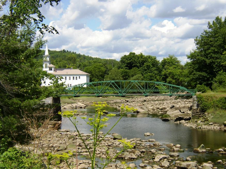
The village is located at the confluence of the North and South branches of the Marsh River, which flow into picturesque Marsh Bay and thence to the Penobscot. Mount Waldo, an 1,064 foot elevation historic source of granite, overlooks the Mendall Marsh.
")
Mount Waldo from which Granite was Cut (2003)
")
Marsh Bay (2003)
Granite cutting and shipping was an important industry up to the early 20th century. In 1902 the Mount Waldo Branch of the Granite Cutters Union was formed. Mount Waldo supplied the product and Marsh Bay, in the Penobscot River, provided the means of shipping it.
")
Granite Structure on Marsh Bay (2014)
")
Boat Launch at the Bay (2014)
The North Branch of the Marsh River flows through the main village, which is clustered tightly where U.S. Route 1A crosses the river. The historic Frankfort Dam is just downstream from the Route 1A bridge.
Form of Government: Town Meeting-Select Board.
Additional resources
Daybook, 1812-1847. (Cataloger Note: Daybook of an unidentified farmer from Frankfort, Maine. The name Andrew Tyler is mentioned in the volume. The volume records work done for various individuals as well as goods sold. Entries list activities such as cutting and hauling wood, making cider, and shearing sheep, as well as the sale of corn, potatoes, beef, etc.) [University of Maine, Raymond H. Fogler Library, Special Collections]
Daybook, 1876-1881. (Cataloger Note: A daybook by an unknown compiler listing financial transactions including payments for labor performed, ice charters, pilotage of various vessels, and groceries and dry goods sold. . . . it may have belonged to Edwin Parker Treat, owner of a general store and cooperage business in Frankfort.) [University of Maine, Raymond H. Fogler Library, Special Collections]
Emerson, Paul. Frankfort and Winterport Men of the Civil War. Frankfort, Me. P. Emerson. 1998? (A journal of men who served from Frankfort and Winterport.)
Frankfort, Maine 1774-1976. Belfast, Me. Frankfort Maine Bicentennial Committee. 1976.
Jones, Erasmus Archibald. History of the Town of Frankfort. Winterport Me. Advertiser Job Print. 1897.
Lewis, Ernestine. The History of Mt. Waldo, Frankfort, Maine. Frankfort, Me. E. Lewis. 1996.
Weed, Reuben G. Ledgers 1855-1866. (Cataloger Note: Includes an account book covering household and farming expenses, lumber mill diary, drawings. Covers the period 1855-1866 in Frankfort, Maine.) [University of Maine, Raymond H. Fogler Library, Special Collections]
Weston, Theodora W. Frankfort-Winterport: The Separation Story: Winterport’s 125th Anniversary. Winterport, Me. Winterport Historical Association. 1985.
")
Marsh River, South Branch toward Marsh Bay (2003)
National Register of Historic Places – Listings
Frankfort Dam
[South of junction of US Route 1A and North Branch of Marsh Stream] (see photo above) The stone dam across the Northern Branch of Marsh Stream is at least the third dam at that location. Frankfort’s earliest settler, Joshua Treat, built the first saw mill and log dam across the stream in 1774. The buildings were burned by the British in 1779 and rebuilt by Treat four years later. Throughout the 19th century a sawmill and gristmill, referred to as the Treat mills, processed lumber that was floated down stream in massive log drives. Pilings from these early mills are still evident on the west side of the stream, about 50 feet south of the present dam.
")
")
The stone dam, built in 1905 of local granite, insured that the water power on Marsh Stream could be harnessed long into the future. The earliest settlers arrived in what became Frankfort in 1773. The village around the North Branch of the Marsh Stream quickly harnessed the river’s energy to run saw and grist mills. The lumber and shipbuilding industry supported a vast region of settlement along the Penobscot River. Mosquito Mountain in Frankfort was the source of foundation stones for Fort Knox in nearby Prospect. In 1846 the granite on nearby Mt. Waldo became the preferred building material for the Fort.
In 1880 the Mount Waldo Granite Company was incorporated. In 1905, John Pierce owner of the Granite Company, purchased the brand new stone dam in Frankfort. A spate of fires in the early 20th century destroyed many of the stores and businesses on the west side of Marsh stream and it is possible that the construction of the new stone dam followed upon the heels of a fire at the sawmill then owned by George Pierce.
The dam was built to harness the water power for industry rather than for flood control. By 1921 the Turner Sawmill was built near the dam. It manufactured shingles during the 1930s. In 1968 the dam was purchased by the Town of Frankfort, which continues to own the property and rent out the water power rights. By the mid-1970s the Turner Mill had been removed and in 1982 a concrete fish way was installed to assist the local salmon and alewife migration. In 1985 a new hydroelectric station was built on top of the dam at the site of the former mill.*
Mount Waldo Granite Works
Address Restricted