T3 R8 WELS

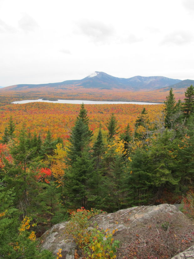
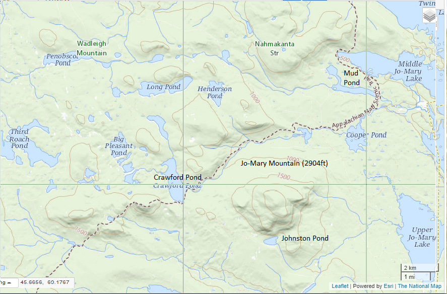
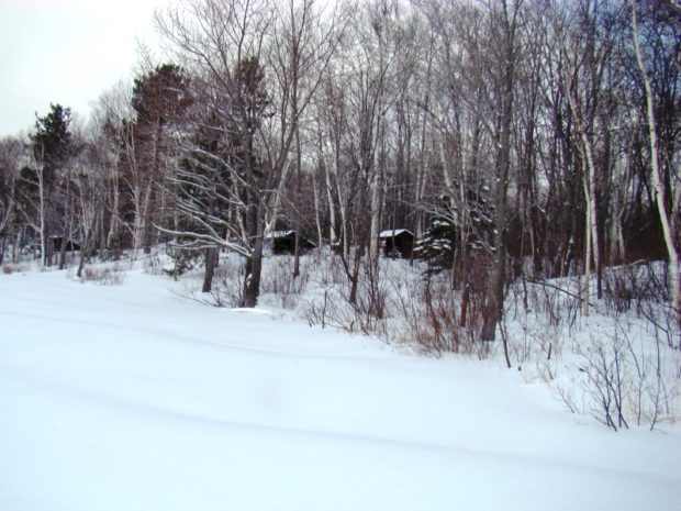
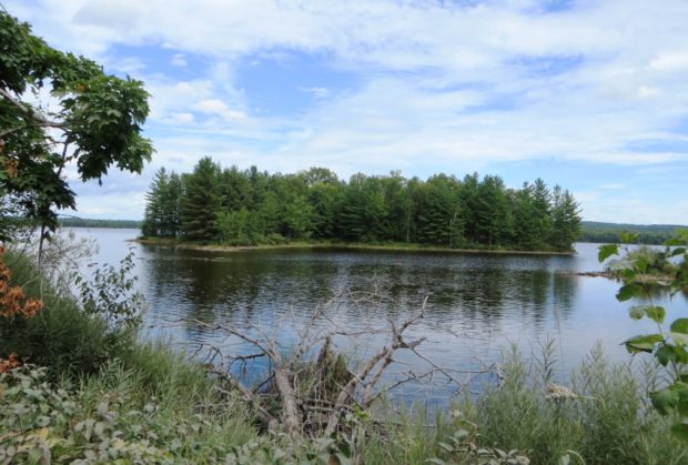
Most of this township  is part of the Katahdin Woods and Waters National Monument.  The exception is a portion in its northwest corner around Katahdin Lake, now part of Baxter State Park. The balance of the township is crossed with many miles of unimproved (dirt) roads. The National Monument here is accessible east of Stacyville…

T4 R9 NWP

sign: "Piscataquis County Line, Entering T4 R9" (NWP) on Route 11 (2014)

       Piscataquis County Line Entering T4 R9 WELS   Community This township is in north central Maine in Piscataquis County. It is dominated by Seboeis Lake and the Seboeis Maine Public Reserved Land, which surrounds most of the Lake. Two small settlements, Schoodic and Packards, are in the west of the township along…

T5 R9 WELS

  This township is located in the northeastern area of Baxter State Park, accessible by Route 159 and Grand Lake Road north of Shin Pond Village. Matagamon Gate is the north entrance to the Park. A slower route is to enter in the south at Togue Pond Gate and travel the relatively slow Park “Tote…

T6 ND BPP

Fourth Lake Road in T6 ND BPP (2013)

     Fourth Lake Road in T6 ND BPP (2013) @ This township is just west of Grand Lake Stream Plantation.  Its Fourth Lake Road leads to the interior, to nearby lakes, including Pocumcus Micmac for “at the gravelly place.” * Eventually the road leads to a campsite and boat launch at Fourth Machias Lake…

T7 R9 NWP

Historic Topographic Map of T9 R9

This township is immediately south of the Bowdoin College Grant East, host to the next northerly section of the AT. The Trail (red dots on the maps) runs from East Chairback Pond, over Chairback Mountain, past West Chairback Pond to Third Mountain and Fourth Mountain in the western edge of the township. In the 1940’s…

T8 R9 WELS

Mount Katahdin with Snow Cap from T8 R9 WELS on the Pinkham Road (2015)

              Mount Katahdin with Snow Cap from T8 R9 on the Pinkham Road (May, 2015) @   This township is bisected, northeast to southwest, by Pinkham Road beginning in T9 R9 WELS and exiting to T8 R10 WELS in the southwest. This well maintained dirt road is one of…

T9 R8 WELS

Moose in the Gravel Pit off the Pit Road in T9 R8 WELS (2015)

                                     Moose in the Gravel Pit off the Pit Road in T9 R8 WELS (2015) Roads Pinkham Road is the main artery in this township from northeast to southwest.  Craigville Road joins Pinkham from the east, just south…

T9 R9 WELS

Maine Forest Service on the Pinkham Road (2015)

Maine Forest Service on the Pinkham Road (2015) @ A Maine Forest Service Station on the Pinkham Road in the south of the township, is adjacent to Brown Brook which crosses the road there.  It seems to be a remote outpost with no other station for many miles. Presumably the brook would provide water for…

TA R10 WELS

Area of TA R10 Township as represented in the 1952 Topographic Map.

                  Area of TA R10 Township as represented in the 1952 Topographic Map. This township is immediately adjacent to T1 R11 WELS, host to the next northerly section of the AT. The trail generally tracks east-west, except for a short northwest-southeast section between Mud Pond and Lower…

TA R11 WELS

View from Little Boardman Mountain

View from Little Boardman Mountain (2007) The township is immediately west of TA R10 WELS, host to the next northerly section of the Appalachian Trail. Heading south, the AT follows Cooper Brook to Crawford Pond, the to the East Branch of the Pleasant River. Two AT shelters may be found in the township, one in…

TA R12 WELS

1952 TA R12 Topographic Map

The township is immediately adjacent to T1 R11 WELS, host to the next northerly section of the AT. The Appalachian Trail cuts briefly through the southeast corner of the township, also known as Shawtown. Shawtown is a very watery township, with four of the Roach Ponds and First, Second, Third, and Fourth West Branch Ponds.…

TB R11 WELS

A view from the ridges in TB R11 WELS 2007

          A view from the Appalachian Trail on ridges in TB R11 WELS (2007) This township, in Piscataquis County, is immediately southeast of TA R12 WELS, host to the next northerly section of the Appalachian Trail. The AT briefly (about two miles) passes through the northwest corner of the township as…

Township C

Detail of 1940

     Detail of 1940’s Township C Topographic Map This oddly shaped, [click Location Map for red location] trapezoidal township, not to be confused with the triangular C Surplus, is immediately west of Township D, host to the next northerly section of the Appalachian Trail. The trail travels about one mile in the township’s southeast…

Township D

                                    Beaver Pond on Route 17 in Township D 1940’s Township D Topographic Map This township is immediately west of Township E, host to the next northerly section of the AT. The Trail enters at the northeast corner…

Township E

Sandy River at Smalls Falls and Roadside Picnic Area on Route 4 (2017)

 Sandy River at Smalls Falls and Roadside Picnic Area on Route 4 (2007) Township E is south of Sandy River Plantation, host to the next northerly section of the AT after Township D. (E Township is a different township in Aroostook County.) Township E, almost triangular in shape,  extends eight miles from Long Pond in…

Townships

Tumbledown Pond in Township 6 North of Weld in Franklin County (2008)

Townships is the designation of minor civil divisions that have no organized local government, such as a plantation, town or city.
School Bell Commemorating the Maine Unorganized Territory School System (2001)

Bell Recalling the Unorganized Territory School System (2001)

Townships in Maine are administered directly by the State government. Taxes are due directly to the State Bureau of Taxation, with funds disbursed to support township services such as schools. They have names or may simply be designated by a township and range identification, such as T3 R4 WELS or T5 ND BPP. T stands for township, and R indicates a range. More abbreviations are here.

Trescott

Location Map for Trescott

The township, in Washington County, has several coastal harbors, one at the village of South Trescott. During the clipper ship boom of the 1850’s, the vessel Sea Lark was launched in 1852. Served by Maine routes 189 and 191, it has substantial frontage on Cobscook Bay at its northern tip.