C Surplus Township

                    CSurplus is a small, triangular township in Western Maine’s Oxford County. It is West of the trio of Township C, Township D and Township E. It is just East of the town of Upton. No improved roads link the two. The Appalachian Trail closely bypasses…

Richardson Town Township

Sign: "State of Maine Public Reserved Land" which is located in the Township. (2018)

  This western Maine township in Oxford County near New Hampshire is just east of Magalloway Plantation. It encompasses Upper Richardson Lake with shore frontage on Mooselookmeguntic Lake. Upper Richardson Public Reserved Land is located north of the small village of Upper Dam. The State of Maine’s lake survey combines data for Upper and Lower…

Lower Cupsuptic Township

The Cupsuptic River crosses under Route 16 to feed Cupsuptic Lake in the southern most portion of this township. A boat launch area is on the east bank of the Cupsuptic River near the bridge. Big-Falls is a waterfall in the northwest corner of the township on the Cupsuptic River. It is accessible from Route…

Adamstown Township

Cupsuptic Lake near Wilsons Mills Road (2018)

                                  This township in Oxford County is the site of Upper Richardson Maine Public Reserved Land and miles of lake shore on Cupsuptic and Mooselookmeguntic lakes. Route 16 cuts a diagonal northeast-southwest swath through the township. West Richardson Pond is…

Parmachenee Township

Location Map for Parmachenee Township

This township is on the New Hampshire border in northwestern Maine. The name, according to Brian McCauley, is “Abenaki for ‘across the usual path.’ Legend says it was the name of an Indian Chief’s daughter.” The Magalloway River runs southward through it and through the 900+ acre Parmachenee Lake, which extends south into Lynchtown Township.…

Lynchtown Township

Location Map for Lynchtown Township

The Oxford County Township, in northwestern Maine on the New Hampshire border, is just south of Parmachenee Township. It includes and  a small north portion of Aziscohos Lake and the bulk of Parmachenee Lake.  That lake was home to the Parmachenee Club. The Club was formed in 1890 by a group of mostly New York…

Milton Township

Corn Field in Milton Township on Route 232 in Autumn (2014)

This small township is surrounded by organized towns: Rumford, Bethel, Woodstock and Peru – all in Oxford County. About one mile of Route 232 is in the western corner and serves as the “Main Street” serving Milton Village. Several mountains, most of which are under 2,000 feet high, mark the landscape: Bean, Bryant, Chamberlain, Davis,…

Batchelders Grant Township

Forest Protection Area in the White Mountain National Forest on Maine Route 113, Wild River at Right (2013)

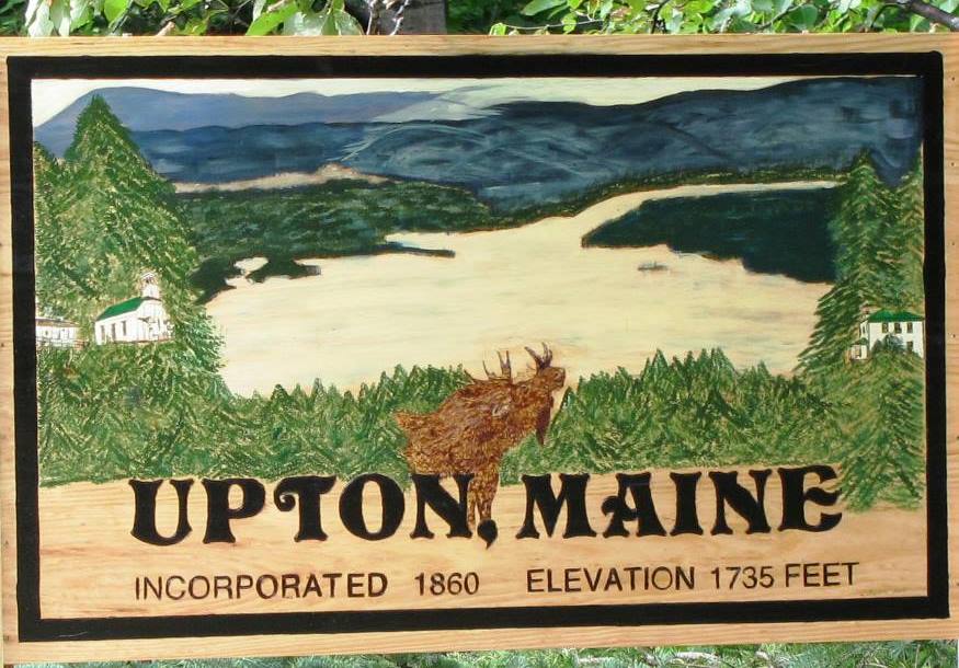
This township in Oxford County was named for the original grantee, Josiah
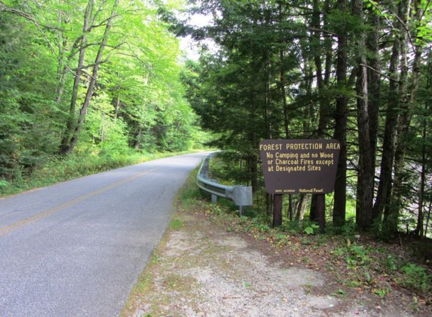
Batchelder. It borders New Hampshire in the White Mountain National Forest.

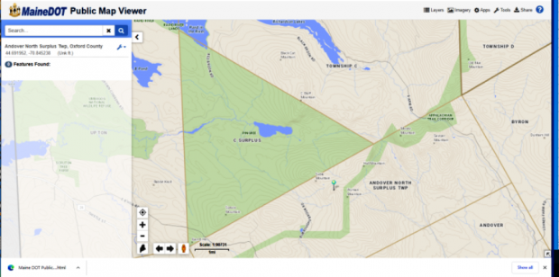
Maine Route 113 runs north-south through the township. Portions of the road, also known as the Evans Notch Road, are closed during the winter. Access is then from Gilead in the north or from Stow in the south.

Evans Notch, in the southern portion of the township, is a deep cut among the White Mountains. It is a popular hiking location using the East Royce Mountain Trail to that mountain from two points on Route 113.

Woodstock

Not the site of the 1960’s rock concert (that was New York), Woodstock’s major village is Bryant Pond, named from the adjacent water body. The Pond outlet is the source of the Little Androscoggin River. See photos. South Woodstock is home to the small South Woodstock Meetinghouse and is the site of an old mill pond and mill on Andrews Brook.

Waterford

Crooked River in East Waterford (2003)

The main village (see photos) lies on the shore of Keoka Lake, and State Routes 35, 37 and 118 provide easy access to lakesides, and to the larger communities to the south. The Artemis Ward House commemorates the birthplace of Charles Farrar Browne, the 19th century humorist. North Waterford, at the junction of Routes 35 and 118, is home to the town’s fairgrounds. The general store there provides gas and basic groceries.

Upton

This small community borders New Hampshire and Umbagog Lake that straddles the two states and is the source of the Androscoggin River. However, the river runs south through New Hampshire before entering Maine in Gilead. Upton is far from other sizable Maine towns on Maine Route 26 as it ends at the New Hampshire border.

Sweden

Webber Pond on the Webber Pond Road in Sweden (2014)

Year Population 1970 110 1980 163 1990 222 2000 324 2010 391 Geographic Data N. Latitude 44:07:24 W. Longitude 70:48:59 Maine House District 71 Maine Senate District 18 Congress District 2 Area sq. mi. (total) 29.7 Area sq. mi. (land) 28.8 Population/sq.mi. (land) 13.6 County: Oxford Total=land+water; Land=land only [SWEE-dehn] is a town in Oxford…

Sumner

Increase Robinson Library (2013)

East-west Maine Route 219 serves Pleasant Pond and the villages of West Sumner and East Sumner on its way from West Paris to North Turner. See photos. After booming for decades, the town was crippled by the Great Depression and eventually by the loss of the railroad in 1952. From Buckfield to Turner, the river is a corridor for canoe trips.

Stow

Cold River in Stow (2014)

Stow borders New Hampshire, which may be reached by Maine Route 113 north from Fryeburg. It was once the home of the Pequawket Indians, who traveled the Pequawket Trail to Biddeford Pool during the summers to fish and gather shellfish. The Cold River enters the state in Stow and flows south through most of this narrow north-south shaped town.

Stoneham

Log cottages at Camp Susan Curtis at Trout Lake in North Lovell (2004)

Though named for the Massachusetts town of the same name, the stony landscape also reflects its title. An excellent mountain climbing region, it is located near the New Hampshire Border in the White Mountain National Forest. East Stoneham is the principal village. The town is home to Camp Susan L. Curtis, named for the daughter of the former Governor. The closest Maine Route is number 11 where, at North Lovell, one may venture into Stoneham’s secondary roads.

Rumford

Deacon Hutchins House (1979)

Year Population 1970 9,363 1980 8,240 1990 7,078 2000 6,472 2010 5,841 Geographic Data N. Latitude 44:31:19 W. Longitude 70:35:50 Maine House District 115 Maine Senate District 18 Congress District 2 Area sq. mi. (total) 69.9 Area sq. mi. (land) 68.6 Population/sq.mi. (land) 85.2 County: Oxford   Total=land+water; Land=land only [RUM-frd] a town in Oxford…

Roxbury

The Swift River in Roxbury from Route 17 (2007)

Several miles north of the Rumford-Mexico area on Maine Routes 17 and 120, the community (see photos) is known for its mineral deposits, especially accessible for amateur rock hunters. It has substantial frontage on Ellis Pond (also known as Silver Lake and Roxbury Pond) and on the Swift River. A wind farm is on Record Hill.

Peru

Apparent Horse Cemetery on the Ridge Road (2013)

The town is on the south bank of the Androscoggin River just below the Rumford-Mexico-Dixfield area. Its main village is West Peru, across the river from Mexico in the northern portion of the town. See photos. Further south on the Ridge and Valley roads, the rolling rural landscape reveals mountain views, farms and forests. A campground and bed & breakfast may be found at the three-mile long Worthley Pond.

Paris

1856 Paris Hill Academy Building (2019)

The Paris Hill neighborhood has several architecturally interesting old homes, while South Paris has been the industrial and manufacturing center. See photos. On the Stearns Hill Road the old Hungry Hollow schoolhouse sits on a small plot. South Paris village, split by the Little Androscoggin River, is the main population center and is half of the Norway-South Paris community.