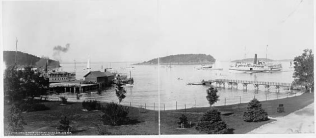
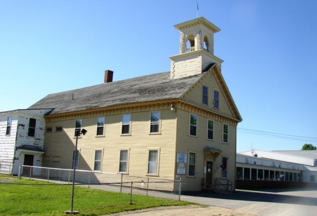
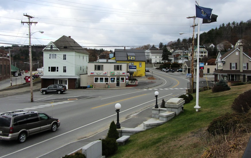
A Fading History

Former 19th Century Josiah Locke Tavern

As time and tides take their toll, physical remnants of Maine’s history disappear. Fires and intentional demolition, or simple abandonment clean the slate for the next generation. Luckily the Maine Historic Preservation Commission and Maine Preservation, along with local organizations, have protected properties destined for demolition. Unfortunately, many historic community icons have, nevertheless, been lost.…

Portland

House in the West End (2014)

The West End is well known for its fine 19th and early 20th century houses and tree-lined streets. Its extends west of State Street between Congress Street and Commercial Street to the Western Prom. Several Greater Portland Landmarks are here.

Woolwich

Woolwich Shore on the Kennebec River from Thorne Head in North Bath (2010)

Woolwich, across the Kennebec River from Bath and with long shores on Merrymeeting Bay, is home to two nature preserves. Settled in the 1600s, it has several historic buildings. Alewives have been a historic part of the community.

Parsonsfield

Porter-Parsonsfield Covered Bridge over the Ossipee River (2014)

Kezar Falls, a village on the Ossipee River named for George Kezar, is the largest in the area at the junction of Maine Routes 25 and 160. The community is split between Parsonsfield and Porter across the river, and is governed and taxed separately by the two towns. An early 20th century sanatorium, Maple Crest, was “located among the beautiful Limerick hills, the wild and picturesque outlines of which may be seen in every direction from the building. The view is in itself enough to stimulate the interest and mental activity so important to the cure of all diseases.

Macwahoc

The name (the Indian term for “bog” or “wet ground”) is appropriate since the main village lies at the north end of a bog on Molunkus Stream. See photos. The township has some frontage on Molunkus Lake. A 485 acre section of Maine Public Reserved Land is here.

Litchfield

The town contains the Tacoma Lakes, Cobbosseecontee Stream, a portion of Cobbosseecontee lake, Pleasant Pond, and several other ponds. See photos. Between Lewiston and Augusta, it offers summer cottage locations for many area residents. Litchfield Corners, in the southern tip of the community, hosts an old tavern, new town office and a country store.

Lisbon

Lisbon Falls, on the Androscoggin River, is the largest village; Lisbon Village, on the Sabattus River, is the next largest. See photos. A mill town harnessing the power of these rivers through most of the 20 century, Lisbon’s economy has turned more toward services and light industry as the mills have closed. Stephen King attended high school here.

Jay

Main Street in Jay near the Mill and Androscoggin River (2013)

Both Jay and Livermore Falls, have been paper mill towns on the River since the 19th century. See photos. Jay’s town line cuts through Livermore Falls village with little obvious effect. The VFW Post is just a few hundred feet north of Livermore Falls. Jay was the scene of an extended and bitter strike of workers against the International Paper Androscoggin mill in 18987-1988. The white granite for President Ulysses S. Grant’s tomb came from North Jay

Gilead

Sign: Welcome to The Town of Gilead (2013)

the Androscoggin River splits Gilead down the middle from west to east, flowing between two mountain ranges. See photos. Only one bridge crosses at the village. In 1973 the U.S. EPA was documenting pollution in the river. A brief canoe trip makes about five of its six miles through Gilead to West Bethel, with spectacular views of the Presidential Range.

Falmouth

Historic Hall

In 1658, a town named Falmouth was created but was destroyed by Indians in 1689. In 1718 a town was again established. Much of the original area was later distributed to new towns: Cape Elizabeth, Portland, and Westbrook. Falmouth is a rapidly growing suburban community, having increased over 35% in population between 1990 and 2000. Percival Baxter donated Mackworth Island to the state, now a nature preserve in the town.

Machias

Sheriff

The town, and its Burnham Tavern, was the site of anti-British plotting resulting in capturing the schooner Margaretta. The Tavern was built in 1770, the only building in eastern Maine directly connected with the American Revolution. The Washington County seat, it is located on the Machias River, the engine of its earlier lumbering and shipbuilding industries. Once a haven for pirates, and now a commercial center, it is home to the University of Maine at Machias.

Burlington

Panoramic view of Saponac Pond, fields and mountains in Burlington Village (2014)

in Penobscot County, incorporated in 1832. The township was first settled in 1824, probably by Tristam Hurd who donated the name “Hurd Ridge” to the area. Saponac Lake, in the south, is from the Indian word for “the big opening.” Lumbering and agriculture have been the main occupations, with little manufacturing.

Bucksport

in Hancock County was settled in 1762. Jed Prouty’s Tavern and Inn, no longer operating, was a stop for the Bangor to Castine stage route. The paper mill (once St. Regis, then Champion, then Verso) dominates the north end of town and is across the Penobscot River from Fort Knox. Northeast Historic Film, a moving image archives, research and education center is located here. See photos.

Belfast

Belfast Bay from Young

its historic district features a variety of architectural styles, primarily from the booming 19th century economy. Located on Penobscot Bay, its shipping and shipbuilding brought a population explosion between 1810 and 1850. In the mid-20th century, Belfast was home to the chicken broiler industry. It has transformed into a tourist destination, touting its historic structures. See video and photos.

Bar Harbor

The Harbor from Newport House (c. 1901)

After Newport, Rhode Island, Bar Harbor was the resort of choice for wealthy eastern Americans until the great fire of 1947 destroyed many homes and forested areas. Acadia National Park dominates tourists’ itineraries when the town’s population swells each summer. The College of the Atlantic is located here.

Baldwin

Field near Valley Lodge with a small cemetery in the woods (2018)

Baldwin is the only one of the towns surrounding Sebago Lake that has no frontage on that lake. East Baldwin village is located in the southeast corner of the town. West Baldwin village sits at the western edge of the Saddleback Hills, which span the width of the town. See photos.

Skowhegan

Recorded as Skwahegan in early reports, the name means “watching place for fish,” drawn from the falls in the Kennebec River that harbored salmon. See photos. Local Indians speared them as they attempted to scale the falls. Textile and shoe manufacturing were major employment options for local residents during the late 19th and early 20th centuries. Once home to Camp Modin, a camp for Jewish boys and girls until 1992, Lake George Regional Park is split between Skowhegan and Canaan.

Richmond

The main village is located on the west side of the Kennebec River, just south of Gardiner on Maine Route 24, where the river splits to form Swan Island. See photos.Benedict Arnold’s expedition, having first landed at Swan Island in the river across from the town, passed by the remnants of Fort Richmond. The town has a substantial collection of grand houses, including several Greek Revival specimens. Peacock Beach State Park is near the historic Peacock Tavern on U.S. Route 201.