Newport

Bird in its safe habitat near the Sebasticook River in North Newport (1014)

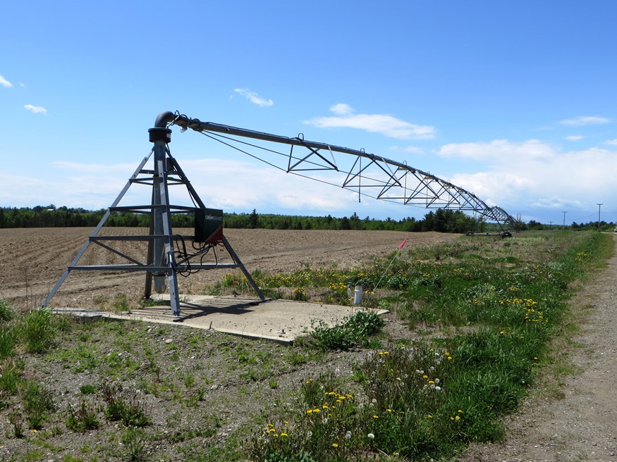
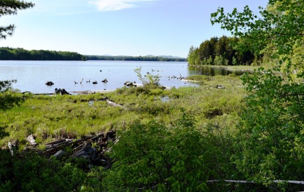
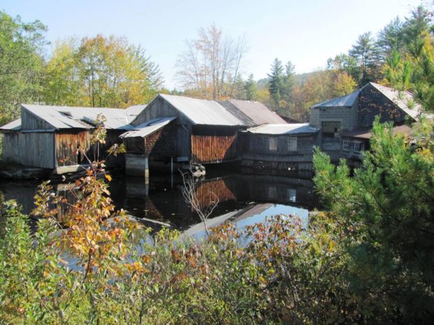
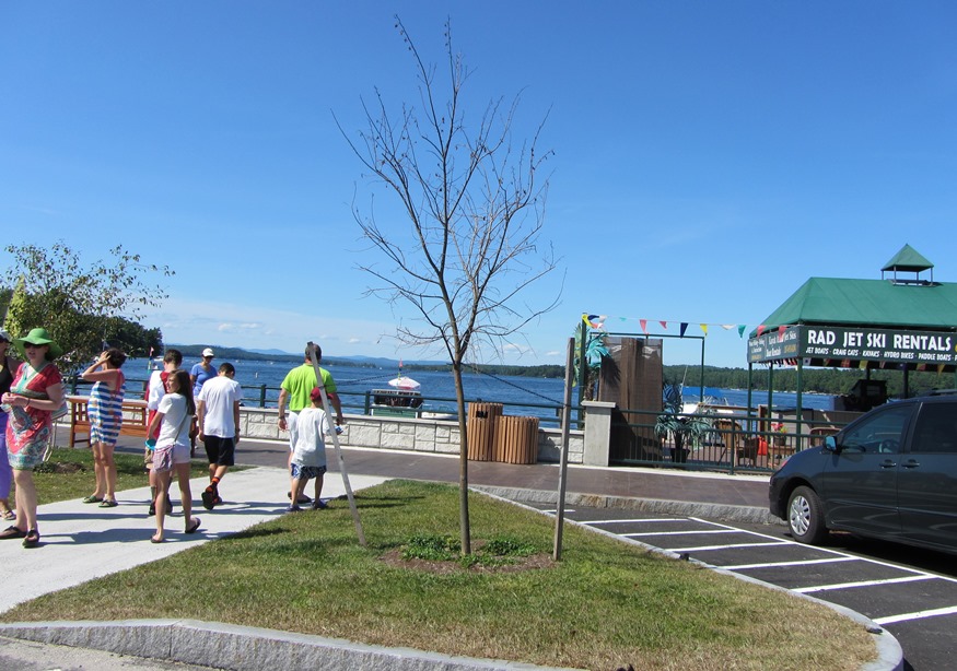
Newport features the six-mile long Sebasticook Lake, providing recreational opportunities for residents and summer visitors. Drought conditions in 2002 lowered the water level substantially. See photos. Prior to the opening of what became the Maine Central Railroad in 1855, Newport was a center of stage coach transportation. Newport is still a heavily traveled crossroads, now of Interstate 95, U.S. Route 2, and Maine Routes 7, 11, and 100. The area east of Sebasticook Lake is known as East Newport.

Newfield

The old center of Newfield village was destroyed by the great forest fire of 1947. See photos. The Willowbrook Historic District covers this area and the buildings that survived the fire. In 1984 the application to establish the historic district reported “Very little change in the buildings or landscape has occurred in the last one-hundred years so that the sense of time and place of a remote southwestern Maine rural community of the 19th century remains strongly present.” At the source of the Little Ossipee River, and dotted with ponds and streams, Newfield is a rapidly growing community about twenty miles northwest of Sanford

Nashville

Location Map for Nashville

Located northwest of Ashland and south of Portage Lake on Route 11. Little Machias Lake, through which the Little Machias River runs, is in the northwest corner of the plantation. Nashville hosts two lots of Maine’s Public Reserved Land, of which about 10% of the acreage is reserved for wildlife, with the remainder allocated to timber management and harvesting.

Naples

Long Lake on Route 302 in Naples (2013)

Blessed with ample access to Long Lake, Sebago Lake at the intersection of U.S. Route 302 and Maine Routes 11, 35 and 114, Naples has long been a vacation resort community. See photos. Henry Wadsworth Longfellow and Nathaniel Hawthorne have sung its praises. The Songo Lock, built about 1830 and now shared with the town of Casco, linked Long Pond and Brandy Pond with Sebago Lake

Moro Plantation

Katahdin Lodge on Route 11 in Moro Plantation (2014)

is located about 24 miles west of Houlton, and north of Patten on Maine Route 11. See photos. Rockabema Lake, the source of the West Branch of the Mattawamkeag River, occupies the north central portion of the township. A Scattering of small ponds lie just north of the lake, providing a fine source of fishing. The heavily wooded area supports hunting, guides, and hunting lodges.

Monmouth

Cumston Hall (2001)

The Theater at Monmouth, specializes in Elizabethan productions. See photos. Highmoor Farm is part of the University of Maine’s agricultural experiment station network. This growing town is located on U.S. Route 202 between Augusta and Lewiston, making it a convenient location for commuters to each city.

Minot

Minot a growing community in recent decades, has become a residential commuter area for nearby Lewiston-Auburn with its location just west of Auburn. West Minot village is tucked away at the northwest edge of the community at the junction of Maine routes 119 and 124, adjacent to Hebron. The village once had an active railroad station and a grist mill. The old grange hall, community church, and railroad station keep the flavor of earlier times.

Milo

House and Barn in Milo on Route 11 [Park Street] (2014)

Milo village lies just north of the junction of the Sebec and Piscataquis Rivers. The Pleasant River flows south through the town from Brownville to join the Piscataquis. Derby, on the east side of the Sebec River, is a service area for the Bangor and Aroostook Railroad.

Mechanic Falls

Ever since a paper mill was established on the Little Androscoggin River in 1850, the town has been part of Maine’s paper making economy. See photos. One of the inventors of the Stanley Steamer automobile, Freeland O. Stanley, built some models here and was the town’s first high school principal.

Masardis

Railroad Crossing in Masardis near Fraser Timber Mill on Route 11 (2015)

The Aroostook River flows northward through the middle of the township and by the village of Masardis. The small Pollard Flat Wildlife Management Area lies on the west bank of the river north of the village. A boat launch provides access to Scopan (formerly Squa Pan) Lake. Most of the Lake is in adjoining Scopan Township.

Manchester

Still a basically rural community, Manchester has maintained its old 1793 North Manchester Meetinghouse. It also features a sustainable forestry project within a few hundred yards of the Meetinghouse on Scribner Hill Road. A suburb of Augusta, the town has substantial frontage on the northern half Cobbosseecontee Lake.

Limington

The Campus of Limington Historical Society (2014)

Limington Academy, now on the National Register of Historic Places, was incorporated in 1848. See video and photos. After 200 years, the old Town Hall was replaced by a modern Municipal Complex. Primary education now takes place in the Emery Memorial School, a major change from the old Longfellow School. Nevertheless, the main village retains its historic character thanks to the local efforts to establish its Historic District.

Lebanon

This western-most town borders New Hampshire on the Salmon Falls River. A rapidly growing rural commuter community, Lebanon tripled its population between 1970 and 2010, adding 20% between 2000 and 2010. Settled in 1743, it was incorporated 1767. A meeting house was erected in 1753, two garrison houses in 1755, and a parsonage in 1759.

Hersey

Hersey Village is in the extreme west of the township on Route 11. Townline Road is its northern boundary, separating it from Moro Plantation. The interior of the township is accessible on the Retreat Road, which extends from Route 159 in Crystal in the south to Route 11 in Hersey’s northwest corner. The 137-acre Crystal Lake is the only one in the town.

Greene

Sawyer Road with Horse Farms (2013)

With the Androscoggin River as its west boundary, the town’s east lies substantially along Sabattus Pond. The more densely populated area surrounds Route 202 near Greene Village. South from there is a rural landscape and views of Sabattus Pond. Inventor Leonard Norcross lived here in the early 19th century as a young boy. Since 1970 the increasingly suburban community in the Lewiston-Auburn area has more than doubled its population.

Exeter

Crop Spray Irrigator at Exeter Corners (2014)

Uncharacteristic for most Maine towns, Exeter has neither a lake, pond or mountain of note. Maine combined Routes 11 and 43 zigs and zags in a generally east-west direction through the town. The economy is a mix between agriculture and work in the Bangor area service industries.

Millinocket

This 1912 building was the Great Northern Paper Co. administration building. Later mill owners used it for offices until just before the mill

The Great Northern Paper Mill and the Bangor and Aroostook Railroad have been keys to the economic life of Millinocket for many years. See photos. The declining employment in the paper industry contributed to the steady loss of population over the past forty years – 42%. Millinocket is the gateway to Baxter State Park and its famed Mount Katahdin.

East Millinocket

Truly a company town, as is Millinocket, its incorporation followed Great Northern’s development of the paper mill and ground wood mill in 1906. Once a source of well-paid employment, the mill has been under economic pressure, a partial cause of population loss of over 3 % during the 1970-2010 period. It is just west of Medway off I-95 in Aroostook County.