Guilford

Park in Guilford with mill buildings downtown (2002)

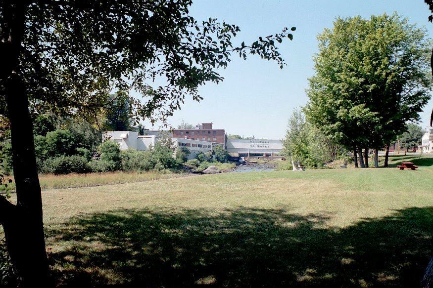
The Piscataquis River flows through the main village with neighboring Sangerville, formed with some land from Guilford, on the southern shore. The town was long a center for textile production. The late 20th century was marked by fires, floods, and economic instability, but the early 21st century opened with efforts at renewal with a river festival and downtown revtlalization.

Greenwood

Located just east of Bethel on Maine Route 26, the Village of Locke Mills in the town of Greenwood lies on the shore of Round Pond which is linked to nearby North Pond and South Pond. One early resident was L. L. Bean, who was born here. The town has shown consistent, moderate population growth over the past forty years.

Greenville

Plaque noting the early settlement of Greenville and the site of its first school

On the shore of Moosehead Lake, it serves as the gateway to Lily Bay State Park and to the upper reaches of the lake via combined Maine Routes 6 and 15. See video and photos. It is also an access point for Elephant Mountain and the preserved site of a B-52 bomber crash in 1963. In 1853 Henry David Thoreau met his guide, Joseph Atteon, in Greenville before boarding a steamboat passing Mount Kineo, to Northeast Carry for the portage to the West Branch of the Penobscot River.

Greenfield

Greenfield Baptist Church (2020)

was a town in Penobscot County, incorporated on January 29, 1834 from Greenfield Plantation. Even though it was growing in population, Greenfield relinquished its status as a town in 1993 and is now an unorganized township.

Greene

Sawyer Road with Horse Farms (2013)

With the Androscoggin River as its west boundary, the town’s east lies substantially along Sabattus Pond. The more densely populated area surrounds Route 202 near Greene Village. South from there is a rural landscape and views of Sabattus Pond. Inventor Leonard Norcross lived here in the early 19th century as a young boy. Since 1970 the increasingly suburban community in the Lewiston-Auburn area has more than doubled its population.

Greenbush

Helen S. Dunn School (2012)

Located on the east bank of the Penobscot River, Greenbush includes several islands, the largest of which, Olamon, abuts Olamon Stream as it empties into the river. Olamon, the name of a village near the island, means “red paint.” The Indians traveled up the stream to retrieve the red ochre they used as paint for decorating their bodies. Greenbush village is on the River and U.S. Route 2. A smaller village, Cardville, is in the middle of the township on the Cardville Road.