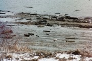
During the many years of drives on Maine rivers, such as the Kennebec pictured here, hundreds of thousands of pulp logs sank to the bottom before reaching their destinations. Along with the bark they shed, their remains continue to decay and consume oxygen. They become visible at low tide in the tidal portions of the rivers, but remain hidden further upstream.
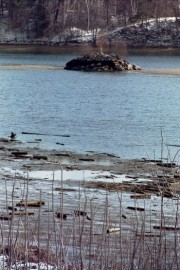
Huge cribworks containing rocks, such as these in the Kennebec River, were built to anchor floating booms that guided the logs around obstructions or coves that were likely to stop the flow to the pulp and paper mills downstream. They remain in the rivers, reminders of the bygone era which ended with the last log drive in 1976. Maine rivers were dammed in many places to provide power and to control the flow of water in support of the many mills and related industries along their banks. A historic moment in this legacy occurred on July 1, 1999 when the Edwards Dam on the Kennebec was breached, allowing the river to flow freely through Augusta for the first time in 162 years. During the winter, U.S. Coast Guard icebreakers keep major rivers navigable, primarily for the delivery of fuel by small tankers.
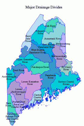
Water abounds in Maine. It has 73 rivers longer than 20 miles, 39 rivers that drain at least 200 square miles, 51 lakes that have an area of at least five miles, 32 civil divisions that contain at least 5,000 acres of water, and 3,478 miles of coastline. Drainage areas (see below) are the land masses and lakes that contribute water to these rivers. Here are the twenty longest rivers in Maine.
| RIVER | LENGTH- (miles) | DRAINAGE (sq. mi) |
| St. John (with southwest branch) | 331 | 8,765 |
| Penobscot (with west & north branches) | 240 | 7,760 |
| Androscoggin | 174 | 3,430 |
| Kennebec (with west outlet) | 170 | 5,900 |
| Saco | 121 | 1,680 |
| Aroostook | 100 | 2,290 |
| Mattawamkeag (with west branch) | 83 | 1,520 |
| Dead River (with south branch) | 74 | 878 |
| Sebasticook | 72 | 890 |
| Allagash | 69 | 1,240 |
| Piscataquis (with south branch) | 67 | 1,500 |
| Sandy | 65 | 644 |
| Moose | 65 | 735 |
| Fish | 62 | 975 |
| Sheepscot (with west branch) | 55 | 228 |
| Narraguagus (with east branch) | 48 | 214 |
| Baskahegan* | 48 | 270 |
| Magalloway (with west branch) | 48 | 455 |
| Little Androscoggin | 47 | 350 |
| Machias | 46 | 450 |
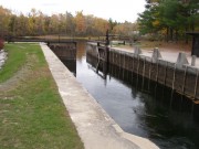
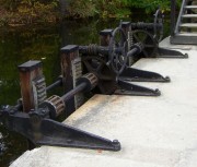
In some cases canals and locks enabled extended the use of Maine rivers as transportation arteries.
The Songo Locks in Casco and Naples are listed on the National Register of Historic Places.
*An Indian word meaning “branch stream
which turns down.” See Glossary, source number 7.


