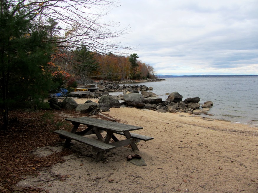
Beach on Frye Island’s northwest side facing Sebago Lake (2013)

Location Map for Frye Island
| Year | Population |
|---|---|
| 1970 | n.a. |
| 1980 | n.a. |
| 1990 | n.a. |
| 2000 | n.a. |
| 2010 | 5 |
| Geographic Data | |
|---|---|
| N. Latitude | 44:03:08 |
| W. Longitude | 70:56:12 |
| Maine House | District 67 |
| Maine Senate | District 26 |
| Congress | District 1 |
| Area sq. mi. | (total) 1.6 |
| Area sq. mi. | (land) 1.3 |
| Population/sq.mi. | (land) 3.8 |
County: Cumberland
Total=land+water; Land=land only |
|
[FRY iland] is an island town in Sebago Lake, Cumberland County, incorporated on July 1, 1998 from a portion of Standish. The Island once had been governed by a semi-autonomous village corporation.
 N43° 50' 51.97\" W70° 31' 8.03\"")
Plaque on the Island (2013) @
To Raymond Terminal
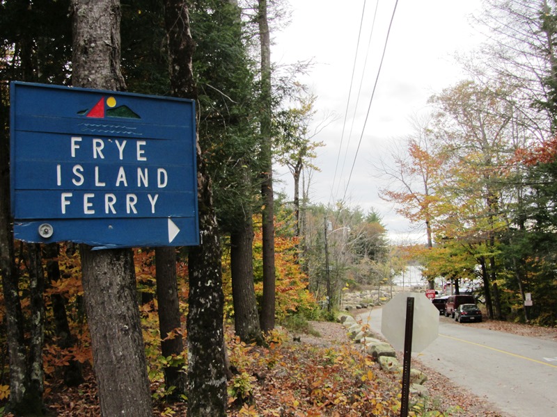
The island is primarily a summer vacation home destination. The Frye Island Ferry operates between the end of Raymond Neck, in the town of Raymond, to the ferry dock on the island. Vehicles, supplies, and people make the trip in about fifteen minutes every half hour.
Community facilities are located near the ferry landing: a general store, post office, emergency rescue, and a mini-park with the plaque and a granite bench. From here one travels the gravel roads to the interior and the seasonal cottages along the shore of Sebago Lake.
All images taken October 2013
Form of Government: Town Meeting-Select Board-Manager.
More Videos!
Additional resources
Frye Island Comprehensive Plan Committee. Town of Frye Island Comprehensive Plan ,July 1. 2002: a vision for one of Maine’s unique towns. Frye Island, Me. The Committee. 2002.
Huchthausen, Peter A. Frye Island: Maine’s Newest Town a History 1748-1998. Bowie, MD Heritage Books. Inc.. c1998.