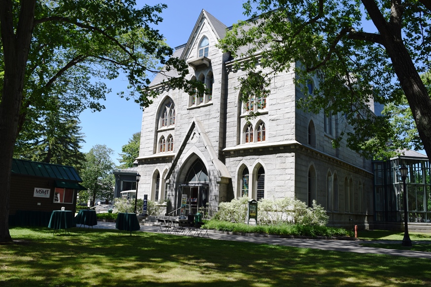
Picard Theater and Maine State Music Theater at Bowdoin College (2018)

Location Map For Brunswick
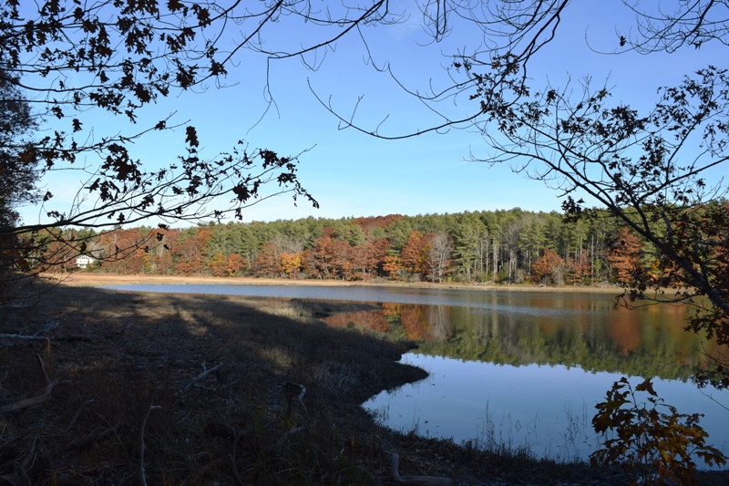
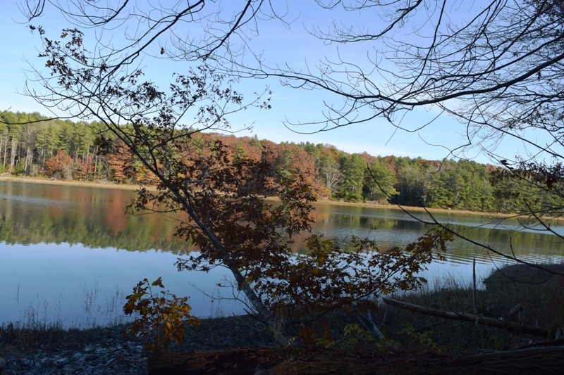
Woodward Cove (2021)
Brunswick-Topsham Land Trust
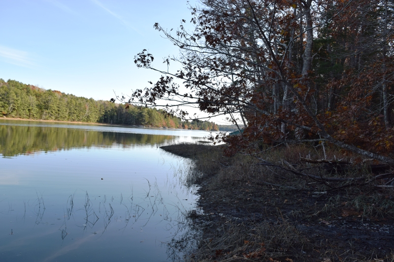
Woodward Cove South
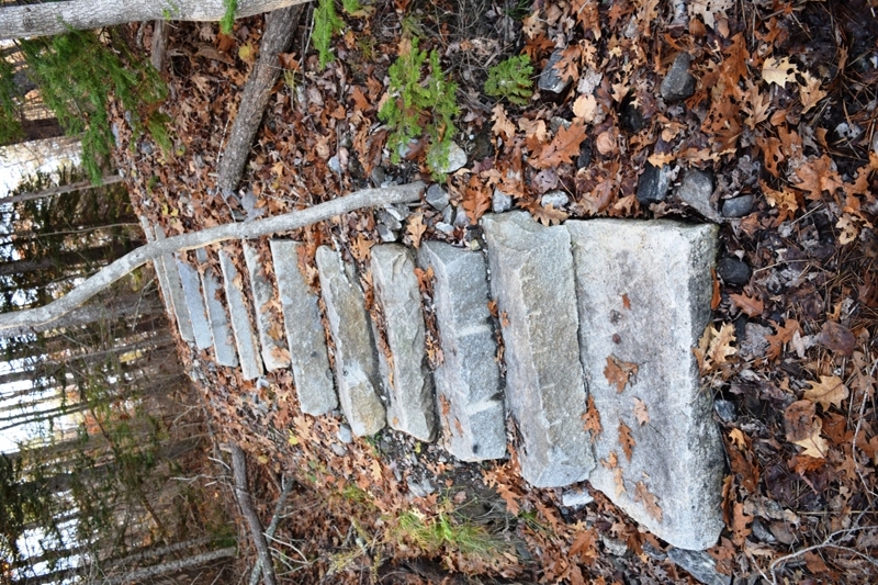
Short Hike to the Cove
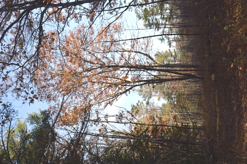
The Cove in Autumn
| Year | Population |
|---|---|
| 1970 | 16,195 |
| 1980 | 17,366 |
| 1990 | 20,906 |
| 2000 | 21,172 |
| 2010 | 20,278 |
| Geographic Data | |
|---|---|
| N. Latitude | 43:53:46 |
| W. Longitude | 69:58:38 |
| Maine House | Dist 49,50,51 |
| Maine Senate | District 24 |
| Congress | District 1 |
| Area sq. mi. | (total) 54.2 |
| Area sq. mi. | (land) 48.6 |
| Population/sqmi | (land) 417.2 |
County: Cumberland
Total=land+water; Land=land only |
|
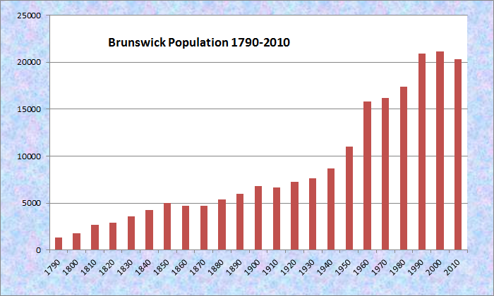
Population Trend 1790-2010
Clipper Ship Built Here Rising Sun–1856
[click photos to enlarge or clear image]
") [BRUN-zwik] Before Europeans arrived, Indians created villages, possibly seasonal, at the Brunswick-Topsham falls, on Mere Point, and on Maquiot Bay. The villages may have housed 50-100 residents, based on the surrounding resources available to support them. After a summer of harvesting fish, clams, corn and berries, historians speculate that the natives would have moved inland for winter hunting and trapping.
[BRUN-zwik] Before Europeans arrived, Indians created villages, possibly seasonal, at the Brunswick-Topsham falls, on Mere Point, and on Maquiot Bay. The villages may have housed 50-100 residents, based on the surrounding resources available to support them. After a summer of harvesting fish, clams, corn and berries, historians speculate that the natives would have moved inland for winter hunting and trapping.
The first European settler was Thomas Purchase who probably arrived about 1628. He and his brother-in-law were granted a small portion of land along the Pejepscot River, apparently including Brunswick and Topsham. Indians destroyed his home in 1676.
")
Plaque Marking the Site of Fort Andros (2011)
")
Old Mill Building on the Site of Fort Andros on the Androscoggin River (2001)
In 1688, Fort Andros appeared, an outgrowth of the increasing friction between the English settlers and the French-Indian alliance. This situation resulted in nearly 50 years of hostilities, during which the village of Brunswick was burned on several occasions.
 N43° 54' 38.8\" W69° 57' 47.6\"")
First Parish Church (2002) @
After protracted wars and raids, few people were left in Brunswick in the 1720’s. Resettlement began in the 1730’s and by 1739 Brunswick had become incorporated as the 11th town in the Province of Maine. The early European residents were mostly English or Scots-Irish – a homogeneous English-speaking Protestant group to be known as Yankees. Many attended the First Parish Church, establish in 1717. They dominated the area, initially surviving on fishing, farming, lumbering and shipbuilding.
The first dam between Brunswick and Topsham was completed about 1753, as the area had a growth spurt. Though only about 19 houses existed in 1742, by 1753 records show 80 males eligible to vote, an number that grew to 92 four years later. Even as the Town grew then, and in the 21st century, residents prized their quality of life. The 1719 grant of the Town Commons by the Pejepscot Company has provided a gift that has lasted nearly 300 years. In 1968 the Town adopted a resolution declaring the Commons an “Historic Landmark.”
")
")
May 31, 1776, the town voted to endorse in advance the Declaration of Independence. Shortly after the Revolution, Brunswick considered seeking even more independence. This time from Massachusetts. It voted in favor of separation in 1787, then changed its mind until 1819 when it again sought separation.
What was known as “the Great fire” of December 13, 1825 destroyed a substantial portion of the town, including 33 buildings – two of them textile mills. Sixty-eight people were left homeless.
")
Pedestrian Bridge over the Androscoggin (2002)
By the 19th century, cotton mills made their appearance and at mid-century industrial growth called for more labor.
The result was a substantial immigration of French speaking Canadians from Quebec who, with their Catholicism, changed the population mix forever. The pedestrian “Swinging” bridge brought workers from Topsham to the “Fort Andros” mill on the Brunswick side of the Androscoggin River.
Another important early industry was shipbuilding, which took place in several yards at Pennellville, Harpswell Neck, and on the Androscoggin River. At least 99 vessels, totaling nearly 12,000 tons, were built here between 1789 and 1807. Most of these early vessels were sloops and small schooners, generally 50 to 70 feet in length and of less than 100 tons.
Along with the mills and the shipbuilding industry, the other defining nineteenth century influence on Brunswick was the rise of Bowdoin College. Established in 1794, Bowdoin began, as did similar institutions throughout New England, as a classically-oriented college primarily engaged in the production of ministers and teachers. While her husband was teaching at Bowdoin in the early 1850’s, Harriet Beecher Stowe was writing Uncle Tom’s Cabin at what is now known as the Stowe House.
Brunswick and Bowdoin were significant later in the century, during the Civil War. An old local saying claims that the Civil War began and ended in Brunswick, which was home to two significant figures of the period. Stowe (who is said to have begun the war with Uncle Tom’s Cabin) and Joshua L. Chamberlain (the bookish Bowdoin professor cum Civil War Hero whose extraordinary military career included the acceptance of the surrender of the confederate infantry at Appomattox , thus ending the war).
")
Plaque Commemorating the “Round-the-World Flight 1924” (2002)
Maine state legislator and U.S. Representative Charles J. Gilman was a resident of Brunswick in the 19th century. Governor Robert P. Dunlap was born here in 1794; he graduated from Bowdoin in 1815.
In 1924 the town hosted the United State Army’s “Round the World Aviators” at Mere Point. The area is now a small State Park.
Catherine “Kate” Furbish was a life-long resident of Brunswick. She was botanic artist, known by some as the “Posey-Lady.” Her discovery of the furbish lousewort plan became a significant element in the demise of the Dickey-Lincoln dam project proposed in the 1960’s.
John Stevent Cabot Abbott, a historian and author of fifty-four books, including Christian ethics and popular history, was born here in 1805. Brunswick is also the birthplace of poet Robert P.T. Coffin. Baseball player Mark Rogers, whose parents live in Harpswell, was born in Brunswick. He was active with the Milwaukee Brewers in 2010 and 2012. Dan Walters, was born here here, and played for the San Diego Padres in 1992 and 1993.
During the twentieth century, Brunswick continued to expand and develop, seeing its population mushroom during the war years, and to grow steadily. Brunswick Naval Air Station appeared in the 1940’s, and became an important influence on the community, providing diversity and economic power in addition to the ubiquitous P-3’s which became a signature feature of the local skies.
")
Control Tower and Buildings at Brunswick Executive Airport (2010)
")
Control Tower and Buildings at Brunswick Executive Airport (2010)
The Naval Air Station closed officially in 2011. The property is being developed for business purposes and hosts the new Brunswick Executive Airport, a general aviation facility at

Maine Street Brunswick, c. 1947Since the demise of the textile and shoe manufacturing industries, Brunswick, Maine’s eighth largest community, has become a service center for the surrounding region and a residential community for people working in the greater Portland area.
The community exchanged its combined town office and police department on historic Federal Street for two larger facilities elsewhere.
")
Former Town Office (2014)
 N43° 54' 47.30\" W69° 58' 32.51\"")
Police Department (2014) @
 N43° 54' 39.53\" W69° 57' 58.89\"")
Town Office (2014) @
The editor of The Maine Times, a popular weekly newspaper focused on politics and the environment 1968-2002, and author John N. Cole was a resident of Brunswick.
")
Pejepscot Historical Society on Park Row in Brunswick (2002)
")
1859 Union Street School (’13)
")
State Music Theater (2003)
Bowdoin College, the Maine State Music Theater, the Maine Writers and Publishers Alliance, the Pejepscot Historical Society, many historic buildings and sites, make the town is a powerful cultural magnet as well. The Pejepscot’s Skolfield-Whittier House on Park Row is in the Federal Street Historic District.
")
Evening Train Back from Boston (2013)
While AMTRAK’s Maine rail service began in 2001, Brunswick’s resumed in 2012 after a long absence. Currently the town is the northern most terminus of AMTRAK’s Downeaster. The Boston trains have frequently been sold-out since service began.
")
Mere Point Boat Launch (2012)
The town has 66 miles of irregular shoreline on the ocean and 12 miles along the Androscoggin River. With the help of state funding, the Mere Point Boat Launch provides all-tide deep-water access onto Northern Casco Bay. It includes facilities for launching kayaks and other hand-carry watercraft. The launch is near the southern end of Mere Point Road.
Bay Bridge Landing, off Bay Bridge Road, is a six-acre wetland park with a trail and interpretive signs featuring osprey and snapping turtle habitat, kayak and canoe launching, and parking.
Form of Government: Council-Manager
")
Post Office on Pleasant Street (2015)
")
Curtis Memorial Library, old section (2015)
")
Downtown Fire Rescue Station (2017)
Additional resources
“Around-The-World Flight Memorial Erected By State Of Maine.” Kennebec Journal. June 6, 1925.
Beard, Frank A. and Bette A. Smith. Maine’s Historic Places.
Brunswick Maine: 200 Years a Town, 1739-1939. Brunswick, Me. The Town. 1939.
Chase, F. Halcyon. Brunswick: a Brief History of the Growth and Development of the Town, Her Business men and their Interests. Brunswick, Me. Brunswick Record. 1903.
Downing, Paul, Ed. Brunswick Maine: 250 Years a Town 1739-1989. Town of Brunswick, Brunswick, Maine, 1989.
**First Parish Church. “History of First Parish Church.” http://www.firstparish.net/history.html (accessed February 24, 2015)
Furbish, John. Facts about Brunswick, Maine: brief accounts of various events, changes, and interesting incidents, connected with the history of the town of Brunswick. Cumberland Co. Maine. Commenced June 27th A.D. 1862. Brunswick, Maine. Pejepscot Historical Society. 1976.
Gutscher, Christopher B. Merrymeeting Park, 1898, Brunswick, Maine. 1985. (Bath, Me. printed by Golden Offset)
Helmreich, Louise R., Ed. Our Town: Reminiscences and Historical Studies of Brunswick, Maine. (from the collections of the Pejepscot Historical Society) Brunswick, Me. 1967.
Jorgensen, Erik, Ed. “Brunswick’s History.” http://www.curtislibrary.com/arts/bacdhis.htm
*Maine. Historic Preservation Commission. Augusta, Me. Text and photos from National Register of Historic Places: http://pdfhost.focus.nps.gov/docs/nrhp/text/xxxxxxxx.PDF and http://pdfhost.focus.nps.gov/docs/nrhp/photos/xxxxxxxx.PDF
Locke, William N. The French Colony at Brunswick, Maine: a Historical Sketch. Montreal. Laval University. 1946.
“National Register Nominations.” Maine Preservation. Spring 2004. p. 8.
Pejepscot Historical Society. A Women’s History Walking Trail, Brunswick, Maine. Brunswick, Me. Pejepscot Historical Society. c1999.
Slattery, Charles Lewis. “Brunswick and Bowdoin College.” New England Magazine. 1891., pp. 449-469.
Wheeler, George A. and Henry W. Wheeler. History of Brunswick, Topsham and Harpswell, Maine.
National Register of Historic Places – Listings
Photos, and edited text are from nominations to the National Register of Historic Places researched by Maine. Historic Preservation Commission.
Full text and photos are at https://npgallery.nps.gov/nrhp
Androscoggin Swinging Bridge
[spanning the Androscoggin River between Topsham and Brunswick] The Androscoggin Swinging Bridge is a pedestrian link between Topsham and Brunswick. Built in 1892 by John A. Roebling’s Sons Co. of New Jersey, it is a steel and wood structure on concrete abutments.
The Bridge is one of three pedestrian swinging bridges in Maine. [See Skowhegan and Waterville.] It was intended to provide a way for mill workers who lived in Topsham Heights to reach the Cabot Mill in Brunswick, as well as to access the commercial district on Mill Street in Brunswick. For many years Topsham and Brunswick have shared the cost of maintaining the bridge. The closing of the Verny Corporation (successor to Cabot Manufacturing) mill in 1955 meant the end of the use for which the bridge was built.
Before the mill closed the bridge had developed a new purpose. It has accommodated Catholic French Canadians who attended church in Brunswick, as well as children attending the town’s public and parochial schools and residents who shop in Brunswick. A tangible reminder of an industrial past, it is now an important recreational and leisure resource for biking, walking, and viewing the river.* [See photo above and in Bridges.]
Boody, Henry, House
") [Maine Street] The 1849 Henry Boody House is a Gothic Revival cottage which is considered a forerunner of the Stick Style. Heavy corner posts, half-timbered gables and a board and batten surface reflect English architect Gervase Wheeler’s expression of the structural qualities of the house. Boody built the house from Wheeler’s 1848 plans. It is virtually unaltered and has become recognized as an important design of its period which had ramifications for the development of 19th century American architecture.
[Maine Street] The 1849 Henry Boody House is a Gothic Revival cottage which is considered a forerunner of the Stick Style. Heavy corner posts, half-timbered gables and a board and batten surface reflect English architect Gervase Wheeler’s expression of the structural qualities of the house. Boody built the house from Wheeler’s 1848 plans. It is virtually unaltered and has become recognized as an important design of its period which had ramifications for the development of 19th century American architecture.
Henry Boody was an 1842 graduate of Bowdoin College and its Professor of Rhetoric and Oratory from 1845 to 1854. He eventually abandoned the struggle to live on a professor’s salary and, after brief service in the Maine Legislature, he moved to New York, where he had a long and successful career as a banker and railroad president.* [See the similar Gilmore House of the same period in Calais; and two other Gothic houses in Portland’s National Register places: The Gothic House and the Sparrow House.
Brunswick Commercial Historic District
This District consists of thirty-four buildings, two objects and one structure along Maine Street in downtown Brunswick. It covers about five acres along a four block section of Maine Street, which runs generally north to south from the Androscoggin River towards Maquoit Bay. The street, once only a narrow trail, was built to be wide enough to protect goods from Indian attacks while being transported from the Androscoggin River to Maquoit Bay.
Thirty-seven buildings and one object (a sign) contribute to the historic nature of the District. The buildings and streetscape of all the buildings form a cohesive grouping that conveys the significance of the district as the commercial and financial center of Brunswick from 1820 to 1961. It includes mainly two-story brick or frame buildings with first-floor storefronts and upper-story offices or apartments. The most prominent influences are the revival styles of the late 19th- and early 20th- centuries, notably Colonial Revival. Common details include strong horizontal lines at the top of the buildings and separating the first floor storefronts from the upper levels. Many have brick fronts with brick “columns” separating bays of grouped windows. The storefronts are visually separated from the upper stories and usually have display windows and recessed entrances. Most buildings are connected to their neighbor or spaced very closely; the setbacks are generally consistent throughout the district, allowing for a wide brick sidewalk and street trees along the street edge.*
The section of Maine Street that lies between the Cabot Mill on the banks of the Androscoggin River, and the First Parish Church in downtown Brunswick served as the primary commercial business district for the region from the early-19th century through the mid-20th century. The District consists of most of the northern half of that historic area, between Mason and School Streets. These buildings retain much of their original design features, and comprise a visually cohesive grouping of commercial buildings built between 1820 and 1961. The history of the district reflects both national and local commercial development trends. During the 19th century Brunswick followed a common development pattern, with a very mixed Maine Street, containing homes, businesses, and churches, gave way to a downtown that was almost entirely commercial at the street level, with living areas on upper floors. Architecturally, the buildings reflect the styles of the mid-nineteenth through early twentieth century, most notably Greek Revival and Colonial Revival periods. Many buildings are a mix of wood and brick, and of gable-front and flat roofs, but it is the two-story long blocks that give the district its defining look pulling together the varied styles.
Cleaveland, Parker, House, National Historic Landmark
[75 Federal Street] Parker Cleaveland, nationally known for his contributions to the study of mineralogy, lived here from 1806 to 1858. A professor at Bowdoin College, he conducted some of the earliest studies of mineralogy in the United States In 1816 his Elementary Treatise on Mineralogy and Geology was the first volume on American mineral species and localities, thereby his becoming the “Father of American Mineralogy.” This comprehensive work, and its revised 1822 edition, was the mineralogy textbook used in American colleges and set the standard for later works.
 N43° 54' 40.85\" W69° 57' 36.90\"") While at Bowdoin, Cleaveland gained the respect and admiration of college community, but it was his excellent teaching skills that were especially appreciated. He was offered far more lucrative positions at more prestigious institutions for his scientific work, but he remained loyal to the college. None of the college buildings that Cleaveland frequented remain but in 1873 the College renovated Massachusetts Hall creating a large room called the Cleaveland Cabinet.
While at Bowdoin, Cleaveland gained the respect and admiration of college community, but it was his excellent teaching skills that were especially appreciated. He was offered far more lucrative positions at more prestigious institutions for his scientific work, but he remained loyal to the college. None of the college buildings that Cleaveland frequented remain but in 1873 the College renovated Massachusetts Hall creating a large room called the Cleaveland Cabinet.
The house is the property most importantly associated with him. Bowdoin built it as a free residence for Cleaveland soon after he arrived in 1805. Although the property was sold to his descendants after his death, Bowdoin repurchased and restored it to ensure its preservation.*
 N43° 53' 20.88\" W70° 0' 2.70\"") Crystal Spring Farm Historic District
Crystal Spring Farm Historic District
 N43° 53' 20.88\" W70° 0' 2.70\"")
[277 Pleasant Hill Road. Previously known as Woodside Farm; Dionne Dairy Farm; Dee’s Ice-Cream] Crystal Spring Farm contains 160 of the acres granted to Robert Spear in 1738. The first known farm family to settle on the land were the Woodsides, who purchased Spear’s interest in 1783. Over the next 120 years, generations of the family farmed the land in an adaptive, diversified fashion. Around 1900 the farmhouse had developed its current form, and shortly thereafter was divided into housing for the farm owners and their employees.
")
The c. 1780 Josiah Melcher’s farm, later owned by Dr. Maurice Dionne, is across the road from Crystal Spring Farm. The Dionne barn clock tower was was originally on the Brunswick Town Hall, demolished in 1961.
Dr. Dionne bought the Crystal Spring property in 1941. The Farm is a complex of agricultural buildings dating primarily between 1947 and 1956 on a large dairy farm. (A 1946 fire had destroyed most of the earlier buildings.) Along with pasture and hay fields, the steel and concrete buildings are accompanied by a 19th century farmhouse and an early twentieth century slaughterhouse. While the land in the historic district has been farmed since the late 18th century, the Farm represents a specific stage in the evolution between the turn of the 20th century family run dairy farm and the far-reaching agribusinesses that dominate the industry at the turn of the 21st century.
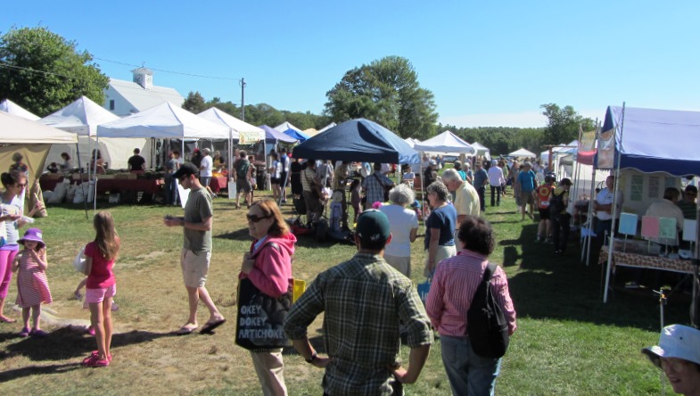
Farmers Market (2013)
The farmhouse continues to serve the farmers who run the property under the auspices of the Brunswick-Topsham Land Trust as a Community Supported Agriculture (CSA) venture. Crystal Spring’s Farmer’s Market is a popular destination for local farmers and shoppers.*
Dunlap, John, House
[4 Oak Street. Also known as the Gilman Mansion.] John Dunlap, a prominent Brunswick resident, chaired the building committee of Massachusetts Hall, the first building at Bowdoin College. The son of Brunswick’s first minister, Dunlap had accumulated a considerable fortune in the fur trade, lumber, and shipping. His Federal style house, built between 1798 and 1800, was undoubtedly the finest residence yet constructed in Brunswick. On the crest of a hill one block west of Maine Street, the house enjoyed a commanding view of the town and the falls of the Androscoggin.
The exterior was rather plain until the addition of a gable pediment and a columned portico in the 1830s. But the scale of the house, and its floor plan with a large central hall, were unprecedented. Construction of the Dunlap Mansion, as it was called, marked the beginning of a new chapter in Brunswick’s architectural history.
 N43° 55' 1.04\" W69° 58' 7.64\"")
John Dunlap House (2013) @
")
John Dunlap House (2013)
FEDERAL STREET
[roughly bounded by Mason, Maine, College, and Federal Streets] Most of the 138 structures on or near Federal Street show a traditional concern for symmetrical design and proportion, especially the 31 Federal, 30 Greek Revival, and 36 Colonial Revival buildings.
Windfall profits of the Revolutionary War years and the founding of Bowdoin College set the tone for the Federal Street neighborhood. They had a profound effect on what to that time had been primarily an agricultural, mill and shipping community.
The Street was accepted as a town road in 1803. Parallel to Maine Street, the first road laid out by the Pejepscot Proprietors in 1717, Federal quickly became a college oriented, “prestige” neighborhood. The original owners established requirements for a uniform setback of twenty feet and a minimum of two stories for every house. An example of early urban planning, it reflected a conscious effort to maintain high standards. Proximity to the college also meant that the faculty chose the area for their homes.
Its influence spread to adjoining areas. What is the Town Mall had been an alder swamp. Beginning in 1826 it was filled in. By 1836 the first trees were planted and the entire atmosphere of Maine Street near the college was altered. Park Row was laid out at about the same time.*
 N43° 54' 42.67\" W69° 57' 37.81\"")
Brick House in Federal Street District (2013) @
")
Houses on Federal Street, South End (2013)
First Parish Church
[
[207 Maine Street] Historically and architecturally, the First Parish Church [See photo above.] ranks as the most important Gothic Revival structure in the state, if not in New England. It was designed in 1845 by the English-born Richard UpJohn, whose 1839 Gothic Revival Gardiner Mansion in Gardiner, had signaled the start of this country’s second great eclectic style following the Greek Revival of the 1820s.*
Recent renovations have occurred in the 1960s and the 1990s. The tower was restored in 2003.
According to the Church history,**
Many notables have been members or spoken at First Parish Church. Both Dr. Lyman Beecher and Dr. Henry Ward Beecher preached from the pulpit. Gen. Ulysses S. Grant was awarded an honorary degree here shortly after the Civil War. The Bowdoin Class of 1825 held its 50th reunion here in 1875. Class member Henry Wadsworth Longfellow was asked to read one of his poems. Disfigured by the fire which had killed his wife, he was reluctant at first to appear in public. But when it was explained that he would be partially hidden by the pulpit, he delivered his Morituri Salutamus (Salute to Death) to the packed house.
Later came President William Howard Taft, Jane Addams, Ralph Waldo Emerson, England’s Poet Laureate John Masefield, Eleanor Roosevelt, and Dr. Martin Luther King, Jr
Lincoln Street Historic District
")
Lincoln Street Historic District (2013)
[Lincoln Street between Maine and Union Streets] Lincoln Street as a district has unusual architectural homogeneity. Most houses were built within a year or two of each other, the land having been owned by Dr. Isaac Lincoln who divided it into uniformly shaped lots that sold within a few months in 1843 and 1844. Lincoln Street retains its period uniformity and represents an interesting mid-19th century phenomenon in urban growth.
Born in Cohasset, Massachusetts in 1780 and graduating from Harvard College in 1800, Dr. Lincoln established a practice in Topsham in 1804. In 1820 he married Maria S. Dunlap and moved to Brunswick where he established an outstanding medical reputation. He was granted an honorary M.D. degree from Bowdoin in 1831 and was a faculty member of the Maine Medical School there 1820-1867. He also served as a member of Bowdoin’s Board of Overseers for 60 years.*
Massachusetts Hall, see Bowdoin College.
Pennellville Historic District
")
Farmhouse and barn in Pennellville (2009)
[roughly bounded by Pennellville Road, Middle Bay Cove, and Pennell Way] Pennellville is a small concentration of early 19th century residential buildings historically part of a local shipbuilding operation on Middle Bay. Houses here are predominantly in the Greek Revival style, typical of Brunswick area residential design during the period.
Six of the seven houses were built by members of the Pennell family, whose shipways were located at the end of the road that bears their name. All principal buildings date from when the shipbuilding industry was at its height.
The district retains its original rural ambiance in which houses are scattered on large lots in a setting characteristic of the 19th century. Also important is the former carpenter’s shop at the end of Pennellville Road near the site of the shipways.
")
Cape style house in Pennellville (2009)
The historically important period for Pennellville was roughly 1775-1875. The Pennells, Dunnings and Givens built homes in this area deriving their income principally from shipbuilding and maritime commerce. An estimated 70 vessels were launched from nearby sites on Middle Bay.
The Pennells were the most important shipbuilding family. Especially outstanding is the James Pennell House, which features a hexagonal cupola ornamented with Greek designs. A ship joiner by trade, he designed the house.*
Richardson-McManus House
 House (2013)")
Richardson (George McManus) House (2013)
[11 Lincoln Street] The 1857 Captain George McManus House is a fine example of a transitional Greek Revival-Italianate residence of the mid-coast region. The 1850s were very-much a Victorian decade in the history of Brunswick architecture. Italianate designs with projecting rooflines became common and were complemented by ornate brackets and intricate ironwork. Brick was the preferred building material. Interiors evolved from the lighter, classical designs to more full bodied and ornamental forms. Most of the houses of this period have a massive character and evidence suggests they were more sturdily built than- their earlier neighbors.
The house was built for Captain George McManus, a prominent Brunswick master mariner. McManus lived in the house until his death about 1864. Subsequent owners were two generations of the Lufkin family (1873-1928) and the Richardson family (1928-1960). Both families were prominent in Brunswick affairs. In the 1960s the house had been used as the parsonage of St. Paul’s Episcopal Church.*
St. Paul’s Episcopal Church
")
St. Paul’s Episcopal Church (2013)
[27 Pleasant Street] Designed in 1845 by famous architect Richard Upjohn, St. Paul’s is an early Gothic Revival example of a board and batten chapel that Upjohn popularized throughout the United States. The Church is a simple, but dignified one-story structure. It has no tower but includes a transept (a crosswise space in the main space or nave) and small chancel (space around the alter). There are no aisles in the nave. Internally, St. Paul’s is unpretentious, decorated with simple but effective Gothic Revival style motifs in wood.
By 1845, English born Upjohn (1802-1878) had established a significant reputation in the United States as an architect, particularly of churches. Among these St. John’s Church (1839) in Bangor, which burned in the Great Fire of 1911, and the magnificent Trinity Church (1841) in New York were nationally known. St. Paul’s combines inexpensive practicality with the quaintness and charm of well executed Gothic Revival design.*
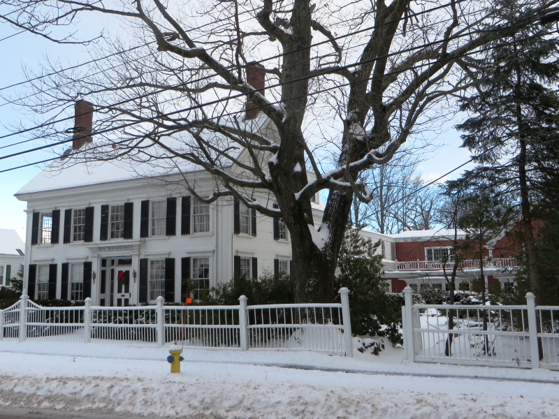
Stowe, Harriet Beecher, House, National Historic Landmark
[63 Federal Street] This 2½-story frame house was from 1850 to 1852 the home of author and humanitarian Harriet Beecher Stowe. It was here that she wrote Uncle Tom’s Cabin, her best known work and the most famous example of American anti-slavery literature. This is its primary significance.
Stowe House (2015)
Stowe Annex (2015)
Stowe House (2015)
The original section was built for the Rev. Benjamin Titcomb in 1807 and remained in his family until 1854. Following the Stowe residence (1850-52), the house was extensively rebuilt and given Victorian detailing. As a result, the present look of the house appears no earlier than mid-19th century.
In 1946 it was used as an inn. Since then, a series of owners have made further significant alterations. Between 1946 and 1957 a restaurant was on the first floor, guest rooms on the second, and a gift shop in the former barn. Bowdoin College bought the property in 2001, using the annex for student housing.*
Whittier Field Athletic Complex
 N43° 54' 21.79\" W69° 57' 25.99\"")
To the Complex (2017) @
[Bowdoin College Campus] The Complex has significant and distinct architectural features. The three major components (field, grandstand, and gate) along with related secondary elements (goal posts, scoreboard, flagpole, etc.) creates an identifiable historic district. The gate and the grandstand are still true to their original design.
The track surface was completely redone in July 2017, but the design, feeling, association, setting, and location of the field retain the original historic experience. Whittier Field (1896), Hubbard Grandstand (1904), and the Class of 1903 Memorial Gate (1928), constitute a related group of facilities developed for intercollegiate football and track and field competitions at Bowdoin College.
1903 Memorial Gate (2017)
")
1903 Memorial Gate (2017)
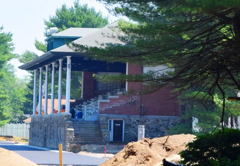
1904 Hubbard Grandstand (2017)
Hubbard Grandstand was designed by English-born Boston architect Henry Vaughan (1845 –1917) and the Class of 1903 Memorial Gate was designed by Bowdoin graduate and Lewiston architect Harry S. Coombs (1878-1939).
The period of historic significance is 1896 to 1967, extending from construction of the earliest element (Whittier Field) until fifty years before the present.*