He looked around, as if he was seeing the world for the first time. Beautiful was the world, colourful was the world, strange and mysterious was the world! Here was blue, here was yellow, here was green, the sky and the river flowed, the forest and the mountains were rigid, all of it was beautiful, all of it was mysterious and magical, and in its midst was he, Siddhartha, the awakening one, on the path to himself. – Siddhartha – Hermann Hesse
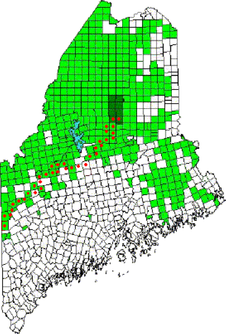
Place the cursor over a red dot to go directly to a township.
![]() On the trail, click a boot for the next step north or south.
On the trail, click a boot for the next step north or south.
NOTES: TWP = township; WELS= West of the Eastern Line of the State (the vertical east boundary on the map). The list on above links towns and townships on the Appalachian Trail in Maine from north (top) to south (bottom).
More Videos!


WE ARE COMING INTO MAINE FROM CANADA VIA ROUTE #201. HEADING FOR BAR HARBOR AREA THIS NEXT WEEK. ARE WE ANYWHERE NEAR A PART OF THE TRAIL THAT WE COULD TAKE A SHORT WALK ON?
The Appalachian Trail crosses U.S. Route 201 at Caratunk. (See the Caratunk article.) A short walk west at the crossing brings one to the Kennebec River, a crossing point for hikers. One might also use the parking area on the east side of 201, then venture along the trail for as long as you wish.