 Carrying Place Town Township")
Historic Topographic Map of T2 R3 (1956)

West Carry Pond Area

East Carry Pond Area
Appalachian Trail routes from details of a 1956 Historic Topographic Map preserved by the University of New Hampshire (see below).
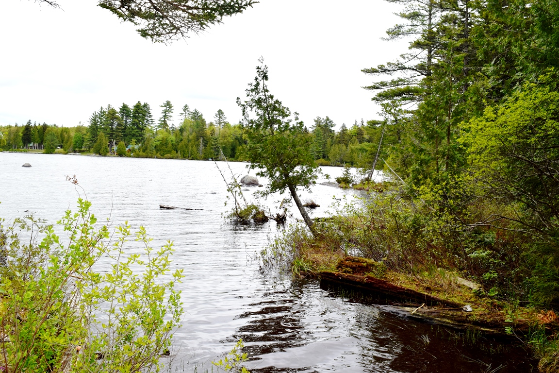
This township is technically known as T2 R3 BKP WKR. The latter initials mean Bingham’s Kennebec Purchase West of the Kennebec River. The township (Not to be confused with Carrying Place Township!) is directly south of Pierce Pond Township host to the next northerly section of the AT. The trail winds from the shore of Pierce Pond south to East Cary Pond across Sandy Stream to West Cary Pond and over Roundtop Mountain. A modern bridge across a bog near the stream was finished by 2017.

Bog bridge on the AT (2017)
 N45° 10' 36.85\" W70° 4' 33.68\"")
Bog bridge on the AT (2017) @
")
East Carry Pond (2007)
")
East Carry Pond with Gates Hill in the Distance (2007)
Benedict Arnold and his expedition trekked across the township between the Kennebec and the Dead rivers, a twelve mile journey across the Carry Ponds and through bogs in 1775. Here are some excerpts from his account:
Wednesday, October 11, 1775. We embarked early this morning and proceeded up the [Kennebec] river, the stream very rapid indeed. At 10, arrived at the Great Carrying Place which is very remarkable, a large brook [Carrying Place Stream] emptying itself into the river just above, which comes out of the first lake [East Carry Pond]. When abreast of the carrying place in the river, you will observe at about 400 yards above you a large mountain [Gates Hill in Caratunk] . . . . Met Lt. Church who had been at the Dead River on a survey and reports as follows: from the Kennebec over the portage to the first pond or lake, course west 27 degrees north, distance 3 1/4 miles, rising ground, bad road but capable of being made good.
The going was very difficult and Arnold hastily put up a “hospital” for the sick and exhausted men between East and Middle Carry Ponds. Later several units and many men were to turn back, leaving the military expedition weakened.
The map below traces his route from the Kennebec River to just before the Dead River through the “Great Carrying Place.” Both Arnold’s Expedition and the Appalachian Trail share similar routes across this near wilderness area.

Historic Topographic Map of T2 R3 Showing Arnold’s route through the Great Carrying Place
See Part 1 in Carrying Place Township
The township is directly south of Pierce Pond Township host to the next northerly section of the AT. The trail winds from the shore of Pierce Pond south to East Cary Pond across Sandy Stream to West Cary Pond and over Roundtop Mountain.
")
Beach at East Carry Pond (2007)
")
Beach at East Carry Pond (2007)
")
Bog on North Branch of Carrying Place Stream (2007)
Since 1956, when the historic topographic maps at left were produced, the Appalachian Trail has been rerouted in some places. On the maps above right, the earlier route is traced with the yellow dots, while the route in 2007 is depicted with those in green. (Click to enlarge maps and photos.)
")
Southbound entrance to the Appalachian Trail (2013)
")
Directional sign at the northbound entrance (2013)
")
Entrance to the Appalachian Trail northbound (2013)
")
AT southbound entrance
For “north bounders,” the
long-hoped-for 2,000 mile marker on the AT is found in this leg of their journey, leaving “only” about 68 miles to go to the summit of Mount Katahdin.
The official length of the trail varies annually with adjustments to its route. In December 2010 the Appalachian Trail Conservancy announced its length to be 2,181.
The crossing (N45° 9′ 21.67″; W70° 9′ 14.30″) , on the Long Falls Dam Road, usually has a “2000” mile notice, in large painted letters, to greet tired hikers.
More Videos!
Benedict Arnold’s Expedition Route – click a Bateau

 <== To Quebec To Beginning ==>
![]() <= South Appalachian Trail – click a boot North
<= South Appalachian Trail – click a boot North ![]() =>
=>
Photos and video content courtesy of Brady G. Williams 2007.
Additional resources
Calvert, Mary R. Dawn Over the Kennebec. 1986, pp. 341-342.
See other resources at Benedict Arnold.
Topographic maps were created from the University of New Hampshire Dimond Library, Documents Department & Data Center, Historic USGS Maps of New England & New York, accessed 1/14/2008: Dead River-Little Bigelow, ME Quadrangle (1956), http://docs.unh.edu/nhtopos/DeadRiver-LittleBigelow.htm.