Red-tailed Hawk
 N45° 54")
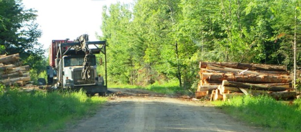
Red-tailed hawk, near the East Branch of the Penobscot River in the Maine woods Lunksoos area and near a logging yard in Crystal
"Those seeking cold, hard statistics on Maine communities won't be disappointed." —Bangor Daily News
Red-tailed hawk, near the East Branch of the Penobscot River in the Maine woods Lunksoos area and near a logging yard in Crystal
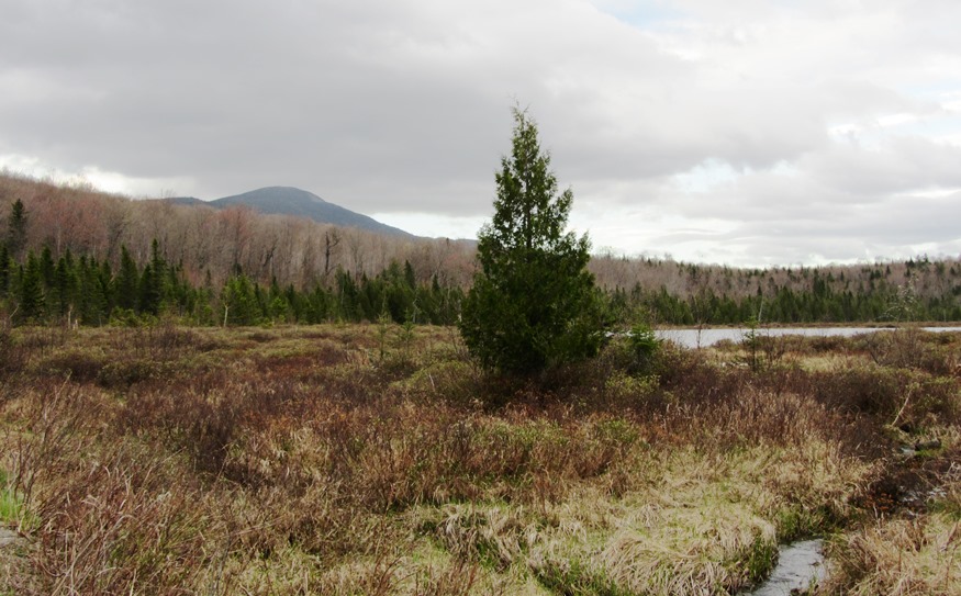
The Lunksoos [pronounced lunksue] area of T3 R7 WELS includes stunning views of the East Branch of the Penobscot River and historic sites such as the Hunt Farm and Lunksoos Camps. In 2014 it was also the local headquarters of Elliotsville Plantation foundation’s “Lunksoos Base Camp.” Not to be confused with Elliotsville Township (once a…
This township is home to Trout Brook Farm Campground in Baxter State Park. A park ranger station is here just off the northern most reach of the park’s Tote Road. Trout Brook flows through in a northeasterly direction to enter Grand Lake Matagamon. The brook crosses the Tote Road near the entrance to the South Branch Ponds. Forest products are harvested in the Scientific Forest Management Area.
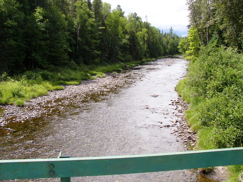
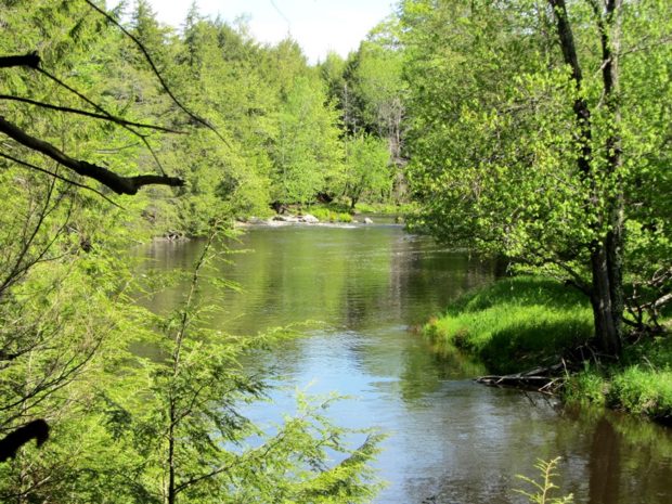
This township is home to the Seboeis River canoe trip put-in on the Grand Lake Road. The 24-mile trip begins at a parking/picnic area near the bridge at N46° 8′ 37.07″ W68° 38′ 0.19″. The trip is most successful in the spring, with high water. These images were taken in August, at relatively low water.…
Wholly within Baxter State Park, also known as T5 R10 WELS, it contains five mountains over 1,700 feet. Trout Brook flow through. Dwelley Pond is it only pond. The Dwelley Pond Trail follows the old Tote Road north to south from near Burnt Mountain to near Strickland Mountain for day hiking, canoeing and fishing.
 N45° 42")
Most travelers see the township from the scenic view on I-95. The attraction is a view of Mount Katahdin over 659-acre Salmon Stream Lake. The outlet of Little Salmon Stream Lake, to the northeast, flows into Salmon Stream Lake. A section of Penobscot Indian Territory is in the northwest corner of the township, along the…

The Island is a City of Portland neighborhood in Casco Bay, accessible by ferry from the terminal on Portland’s waterfront. The brief trip carries freight, vehicles, bicycles and tourists. Little Diamond Island and Great Diamond Island are just to the west. While the population is about 900, the number of people on this 720-acre island…
East of Baxter Park, it is home to Katahdin Woods & Water Recreation Area, Sandbank Campsite, Wassataquoik Public Reserved Land, and Whetstone Falls. West of Stacyville, access is by Swift Brook Road and a network of dirt roads.
")
The West End is well known for its fine 19th and early 20th century houses and tree-lined streets. Its extends west of State Street between Congress Street and Commercial Street to the Western Prom. Several Greater Portland Landmarks are here.

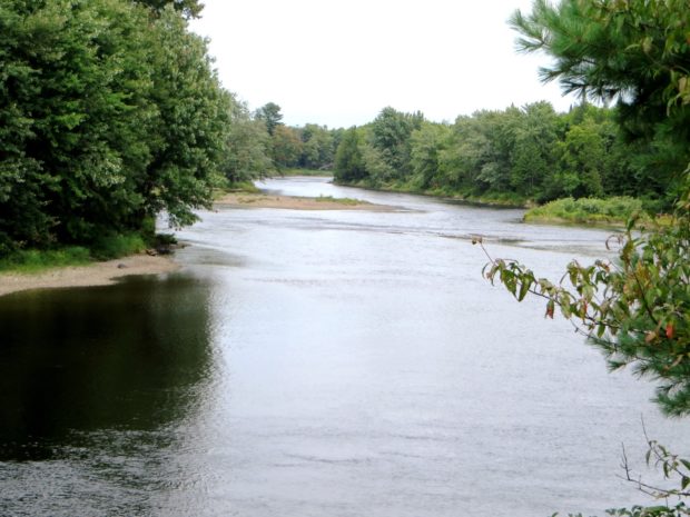
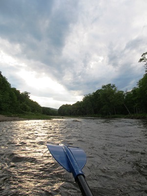
Windows on the River: East Branch Windows on the River: West Branch The Penobscot River Basin drains 8,680 +/- square miles in northeastern Maine. The main stem of the river flows for 105 miles from the confluence of its East and West Branches in Medway, south to its mouth in Penobscot Bay. Approximately 95% of…
This township is just east of Silver Ridge Township in southern Aroostook County. Crisscrossed with dirt logging roads, its main thoroughfare is the 6000 Road from U.S. Route 2 in Silver Ridge Dixie Road in the east terminating on U.S. Route 2A in Glenwood. Macwahoc Stream…
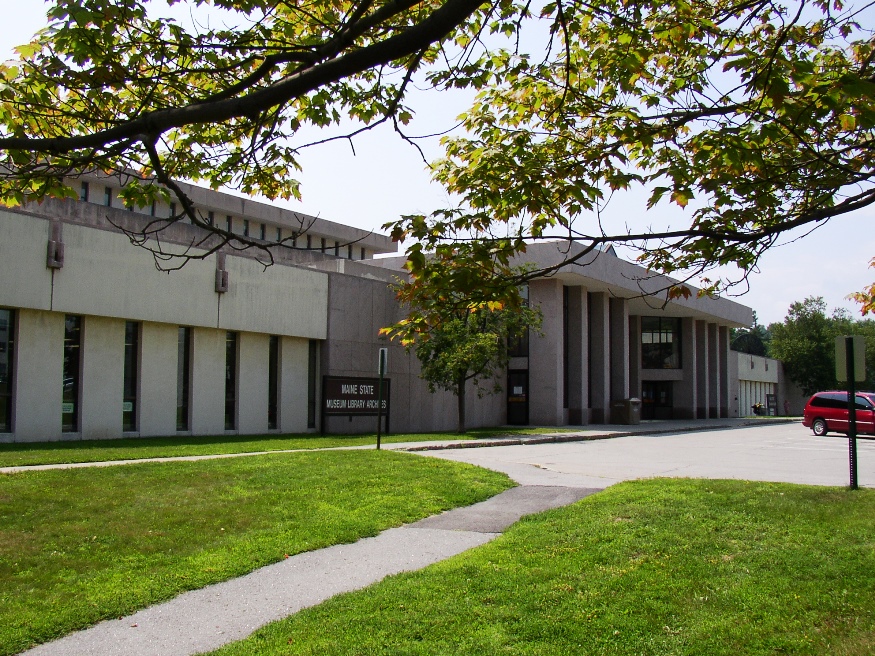
Maine State Cultural Building in Augusta with the State’s Archives, Museum and Library near the State House (2004) The Maine State Archives, located in Augusta, is the custodian of the permanently valuable records of state government, including early court records and vital records (births, deaths, marriages, etc.). According to its website, “The permanently valuable records…
")
A bird somewhat harder to find than the Great Blue Heron, the Little Blue Heron ranges from the Gulf of Mexico and along the Atlantic Coast to their northern most reach in Maine. They feed in marshes, tidal flats and even in some freshwater areas, nesting near wetlands. This one was observed in Winslow Park…
South Freeport is on the broad Harraseeket River leading to Casco Bay. Once a shipbuilding center, it now hosts the town’s public wharf, a marina, a boatyard, and the Harraseeket Yacht Club. Winslow Park on the Bay provides recreation and camping opportunities.
Stroudwater, a neighborhood in the City of Portland, lies west of the railroad tracks to the Westbrook border. Several locations of historical significance include the Tate House Museum, a portion of the Cumberland & Oxford Canal, and an old dam on the Stroudwater River. It is a highly developed residential and commercial area.
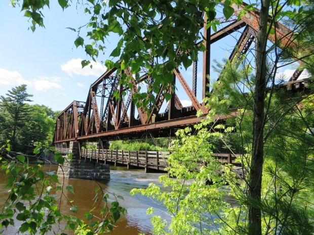
The 1909, 318-foot long truss bridge was built by Pennsylvania Steel Company of Steelton, Pennsylvania, replacing an earlier double-decker bridge. It spans the Androscoggin River between Brunswick and Topsham. According to the website HistoricBridges.org: This double deck bridge is one of the most unusual and unique bridges in Maine due to its suspended highway deck…
Incorporated as a town in 1892, it deorganized in 1937. This township is just north of Brighton Plantation, with Mayfield Corner being the intersection of Routes 16 and 151 and the site of a village in the 19th century. It has private frontage on Otter Pond, Mayfield Pond and Kingsbury Pond. According to a report…
The Cathance River Preserve is one of several preserves in Sagadahoc County. Managed by the nonprofit Cathance River Education Alliance, it features summer camps, educational programs, and research. Its Ecology Center is a learning facility that is itself a model of ecological sensitivity. Located in Topsham, the preserve offers several trails available from dawn to…
The township is north of Moose River in northwestern Somerset County. It should not be confused with Bald Mountain Township T2 R3 BKP EKR, which contains a section of the Appalachian Trail, in northeastern Somerset County east of Caratunk. The township apparently was once a Plantation. The U.S. Census reports four years of population counts:…

For travelers driving north from The Forks to Jackman, and maybe Quebec, Johnson Mount Township is probably just another strip of U.S.Route 201 through the woods. However, for the adventurous seeking a mountain to climb, waterfall or a primitive campsite by a stream, the rewards are nearby. Johnson Mountain is accessible off the (unimproved) Enchanted…