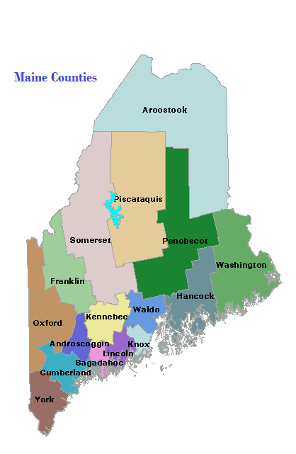
Cumberland County

Map of Maine Counties and Baxter Park

the most populous of Maine’s counties, contains approximately 20% of the state’s population with less than 3% of the state’s land area.  Four of the ten largest communities by population are in Cumberland County. See an 1857 map of the county in the Map Cabinet. The City of Portland dominates the cultural and commercial environment…

Androscoggin County

Map of Maine Counties and Baxter Park

is home to Maine’s second largest population center – the Lewiston-Auburn area, and is fourth in overall population among Maine’s counties.  It was established in 1854 by taking several towns from Cumberland, Kennebec, Lincoln, and Oxford counties. See an1858 map of the county in the Map Cabinet. A commercial and industrial hub, it has been…

Aroostook County

Map of Maine Counties and Baxter Park

the “rooftop of Maine,” John Steinbeck. This northernmost county, known as “the County,” is the state’s largest, established in 1839, during the “Aroostook War.” Famed for its potato growing, the County’s premiere crop has declined steadily, as has its population. Nevertheless, agriculture still dominates the County’s economy and its culture.

Counties

Maine has sixteen counties, as well as hundreds of local governments. The earliest established was York, in 1652; the latest, Knox in 1860. The structure and functions of county government are similar throughout the state. For a brief sketch of each county, click on its name in the map at right. Aroostook is the largest…

January 22

The Bailey Farm Windmill in North Anson (2001)

January 1 2 3 4 5 6 7 8 9 10 11 12 13 14 15 16 17 18 19 20 21 22 23 24 25 26 27 28 29 30 31   1812   Town of Hollis gets its name after having it changed from the original Phillipsburg. 1844 Edward Kavanaugh, member of Congress…