Stratton

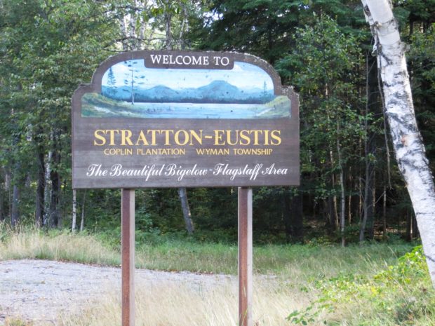
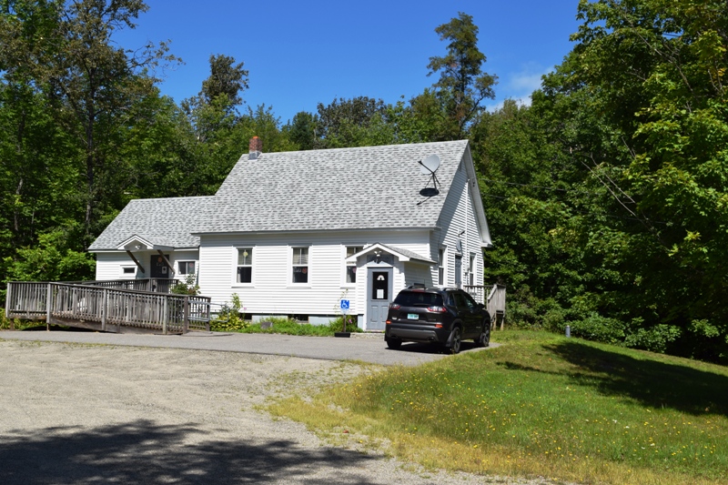
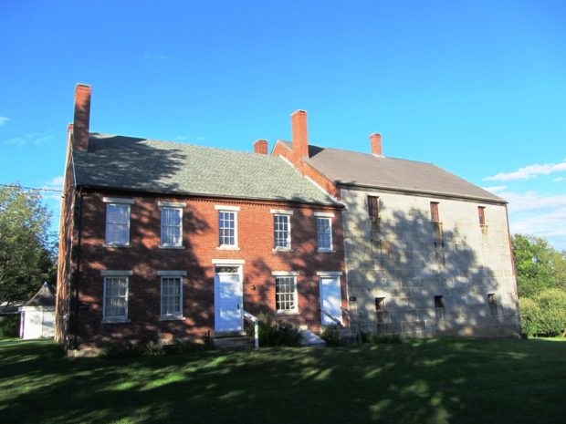
Stratton is a village in the town of Eustis. It is the main village with a small commercial area and civic facilities, including the town office, fire department, library, and post office. The Oramendal Blanchard House, home to the local sawmill owner in the late 19th century, is on the National Register of Historic Places.

Benedicta Township

Plunkett Pond, locally known as Perry Pond, in Benedicta (2015)

Benedicta is located in southern Aroostook County. It was established as a plantation on February 1, 1873 with a population of about 400. Just over one-hundred years later, in 1987, it surrendered its plantation status and became an unorganized township administered by the State.     By 1970 it had reached a historic low of…

Bowdoin College Grant West TWP

[T8 R10 NWP] is located immediately east of Greenville, accessible from that town’s  East Road, then the K1 Road which travels through the township to Gulf Hagas. The K1 road is private and travelers must stop at the North Maine Woods Hedgehog checkpoint on the way to Little Lyford Ponds and Katahdin Iron Works. See…

November 22

The Selectmen

November 1 2 3 4 5 6 7 8 9 10 11 12 13 14 15 16 17 18 19 20 21 22 23 24 25 26 27 28 29 30 1652 Incorporation of the town of York 1876 Birth date of Percival P. Baxter, Governor (1921-1925) and founder of Baxter State Park. 1963 President…

Stonington

The Village at the Harbor (2003)

ts name implies the great granite quarries, four of which were developed after 1870 and supplied material for many buildings in New York City and the Museum of Fine Arts in Boston. Fishing and, increasingly, summer residences provide the mainstay of the local economy. Stonington consistently lands more lobsters than any other port in the State.

Glenwood

Glenwood contains most of Wytopitlock Lake (the balance is in T2 R4 WELS) and Orcutt Brook, which empties into it. In 2004 only a few camps were scattered along the rocky shore. The Bureau of State Parks and Public Lands owns and maintains a boat launch in the shallow outlet cove, located in Glenwood. Wytopitlock Stream is the outlet and the start of a popular canoe trip. Glenwood is subject to the Maine Land Use Regulation Commission, which has identified critical natural areas in the plantation.

York

1787-1794 John Hancock Warehouse and Wharf in York (2018)

Most of the town’s inhabitants are located between U.S. Route 1 (inland) and U.S. Route 1A which runs along the coast. Its population has more than doubled in the past thirty years, and grew by nearly 31 percent between 1990 and 2000. Beaches and cottages characterize the coast.

Yarmouth

Yarmouth is a coastal town northeast of Portland on I-295 and U.S. Route 1. See photos. It is home to the Delorme Mapping Company and North Yarmouth Academy. Cousin’s Island is home to a large, oil fueled electric power plant known as Wyman Station. The Island has ferry terminal for Chebeague Island.

Woolwich

Woolwich Shore on the Kennebec River from Thorne Head in North Bath (2010)

Woolwich, across the Kennebec River from Bath and with long shores on Merrymeeting Bay, is home to two nature preserves. Settled in the 1600s, it has several historic buildings. Alewives have been a historic part of the community.

Woodville

Woodville Town Office on Route 116 in South Woodville (2020)

The town dominates the west side of the great bend in the Penobscot River just south of Medway where the East and West branches combine. Maine Route 116 leaves the River in Chester and cuts through Woodville to Medway.

Woodstock

Not the site of the 1960’s rock concert (that was New York), Woodstock’s major village is Bryant Pond, named from the adjacent water body. The Pond outlet is the source of the Little Androscoggin River. See photos. South Woodstock is home to the small South Woodstock Meetinghouse and is the site of an old mill pond and mill on Andrews Brook.

Woodland

Long view in Woodland on the Colby Siding Road (2003)

With little in the way of a central village, the town lies west of Caribou served by Maine Routes 161 and 228. See photos. Unable to find enough land in New Sweden, members of the Swedish Colony were granted 100 acre lots in Woodland. This northern community, in the heart of potato and forest product country, is not to be confused with the village of Woodland in the town of Baileyville.

Wiscasset

is on U.S. Route 1 and the Sheepscot River. See photos and videos. With many historic structures, the town was host to “The Greenland Expedition of 1925,” which included explorers Richard Byrd and Donald McDonald. Since 1918 Camp Chewonki has been offering outdoor programs here. The town was once best known for its Maine Yankee Atomic Power plant.

Winthrop

Maranacook Lake in Winthrop (2013)

n addition to its recreational attractions, the town is a suburban community serving both the Augusta and Lewiston-Auburn areas. See photos. Winthrop is the birthplace in 1899 of Delphia Louis “Del” Bissonette, who played for the Brooklyn Dodgers.

Winterville Plantation

Location Map for Winterville Plantation

Located about 25 miles south of Fort Kent on Maine Route 11, the area is an attraction for fishermen and hunters. St. Froid Lake (see photo) dominates the plantation by running virtually its whole length from north to south, a watery barrier separating the eastern from the western land portions. Quimby village is on the eastern shore of the lake; Winterville village is on Route 11, about two miles east of the lake.

Winterport

Marsh Bay on the Penobscot River just South of Winterport Village (2003)

Winterport is primarily a rural community with its land area extending ten miles westward from the river. See photos. An attraction along Route 139 among the farms and woods is the Winterport Dragway, featuring auto drag races with specialty vehicles and “street” vehicles. In recent years a marina has expanded and an export business has been established on the river. A dockside freezer operation enabled the storage and shipping of commodities such as fish and chicken.

Winn

Location Map for Winn

Winn village is on U.S. Route 2 between Lincoln and Mattawamkeag on the east bank of the Penobscot River. See photos. During the 19th century, International Paper Company harvested wood to supply its pulp and paper mills. Winn is an agricultural community slowly losing its small population as are many northern Maine towns.