T3 R7 WELS
East of Baxter Park, it is home to Katahdin Woods & Water Recreation Area, Sandbank Campsite, Wassataquoik Public Reserved Land, and Whetstone Falls. West of Stacyville, access is by Swift Brook Road and a network of dirt roads.
"Those seeking cold, hard statistics on Maine communities won't be disappointed." —Bangor Daily News
East of Baxter Park, it is home to Katahdin Woods & Water Recreation Area, Sandbank Campsite, Wassataquoik Public Reserved Land, and Whetstone Falls. West of Stacyville, access is by Swift Brook Road and a network of dirt roads.
")
The West End is well known for its fine 19th and early 20th century houses and tree-lined streets. Its extends west of State Street between Congress Street and Commercial Street to the Western Prom. Several Greater Portland Landmarks are here.

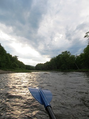
Windows on the River: East Branch Windows on the River: West Branch The Penobscot River Basin drains 8,680 +/- square miles in northeastern Maine. The main stem of the river flows for 105 miles from the confluence of its East and West Branches in Medway, south to its mouth in Penobscot Bay. Approximately 95% of…
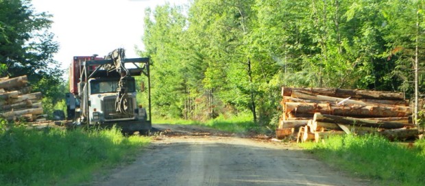
This township is just east of Silver Ridge Township in southern Aroostook County. Crisscrossed with dirt logging roads, its main thoroughfare is the 6000 Road from U.S. Route 2 in Silver Ridge Dixie Road in the east terminating on U.S. Route 2A in Glenwood. Macwahoc Stream…
According to the Oxford English Reference Dictionary “magic” may mean “an inexplicable or remarkable influence producing surprising results.” For hikers of the Appalachian Trail it means relief from the weary, but rewarding, trek for many miles for many days. Sometimes it comes in the form of drinks planted in a cold stream on the trail.…

Mud Brook, with origins in Stacyville, flows south into Herseytown Township and then to Soldiertown Township in Penobscot County where it joins the Penobscot River East Branch. In April 2014 the brook was still at spring flood stage, making access from Route 11 an opportunity for a short trip. Scout Brady Williams identified the spot…
")
Maine has a significant portion of the maple sugaring and maple syrup industry with 14% percent of the U.S. production in 2014. Vermont produced 40%, and New York, 18%. Big Six Township, in northern Somerset County, is said to account for roughly 23% of Maine’s maple sugar production and 4% of the U.S. total production.…
born in Nauskeag (now Woolwich), a ship tradesman in Arrowsic, then governor of Massachusetts Bay Colony, he commanded several military expeditions against the French in Canada. As governor, he pardoned those who were accused in the Salem witch trials.
")
Wind turbines and wind “farms” of many turbines are sprouting all over Maine. Ridges and mountains are the most likely spots. As a result, they are visible for many miles and may intrude on enjoyment of hikers or residents near the devices. Electricity generated by the turbines displace that generated by other sources, including those…
Livermore, the main village, fronts on Brettuns Pond. A boat launch is located off Route 4. Near Livermore village several old community buildings suggest an earlier location for the village center. North Livermore village is centered on twin water bodies, Round Pond and Long Pond. North Livermore Baptist Church graces the community, just north of “The Norlands” a living history center.

T3 R4 BKP WKR This township hosts the Long Falls Dam on the Dead River. That dam maintains the level of Flagstaff Lake, but required the removal of the village of Flagstaff, which was flooded as a result of its construction.. There was a small natural lake at Flagstaff. In 1950, Central Maine Power Company…
")
The township is just south of Jackman on U.S. Route 201. It is the only improved road, except for about two miles of Hardscrabble Road on its town line with Johnson Mountain Township to the south. Parlin Pond, the water body, is a two-mile long pond along U.S. Route 201 in the southern portion of…
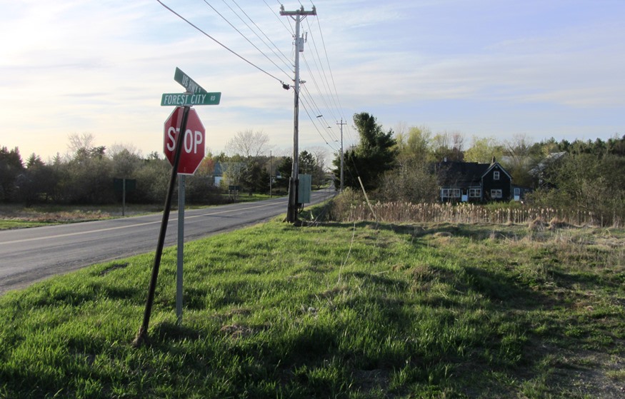
Forest City Township in eastern Washington County was created as a plantation on February 15, 1887 from a portion of the town of Eaton. Eaton no longer exists as a town since its remaining portion was annexed to Danforth. Eaton village in Danforth sits at the southeastern shore of the four-mile long Crooked Brook Flowage…
This township in Oxford County was named for the original grantee, Josiah
Batchelder. It borders New Hampshire in the White Mountain National Forest.
Maine Route 113 runs north-south through the township. Portions of the road, also known as the Evans Notch Road, are closed during the winter. Access is then from Gilead in the north or from Stow in the south.
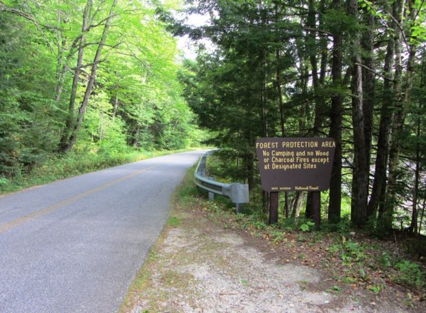
Evans Notch, in the southern portion of the township, is a deep cut among the White Mountains. It is a popular hiking location using the East Royce Mountain Trail to that mountain from two points on Route 113.

canoe tripsThis is a pleasant, scenic, and sometimes challenging trip, on the Sheepscot River. Click on numbered canoe icons at right for video clips. The river at this point runs north to south for about six miles from the East River Road Bridge in Whitefield to Head Tide Dam at Head Tide Village in Alna.…
")
Relics of farmhouses hint at the glory days of Maine’s agricultural tradition. In remote villages, scenes of abandoned homes, churches, and vehicles mark changes in communities as populations ebb. The landscape is littered with these ghosts of Maine’s past, recalling a lost civilization but evoking questions of their secrets. …
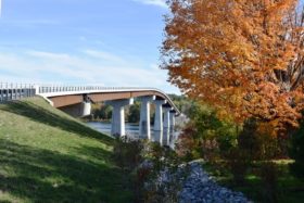
This bridge, built in 1931 by the American Bridge Company was slated for replacement in 2013, and was described in the Federal Infrastructure Projects web site as noted below. The project replaced an 80 year-old movable span truss bridge at the end of its service life with a high level, fixed bridge over the Kennebec…

People who have worked on farms, in forests, on the seas, in mills, factories and offices — all have contributed to the Maine economy over the past nearly four centuries. In the twenty-first century more people are working in commercial, health, electronic, financial and other services than ever before. A perspective of where workers have…

The township, in Washington County, has several coastal harbors, one at the village of South Trescott. During the clipper ship boom of the 1850’s, the vessel Sea Lark was launched in 1852. Served by Maine routes 189 and 191, it has substantial frontage on Cobscook Bay at its northern tip.
")
Carrabasset village in the town of Carrabasset Valley is located along the river of the same name. The village is east of Sugarloaf Mountain, about eight miles by road. It is served by Maine combined Routes 16/27 from Farmington (27) and Anson (16) and by a regional airport. Carrabasset Valley Academy is a private school,…