North Maine Woods
In addition to be a general term for the forests of northern Maine, North Maine Woods is an organization that manages access to a specific area of mostly privately own land.
Land Ownership
The complicated historic land ownership in Maine’s unorganized territories led to a fragmented set of rules and permissions for the use of the state’s forests. Beginning with modest land grants and small privately owned tracts, the north woods later became acquired by large industrial organizations, such as paper companies and land management companies, in the the late 19th and early 20th centuries.
During the 20th century industrial ownerships increased and remaining family ownerships were divided into smaller shares with each succeeding generation. This diverse ownership situation demonstrated the need for more consistent management that would benefit the owners as well as others who wished to use the land primarily for recreation.
North Maine Woods, Inc.
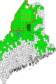
While its boundaries have shifted from time to time, the North Maine Woods, a non-profit corporation, manages an area composed of 155 townships.
As its web site noted in 2015, “Recreational users of the area are guided by one set of uniform regulations and fees. Users do not have to obtain several permits or pay different user fees to many separate landowners.”
The end of river log drives accelerated the development of well-maintained roads to service the large trucks carrying long logs to market. These roads improved access for recreational users seeking places to hunt, fish, hike, canoe and camp.
 In 2015 and later travel is possible throughout the entire area with few restrictions, based on. agreements between adjacent landowners and between landowners and governmental agencies. North Maine Woods has a contract with the Bureau of Parks & Land to collect Allagash Wilderness Waterway and Penobscot River Corridor user fees as visitors pass through its checkpoints and an agreement to maintain campsites on some Public Reserved Lands.
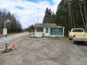
6 Mile Checkpoint on the Realty Road in Garfield Plantation (2015)
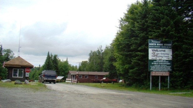
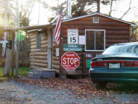
Checkpoints, such as this one in Garfield, are stationed in several locations near the North Maine Woods boundary. They are generally staffed, but they have camera monitors and telephone access to supplement communication when staff is not available.
The Territory
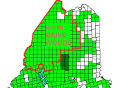
Most of the territory managed by the North Maine Woods is in unorganized townships. A few plantations, Garfield, Nashville, Oxbow, and one town, Allagash (all in Aroostook County) are also included. Links to articles on eastern townships in the NMW area appear below.
Adjacent Townships:
| T12 R07 WELS | Nashville | |||
| T11 R08 WELS | T11 R07 WELS | Garfield | ||
| T10 R09 WELS | T10 R08 WELS | T10 R07 WELS | ||
| T09 R09 WELS | T09 R08 WELS | |||
| T08 R09 WELS | ||||
Search “North Maine Woods” for related articles and images.
Additional resources
“North Maine Woods Authorized Campsites.” https://www.google.com/maps/d/viewer?mid=zyrPi5Hf5XuQ.kR5AiETSAumg (accessed June 24, 2015)
“North Maine Woods, Inc.” http://www.northmainewoods.org/ (accessed May 8, 2015)


