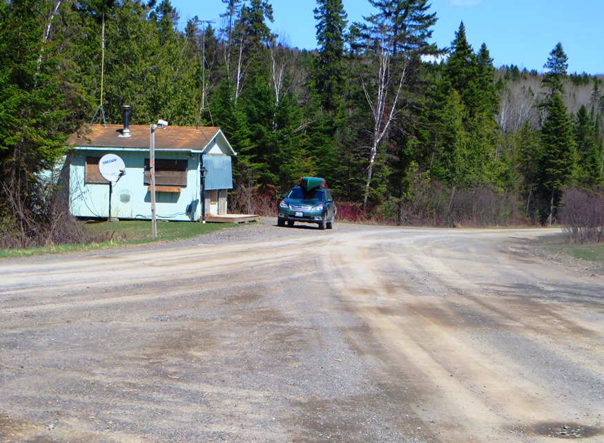
North Maine Woods Checkpoint on American Realty Road in Garfield Plantation (2015)

Location Map for Garfield
| Year | Population |
|---|---|
| 1970 | 104 |
| 1980 | 107 |
| 1990 | 102 |
| 2000 | 86 |
| 2010 | 81 |
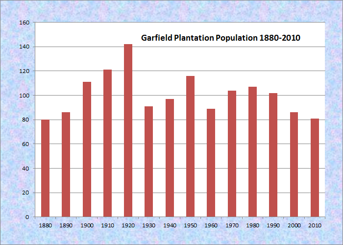
Population Trend 1880-2010
| Geographic Data | |
|---|---|
| N. Latitude | 46:36:25 |
| W. Longitude | 68:30:268 |
| Maine House | District 151 |
| Maine Senate | District 1 |
| Congress | District 2 |
| Area sq. mi. | (total) 38.5 |
| Area sq. mi. | (land) 38.2 |
| Population/sq.mi. | (land) 2.1 |
County: Aroostook
Total=land+water; Land=land only |
|
 N46° 31' 23.00\" W68° 21' 29.04\"")
Garfield RD, Masardis (’15) @
[GAR-field] formerly No.11, Range 6, is a plantation in Aroostook County, first organized on March 26, 1883, organized again on April 13, 1885. Finally its organization was confirmed on March 5, 1895.
This small plantation has struggled to stem population loss from 1970 through 2010.
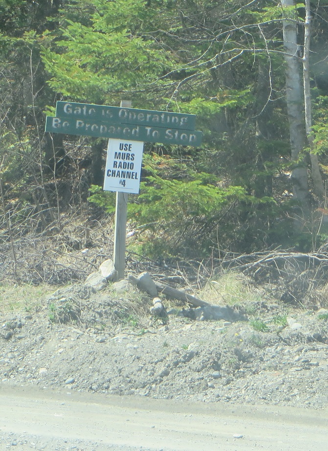
“Gate Operating” sign on the American Realty Road (2015)
The Garfield Road begins off Route 11 in Masardis, winding west then north to the plantation. Realty Road, also known as American Reality Road, runs east-west across Garfield’s northern portion beginning at the town line with Ashland and continuing to adjoining T11 R7 WELS township and beyond.
Just west of Ashland, the Machias River [not the river in Washington County] makes its way through the plantation to join the Aroostook River in Ashland.
Garfield is within the management area of North Maine Woods, Inc. whose Six Mile Checkpoint is located 6 miles west of Ashland on the Realty Road. North Maine Woods, Inc. represents an association of landowners to help manage access and provide information to those owners. Occasionally closed, the checkpoint is usually staffed from Spring to Fall. A camera monitors the checkpoint and a telephone is available to contact the Woods management if needed.
 N46° 38' 9.48\" W68° 31' 40.63\"")
Checkpoint on Realty Road in Garfield (2015) @

Fork at Realty Road and Pinkham Road (2015)
Pinkham Road branches south (left) from Realty Road just past the checkpoint. It follows along a section of Maine Public Reserved Land, a 1,040 acre lot that was an original public lot dating back to 1841.
Access is by permission of abutting landowners on summer roads. Maine’s Bureau of State Parks and Public Lands management goals for this section were indicated in a recent report:
Focus forest management on producing multiple age classes over time. Grow quality spruce, fir, hemlock and hardwoods and retain some large old hemlock for wildlife.
The age diversity in the overstory will help in improving overall diversity and achieving these goals. Perform timber stand improvements if commercially feasible, and retain some old hemlock as wildlife legacy trees.
Garfield is subject to the Maine Land Use Regulation Commission, which has identified critical areas as noted on the map below. Click to enlarge. See disclaimers.
")
Garfield Plantation Land Use Guidance Map (2014)
The major roads are well groomed dirt but with sufficient pits and bumps to warrant caution. Side roads must be approached with care, especially in Spring or wet weather.
")
Notice at North Maine Woods Checkpoint on American Realty Road (2015)
")
Signs at the intersection of American Realty Road and Pinkham Road (2015)
The North Maine Woods management has its rules to protect both landowners and visitors in this active logging environment with loaded trucks hurtling toward mills.
Form of Government: Assessors-Annual Meeting.
Additional resources
Maine. Land Use Regulation Commission. http://www.maine.gov/tools/whatsnew/attach.php?id=9913&an=1 (accessed March 13, 2014)
Maine. Department of Agriculture, Conservation and Forestry. “Garfield Plantation Lot.” Augusta, Me. 2009. https://www.maine.gov/dacf/parks/get_involved/planning_and_acquisition/management_plans/docs/SmallLotsthroughAppendices.pdf (accessed March 13, 2014)