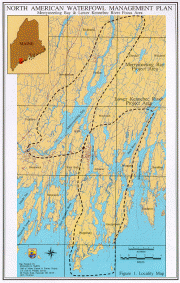
Merrymeeting Bay is a broad expanse of water at the confluence of the Kennebec and Androscoggin rivers, and four smaller rivers: the Eastern (from Dresden), the Abagadasset, the Cathance (both from Bowdoinham), and the Muddy (from Topsham).
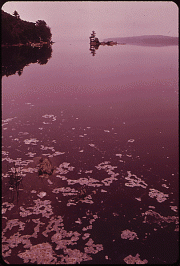
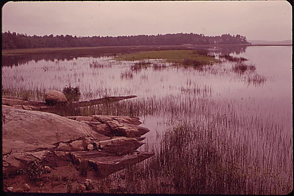
In the mid-twentieth century, the Androscoggin, which empties into Merrymeeting Bay, was the most polluted river in the state. (See photos below.)
Thanks to documentation of the problem by the U.S. Environmental Protection Agency (EPA), and subsequent federal laws, the river and the bay have both recovered substantially.
The Maine Department of Conservation, in its overview of Focus Areas for Conservation in Southern and Central Maine, comments that
Merrymeeting Bay has long been recognized as a habitat of special significance for both wildlife and rare plants. Bald eagles nest in several locations around the Bay — most notably Swan Island — and the Bay supports numerous eagles during the winter. Over 50 species of freshwater fish use the Bay, as well as ten species of anadromous fish, including the rare Atlantic salmon, shortnosed sturgeon and Atlantic sturgeon. At least one rare mussel species inhabits the Bay, and one of the Bay’s small tributaries is the state’s only known location for the redfin pickerel.
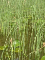
Merrymeeting Bay’s freshwater tidal marshes support some of the best habitat for certain rare plant species anywhere in the northeast.
The wide bay is created as the two rivers flow directly toward each other: the Androscoggin moving northeast and the Kennebec surging southwest. The overflow heads toward the sea through the relatively narrow “Chops” on the east side of the bay. As may be imagined, the water becomes treacherous at times with the force of the two rivers plunging through its gap.
According to a 1998 report prepared for the Friends of Merrymeeting Bay,
Merrymeeting Bay is an inland, freshwater river delta, encompassing 9,600 acres of wetland habitat. Seventeen miles upstream from the mouth of the Kennebec River, the Bay is subject to the tidal forces of the Gulf of Maine: it exhibits a six foot tidal range. Merrymeeting Bay is one of the largest and most important freshwater tidal ecosystems in the country. (Gulf of Maine Coastal & Estuary Project: 1994)
Merrymeeting Bay is not a bay, despite its appearances. At the convergence of two great rivers, it is much more like a freshwater river than a bay, but with two significant differences: 1) it is partially impounded by the constriction known as the Chops and 2) it is subject to the action of the tides. Unlike most rivers, the Bay has vast, vegetated intertidal flats which support a very productive and diverse biological community. . . . Finally, although subject to the action of the tides (undoubtedly the source of its identification as a “bay”), the Bay is essentially freshwater in nature with little of the biological community associated with marine and estuarine ecosystems.
1973 photos from the National Archives collection of U.S. Environmental Protection images. Reference numbers respectively:# NWDNS-412-DA-8265, and # NWDNS-412-DA-8.
Additional resources
Maine Department of Conservation, Bureau of Geology and Natural Areas, Maine Natural Areas Program. Augusta, Maine.
Burroughs, Franklin. Confluence: Merrymeeting Bay. Gardiner, Me. Tilbury House. 2006.
“Location Map” from Friends of Merrymeeting Bay, P.O. Box 233, Richmond, Maine. http://www.friendsofmerrymeetingbay.org/fombnew/index.htm
Koulouris, Becky, et al. Merrymeeting Bay Notes: Notes for Comprehensive Planning in the Bay Region. 1990. [University of Maine School of Law. Garbrecht Law Library; Maine State Library]
MERRYMEETING BAY SALMON HABITAT RECOVERY UNIT, GENERAL CONSERVATION PLAN [DRAFT] for National Marine Fisheries Service, Northeast Regional Office, Protected Resources Division, Gloucester, MA. October 3, 2011. http://www.nero.noaa.gov/prot_res/altsalmon/conservationplan/general/Merrymeeting%20Bay%20SHRU%20GCP%20-%20Oct%202011-1.pdf (accessed January 21, 2012)
Resource Services. “Merrymeeting Bay: An Environmental Review.” Prepared for Friends of Merrymeeting Bay. Brunswick. 1998.


I began visiting here about 1948 when 10. My great uncle Osker was caretaker for a judge, Lou Jack and lawyer , John Jack . For many years our extended family from Canada to Connecticut (We were from Vt.) visited each year for 2 – 3 weeks which were the happiest of times. We have occupied all three camps at the entrance to Pleasant Point. I have since visited several times on day trips and have enjoyed the eagles nests and the company of the owners friendly dogs on the hike to the Point. The cordiality of the current owner, Mr. Trafton has been a heartwarming surprise. Pleasant Point has provided some of the most memorable moments of my life.
Although not mentioned in the article, my father many times told me the bay is one of the country’s finest places for hunting migratory waterfowl. He and one of my brothers came home with a Canada goose, one of the most difficult game birds to hunt because they are so intelligent. I’ve watch Canada geese feeding in cut back corn fields in the fall. You could draw a line beyond which they will not feed near a road. The distance? The range of a shotgun.