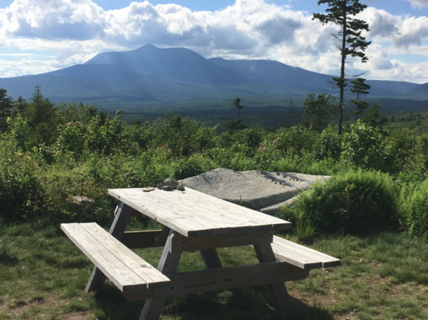
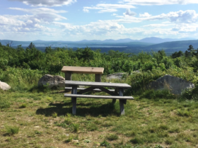
In August 2016, President Barak Obama designated this area a National Monument. It was offered to the United States government by the Roxanne Quimby Foundation, which has established a substantial endowment with the National Park Foundation to support the administration the monument.
Katahdin Woods and Waters Recreation Area, east of Baxter State Park, contains about 87,500 acres within a larger landscape already conserved by public and private efforts starting in the early 20th century. It contains a significant piece of this natural and cultural landscape where the East Branch of the Penobscot River and its tributaries, including Wassataquoik Stream and the Seboeis River, run freely. Since the glaciers retreated 12,000 years ago, these waterways and associated resources have attracted people to the area. Native Americans still cherish these resources. Lumberjacks, river drivers, and timber owners have earned their livings here. Artists, authors, scientists, conservationists, recreationists, and others have drawn knowledge and inspiration from this landscape.
For some 11,000 years, Native peoples have inhabited the area, depending on its waterways and woods for sustenance. They traveled during the year from the upper reaches of the East Branch of the Penobscot River and its tributaries to coastal destinations like Frenchman and Penobscot Bays. Native peoples have traditionally used the rivers as a vast transportation network, seasonally searching for food, furs, medicines, and many other resources. Much of the archeological record of this Native American presence remains to be discovered here. The Wabanaki people, in particular the Penobscot Indian Nation, consider the Penobscot River (including the East Branch watershed) a centerpiece of their culture and spiritual values.
The first documented Euro-American exploration of the Katahdin region dates to a 1793 survey commissioned by the Commonwealth of Massachusetts. After Maine achieved statehood in 1820, Major Joseph Treat, guided by John Neptune of the Penobscot Tribe, produced the first detailed maps of the region. The Maine Boundary Commission authorized a survey of the new State in 1825, for which surveyor Joseph C. Norris, Sr., and his son established the “Monument Line,” which runs through Katahdin Woods and Waters and serves as the State’s east-west baseline from which township boundaries are drawn.
Logging
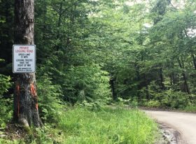 By the early 19th century until the late 20th century, logging was a way of life throughout the area. To access the upstream forests, a tote road was built on the Wassataquoik’s north bank around 1841. In the 1880s, after the choice pines were gone, loggers switched to spruce long logs, and built camps, depots, and many dams on the Wassataquoik to control its flow for the log drives. Log driving was dangerous, and many men died on the river and were buried nearby. A large fire in 1884 damaged logging operations on the Wassataquoik, and an even larger fire in 1903 put an end to the long log operations. The East Branch of the Penobscot River and its major tributaries served as a thoroughfare for huge log drives headed toward Bangor. Log drives ended (based primarily on environmental concerns) in the 1970s, after which the timber companies relied on trucking and a network of private roads they started to build in the 1950s.
Recreation
In the 1800s, the infrastructure that developed to support the logging industry also drew hunters, anglers, and hikers to the area. In the 1830s, within 2 miles of one another on the eastern side of the Penobscot East Branch, William Hunt and Hiram Dacey established farms to serve loggers, which soon also served recreationists, scientists, and others who wanted to explore the Katahdin region or climb its mountains. Just across the East Branch from the Hunt and Dacey Farms (the latter now the site of Lunksoos Camps) lies the entrance to the Wassataquoik Stream. In 1848, the Reverend Marcus Keep established what is still called Keep Path, running along the Wassataquoik to Katahdin Lake and on to Mount Katahdin. From that time until the end of the 19th century, the favored entryway to the Katahdin region started on the east side of Mount Katahdin with a visit to Hunt or Dacey Farm, then crossed the East Branch and ascended the valley of the Wassataquoik Stream.
Henry David Thoreau approached from the headwaters of the East Branch to the north. With his Penobscot guide Joe Polis and companion Edward Hoar in 1857, on his last and longest trip to the area, he paddled past Dacey Farm with just a brief stop at Hunt Farm. During his 1879 Maine trip on which he climbed Mount Katahdin, Theodore Roosevelt followed the route across the East Branch and up the Wassataquoik. As Roosevelt later recalled, he lost one of his hiking boots crossing the Wassataquoik but, undaunted, completed the challenging trek in moccasins. Many including Roosevelt himself have observed that his several trips to the Katahdin region in the late 1870s had a significant impact on his life, as he overcame longstanding health problems, gained strength and stamina, experienced the wonder of nature and the desire to conserve it, and made friends for life from the Maine Woods.
Native Mainer Percival P. Baxter, too, followed this route on the 1920 trip that solidified his determination to create a large park from this landscape. Artists and photographers have left indelible images of their time spent in the area. In 1832, John James Audubon canoed the East Branch and sketched natural features for his masterpiece Birds of America. Frederic Edwin Church, the preeminent landscape artist of the Hudson River School, first visited the area in the 1850s, and in 1877 invited his landscape-painter colleagues to join him on a well-publicized expedition from Hunt Farm up the Wassataquoik Stream to capture varied views of Mount Katahdin and environs. In the early 1900s, George H. Hallowell painted and photographed the log drives on the Wassataquoik Stream, and Carl Sprinchorn painted logging activities on the Seboeis River.
Geology
The oldest rock in Katahdin Woods and Waters, a light greenish-gray quartzite interlayered with slate from the early Cambrian period (over 500 million years ago), can be observed along the riverbank of the Penobscot East Branch for over 1,000 feet at the Grand Pitch (a river rapid).
The area’s geology also provides prominent evidence of large and powerful earth-changing events. During the Paleozoic era (541 to 252 million years ago), mountain-building events contributed to the rise of the primordial Appalachian Mountain range and the amalgamation of the supercontinent Pangaea. Following the last mountain-building event, significant erosion reshaped the topography, helping to expose the cores of volcanoes, the Katahdin rock structure, and the structure of the previous mountain-building events.
This post-glacial topography is studded with attractive small mountains, including some like Deasey, Lunksoos, and Barnard, that offer spectacular views of Mount Katahdin. Katahdin Woods and Waters abuts much of Baxter State Park’s eastern boundary, extending the conservation landscape through shared mountains, streams, corridors for plants and animals, and other natural systems.
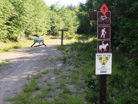 East Branch of the Penobscot River system includes its major tributaries, Seboeis River and Wassataquoik Stream, and many smaller tributaries. Known as one of the least developed watersheds in the northeastern United States, the Penobscot East Branch River system has a stunning concentration of hydrological features in addition to its significant geology and ecology. The main stem of the East Branch drops over 200 feet in about 10 miles through a series of rapids and waterfalls — including Stair Falls, Haskell Rock Pitch, Pond Pitch, Grand Pitch, the Hulling Machine, and Bowlin Falls.
Forests
Katahdin Woods and Waters has significant biodiversity. Spanning three ecoregions, it displays the transition between northern boreal and southern broadleaf deciduous forests, providing a unique and important opportunity for scientific investigation of the effects of climate change across ecotones. The forests include mixed hardwoods like sugar maple, beech, and yellow birch; mixed forests with hardwoods, hemlock, and white pine; and spruce-fir forests with balsam fir, red spruce, and birches. In wetland areas, black spruce, white spruce, red maple, and tamarack dominate.
Wildlife
The expanse of Katahdin Woods and Waters, located next to other large conservation properties including Baxter State Park and additional State reservations, supports many wide-ranging wildlife species including ruffed grouse, moose, black bear, white-tailed deer, snowshoe hare, American marten, bobcat, bald eagle, northern goshawk, and the federally threatened Canada lynx. Seventy-eight bird species are known to breed in the area, and many more bird species use it. Visitation and study of the area have been limited to date, as compared with other areas like Baxter State Park, and many more species of birds and other wildlife may be present.
Katahdin Woods and Waters’s daytime scenery is awe-inspiring, from the breadth of its mountain-studded landscape, to the channels of its free-flowing streams with their rapids, falls, and quiet water, to its vantages for viewing the Mount Katahdin massif, the “greatest mountain.” The area’s night skies rival this experience, glittering with stars and planets and occasional displays of the aurora borealis, in this area of the country known for its dark sky.
Access
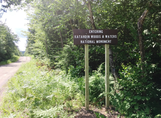
See the “Directions” link below. From Route 11 in Stacyville, one follows the Swift Brook Road through T3 R7 WELS about 3 miles to the southeast portion of the Monument and a sign “Entering Katahdin Woods & Waters.” Continue another 2.5 miles to a sign prompting a left turn (at N45° 52′ 50.17″ W68° 36′ 13.92″) to Katahdin Loop. In 1.5 miles cross over the Whetstone Falls bridge on the East Branch of the Penobscot River. Then continue about 5 miles to the Katahdin Loop Road (N45° 52′ 26.50″ W68° 42′ 20.89″). [This is all our best estimates; use at your own risk!]
Additional resources
Obama, Barack. “Presidential Proclamation — Establishment of the Katahdin Woods and Waters National Monument.” Washington, DC. August 24, 2016. https://obamawhitehouse.archives.gov/the-press-office/2016/08/24/presidential-proclamation-establishment-katahdin-woods-and-waters (accessed July 3, 2017)
“Directions to Katahdin Woods and Waters National Monument.” https://www.nrcm.org/wp-content/uploads/2016/05/KWWNMwrittendirections.pdf [In July 2017 there was no access to KWWNM near the southern entrance to Baxter State Park, so follow directions carefully! Setting your GPS to N45° 52′ 49.31″ W68° 33′ 31.65″ may help.]


