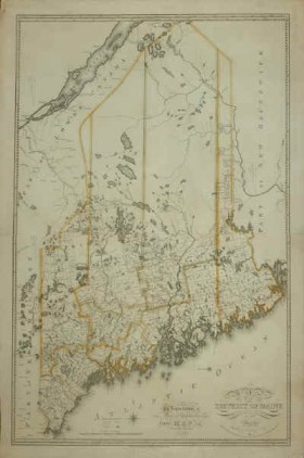
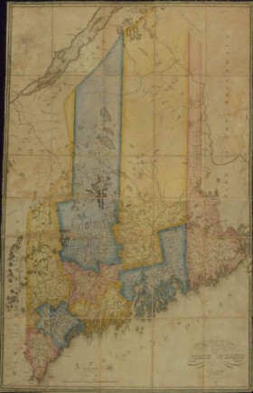
(1777-1834) was a geographer and one who believed that Maine’s economic and civil success would be best supported by a clear understanding of its geographic, economic, and demographic resources. He became know as “Maine’s First Mapmaker.”
[Click each map to see more detailed images from the Osher Map Library.]
Born in 1777 in Newburyport, Massachusetts, he is best known for his large, colorful maps of Maine published in the early nineteenth century.
When he was thirteen, his family moved to New Gloucester in the District of Maine. By 1799 he opened the first of several general stores he owned as he moved across Maine, his last being in Bangor near where the Kenduskeag Stream enters the Penobscot River.
According to Macdougall, young Mr. Greenleaf, by that time, was looking for a new start and had four objectives for himself: independence, rank, competence, and respectability.
In 1811 he settled in Williamsburg (now an unorganized township) based on a deal with the owner of the township that he would bring settlers and prosperity to the area in exchange for a chance to buy a share of the township with profits he hoped to generate.
Always interested in fostering development in Maine, he published his “Statistical View of Maine” in 1816, and produced a “Survey of the State of Maine” accompanied by a map showing patterns of settlement since 1778, along with political and property data. He later became known as “Maine’s first map-maker” and one of the best of his time.
By 1825, Greenleaf had determined that slate deposits in Williamsburg would produce a great return to investors. Although he heavily promoted attracting labor and transportation to the area, nearby Brownville quarries were more favorably located and were developed before the Williamsburg deposits could be exploited.
Greenleaf was heavily involved in surveying land in the remote townships. At one point, probably in 1829, he was working with a neighbor, William Hammatt who had bought several townships to the north [of Williamsburg] and was an agent for Massachusetts, selling stumpage on several more towns still owned by the commonwealth.
Just how involved Moses was with Hammatt’s venture is impossible to say, but the two men were together in the wilderness, cruising and surveying, when Moses came down with typhoid. He was too sick to move that morning as his neighbor built a shelter over him and placed water and the little food they had within his reach. Hammatt went for help and a week later Greenleaf was carried home. However, his aging body never recovered sufficiently to continue the backwoods surveying he had done so long.
His “Survey of the State of Maine” nearly ruined him financially because of its cost and the initial lack of interest in it. Luckily, the Maine Legislature apparently saw the value in having firm information about the state to promote its development. Although the State purchased many copies, Greenleaf apparently saw little of it himself.
He died in Williamsburg on March 20, 1834.
Attributions
Greenleaf, Moses. 1815. “Map of the District of Maine from the Latest and Best Authorities.” Boston: Cummings & Hilliard, 1815. Osher Map Library and Smith Center for Cartographic Education, University of Southern Maine. http://www.oshermaps.org/exhibitions/printed-maps-of-maine-1793-1860/ii-moses-greenleaf-maines-greatest
Greenleaf, Moses. 1820. “Map of the District of Maine from the Latest and Best Authorities … 1820.” Boston: Cummings & Hilliard, 1820. Osher Map Library and Smith Center for Cartographic Education, University of Southern Maine. http://www.oshermaps.org/exhibitions/printed-maps-of-maine-1793-1860/ii-moses-greenleaf-maines-greatest
Additional resources
Correspondence of the Greenleaf family of Williamsburg, Maine, 1821-1913. Williamsburg, Me., 1821-1913. Maine State Library safe file box.
Greenleaf, Moses. A Statistical View of the District of Maine; More Especially with Reference to the Value and Importance of its Interior. Boston. Cummings and Hilliard at the Boston Bookstore, No. 1, Cornhill. 1816.
Greenleaf, Moses. Atlas. [accompanying his Survey of Maine.)
Greenleaf, Moses. Survey of Maine. A Survey of the State of Maine in Reference to its Geographic Features, Statistical and Political Economy; Illustrated by Maps. Portland. Shirley and Hyde. 1829.
Macdougall, Walter M. Settling the Maine Wilderness: Moses Greenleaf, His Maps, and His Household of Faith, 1777-1834. Portland, Me. Osher Library Associates. 2006.
Osher Map Library and Smith Center for Cartographic Education. Albert Brenner Glickman Family Library. University of Southern Maine. Portland, Maine.
Smith, Edgar Crosby, ed. Moses Greenleaf, Maine’s first map-maker: a biography: with letters, unpublished manuscripts and a reprint of Mr. Greenleaf’s rare paper on Indian place-names, also a bibliography of the maps of Maine. Bangor, Me. Printed for the De Burians [by C. H. Glass & co.]. 1902.


