
Location Map for Freedom
| Year | Population |
|---|---|
| 1970 | 373 |
| 1980 | 458 |
| 1990 | 593 |
| 2000 | 593 |
| 2010 | 717 |

Population Trend 1820-2010
| Geographic Data | |
|---|---|
| N. Latitude | 44:30:20 |
| W. Longitude | 69:20:30 |
| Maine House | District 99 |
| Maine Senate | District 11 |
| Congress | District 2 |
| Area sq. mi. | (total) 22.2 |
| Area sq. mi. | (land) 21.5 |
| Population/sq.mi. | (land) 33.4 |
County: Waldo
Total=land+water; Land=land only |
|
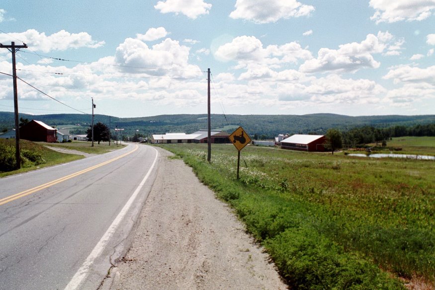
Farm with pond, barns, and silos on Route 137
[FREE-dum] is a town in Waldo County, settled in 1794 by Revolutionary War soldier Stephen Smith. He built the first house, with the help of his brothers. Soon other Smiths arrived, leading it to become known as Smithtown. Freedom was incorporated on June 11, 1813 from Beaver Hill Plantation.
The town is the birthplace of Daniel F. Davis, state legislator and governor of Maine 1880-1881.
Freedom Academy was incorporated on February 18, 1836. In 1909 it had three teachers and 69 students. The Academy building burned in 1947 and the replacement building burned in 1957. In the 1880’s, the town supported nine public schoolhouses with a population, in 1880, of 652.
According to the draft 2011 Comprehensive Plan,
The three acre Freedom Park, near the center of town, occupies the original grounds of Freedom Academy. Two monuments are at the park. One is on an area that had been the front lawn of Freedom Academy and commemorates the school. The second is close to the ball field and is dedicated to Harold “Red” Mitchell. A Veterans Memorial Bench is on the grounds and the Veterans Monument at Pleasant Hill Cemetery will be moved to the Park in the near future.
")
Old Townhouse on Townhouse Road (2005)
 (2005)")
Dirigo Grange No. 98, 32 Belfast Road (Route 137) (2005)
Sandy Pond, also known as Freedom Pond, has a boat launch for easy access. Freedom village is at its northeast tip.
Maine routes 137 and 220 serve the community, which is just south of Unity.
")
Store and Grange on Route 137 (2001)
From 1890 through 1990, Freedom’s population averaged about 500 people. In 2000 and 2010, the U.S. Census reported substantial increases to 645 and 719 respectively.
Again, the 2011 draft Plan notes:
Nineteenth century Freedom was a center of industry and prosperity. By 1850 there were 950 residents in town which supported a variety of industries including a flour mill, woolen mill, shingle mill, corn mill, a tannery and shovel factory. To support the population the town also had a dry goods store, two cheese makers, millinery, general store, barber shop, two blacksmiths, and a shoe store. The town also had a physician and dentist. None of these businesses, except a general store, exists today.
Today Freedom is a bedroom community between Waterville and Bangor, and north of Belfast.
")
The Village from the West on Route 137 (2005)
")
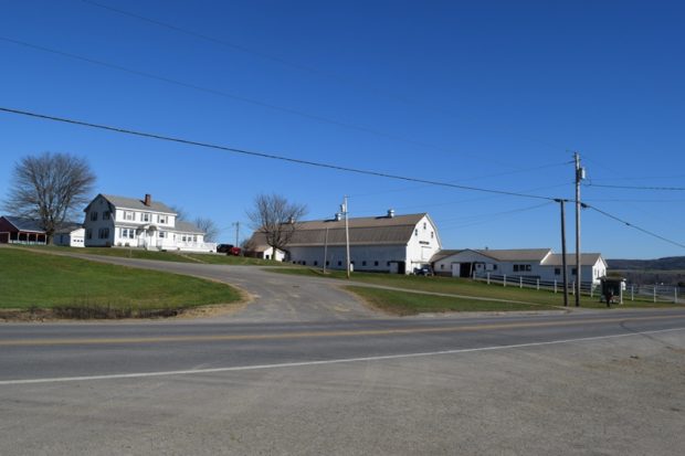
Farm on Route 137 (2001)
Form of Government: Town Meeting-Select Board.
-

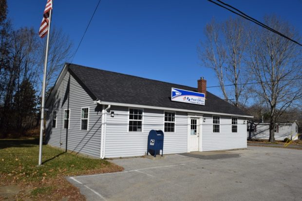
- Post Office, Freedom Maine
-
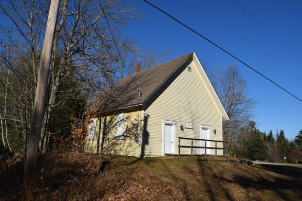
- Freedom Town Meeting House
-
- Dairy Near Knox Corner
-
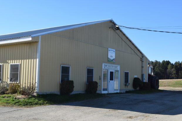
- Large modern dairy farm on Knox Ridge South
Additional resources
Elliott, Norman. Cemetery inscriptions of Freedom, Maine. Maine Old Cemetery Association, 1971.
The Academy Echo. (Published by the students of Freedom Academy) Freedom, Me. Freedom Academy. Serials v.5-17, 1901-37. [University of Maine, Fogler Library, Special Collections]
Historical scrapbook: Freedom, Maine, 1794-1976. Thorndike, Me. Hutchins Brothers, 1976.
Mosher, Elizabeth M. (transcriber). Vital records of Freedom, Waldo County, Maine, prior to 1892. Camden, Me. Picton Press. 1991.
Town of Freedom. Draft 2011 Comprehensive Plan. https://www.maine.gov/spo/landuse/compplans/plans/freedom/Freedom_Comp_Plan_Draft_w_Appendices.pdf (accessed December 2, 2011)
National Register of Historic Places – Listings
Photos, and edited text are from nominations to the National Register of Historic Places researched by Maine. Historic Preservation Commission.
Full text and photos are at https://npgallery.nps.gov/nrhp
Keen Hall, 1927-1957
Keen Hall is the last building associated with Freedom Academy which was authorized by a special act of the state legislature in1836 and continued to operate until destroyed by fire in 1957. The small rural village is proud of their educational heritage which included the only secondary academy in the county for many years. As a result of fires or deterioration, all other school and support buildings associated with the academy are gone as are one room and later elementary schools.
Keen Hall is significant for its association with educational history in the area. The existing home was purchased for the academy in 1927 to serve as the principal’s house. It alleviated the problem of finding local housing and helped attract well qualified principals to administer and teach at the school. The house sits on a sloping lot at the corner of Route 137 and Main Street, less than a quarter mile from the former academy. Also known locally as the Principals House, this building is significant as the last physical reminder of the areas early and long lasting commitment to secondary education. The building was moved forward on its original lot in 1930 to accommodate the construction of State Route 137.The property retains eligibility for the stated period of significance as the single surviving property most closely associated with education in Freedom.
Mill at Freedom Falls, Freedom, 1834-1962
Built initially in 1834 as a gristmill on Sandy Stream in the town of Freedom, the Mill at Freedom Falls functioned as an industrial site for 133 years. The building’s history, which includes conversion to a wood turning mill (or “turnery”) in the last decade of the 19th century, reflects the predominant land use patterns of the region and the viability of enterprises designed to serve those land uses.
The mill features a traditional timber frame superstructure that housed the operating equipment, set atop a high dry-laid granite, stream side foundation that housed the waterpower system. This general composition characterized countless 19th century mills throughout the state, often making use of locally available raw materials, both in their construction and their production.
Although several other mill sites were utilized in Freedom, by virtue of its height and location, this mill was, throughout its years of operation the dominant industrial structure on the landscape and remains the dominant building today. The mill at Freedom Falls was listed in the National Register as “a property associated with events that have made a significant contribution to the broad patterns of our history”, and architecture, as “a property that embodies the distinctive characteristics of a type, period or method of construction”. The period of significance for this property encompasses both the period of operation as a gristmill, 1834 to circa 1894, and the period of operation as a wood turning mill, from circa 1894 to 1962, shortly before operations ceased and the building was abandoned.
I just found academy echo may 1903. It was dedicated to mr. killam.he would have been related francis killam who used to live in my home. I have enjoyed reading it.