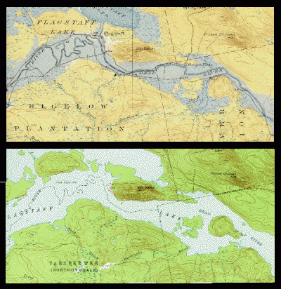
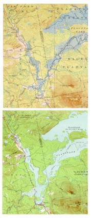
The bulk of Flagstaff Lake (maps on right) cover Flagstaff, Bigelow, and Dead River townships in western Somerset County. See also Bigelow Township.The North Branch of the Dead River (maps on left) flows through the town of Eustis.
Comparing the course of the Dead River in 1928 (upper maps) with that in 1956 (lower maps), one can appreciate two things. First, how much the low lands and the old river bed have been flooded in 1950 by the Long Falls Dam that created Flagstaff Lake.
Second, how difficult it must have been for Benedict Arnold’s men to follow the winding path of the river when it had overflowed its banks during the heavy rains of October 1775. He finally did so, turning northwest and camping at Shadagee Falls in Jim Pond Township on October 23rd on his way to the Chain of Ponds, Coburn Gore, and then Canada.
Benedict Arnold’s Expedition Route – click a Bateau

 <== To Quebec To Beginning ==>
Topographic maps were created from the University of New Hampshire Dimond Library, Documents Department & Data Center, Historic USGS Maps of New England & New York, accessed 1/14/2008: Stratton, ME Quadrangle (1928 and 1956), http://docs.unh.edu/nhtopos/Stratton.htm.


