State Parks

Camden Harbor (2001)

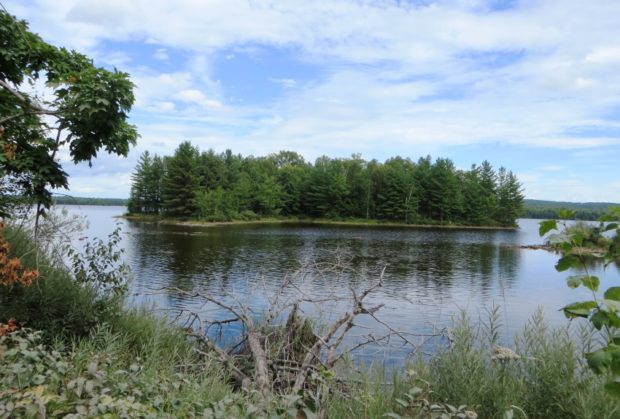
and other public outdoor recreational areas State Parks Allagash Wilderness Waterway (Aroostook County). A canoe camper’s paradise. This 92-mile corridor of lakes and river is surrounded by a vast commercial forest. If you plan to canoe the Allagash, contact the Maine Bureau of Parks and Lands. Aroostook State Park (Presque Isle). On Echo Lake. Swimming,…

T2 R10 WELS

Nesowadnehunk Falls on the Penobscot West Branch (2018)

Nesowadnehunk Falls on the Penobscot West Branch (2018)     Three Routes This township, officially known as T2 R10 WELS, is the crossroad of two major “highways” in Maine: The Golden Road and the Appalachian Trail. Both travel the Abol Bridge over the West Branch of the Penobscot River. The Golden Road From east of…

T3 R11 WELS

Ripogenus Gorge

This township is located east of the southern portion of Baxter State Park.  Both the Golden Road and the West Branch of the Penobscot River span its width.  Ripogenus Dam, Lake, and Gorge are major geographic features. [See related Chesuncook]                              …

T3 R12 WELS

Chesuncook Lake from the Golden Road (2012)

Commanding the southern portion of Chesuncook Lake and much of Caribou Lake and Ripogenus, the township is accessed by the Golden Road from Greenville or Millinocket.                 Allagash Gateway Campground offers tenting, a store, LG gas supply, swimming, fishing, and boating. Situated on the shore of Ripogenus Lake,…

T4 R9 NWP

sign: "Piscataquis County Line, Entering T4 R9" (NWP) on Route 11 (2014)

       Piscataquis County Line Entering T4 R9 WELS   Community This township is in north central Maine in Piscataquis County. It is dominated by Seboeis Lake and the Seboeis Maine Public Reserved Land, which surrounds most of the Lake. Two small settlements, Schoodic and Packards, are in the west of the township along…

Trout Brook Township Campground Baxter Park

Trout Brook from the north side of the bridge on the Perimeter Road in Baxter State Park (2007)

This township is home to Trout Brook Farm Campground in Baxter State Park. A park ranger station is here just off the northern most reach of the park’s Tote Road. Trout Brook flows through in a northeasterly direction to enter Grand Lake Matagamon. The brook crosses the Tote Road near the entrance to the South Branch Ponds. Forest products are harvested in the Scientific Forest Management Area.