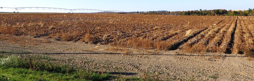
Irrigation Equipment in a Potato Field in Castle Hill (2014)

Location Map For Castle Hill
| Year | Population |
|---|---|
| 1970 | 519 |
| 1980 | 509 |
| 1990 | 449 |
| 2000 | 454 |
| 2010 | 425 |
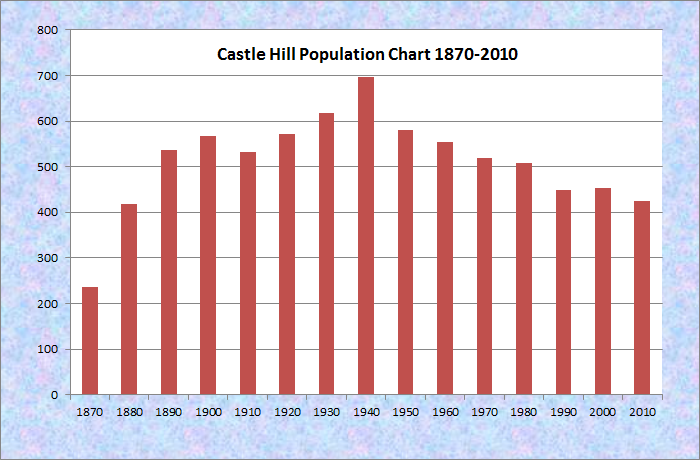
Population Trend 1870-2010
| Geographic Data | |
|---|---|
| N. Latitude | 46:41:58 |
| W. Longitude | 68:13:38 |
| Maine House | District 146 |
| Maine Senate | District 1 |
| Congress | District 2 |
| Area sq. mi. | (total) 37.0 |
| Area sq. mi. | (land) 37.0 |
| Population/sq.mi. | (land) 11.5 |
County: Aroostook
Total=land+water; Land=land only |
|
")
[KAS-el HILL] a town in Aroostook County, incorporated on February 25, 1903 from Castle Hill Plantation. According to George Varney, the 1886 landscape of the then plantation appeared as follows:

Potato Field, Fall 2001
It is on the stage-line [Route 227] from Presque Isle to Ashland. . . . The township is without high hills and large ponds. . . . The Universalists and the Baptists have societies in the town, and sustain ministers a portion of the time. The plantation has six public schoolhouses . . .
Castle Hill’s population in 1870 was 237, leaping to 419 in 1880. The 1,341 foot high Haystack Mountain is the only exception to Varney’s characterization of the landscape.
")
Haystack Mountain from Haystack Road (2001)
Phineas Ellis was the first town manager of Castle Hill, and served neighboring Mapleton in that position as well. He was in the legislature from 1935 to 1937, and again in 1947. Ellis, in Call Me Phin, wrote about the infamous lynching of Jim Cullen of Mapleton in Presque Isle in 1873.
This small, rural community is served by Maine Route 227 ten miles west of Presque Isle and a small section of Route 163 in its southeast corner, known as the Haystack Road. Locally the town has four roads: Dudley, McDonald, Turner and Waddell. The unimproved Richardson Road, extending north from Turner Road, passes close by the namesake Castle Hill near a major bend in the Aroostook River.
 N46° 40' 51.92\" W68° 12' 25.94\"")
The Dudley Road (2014) @
 N46° 41' 25.21\" W68° 14' 16.68\"")
The McDonald Road (2014) @
 N46° 42' 59.16\" W68° 13' 19.38\"")
Church:Turner Rd/Rt 227 ’14@
In 2013 “A Comprehensive Plan for the Towns of Mapleton, Castle Hill and Chapman,” was adopted by each town.
A brief history, condensed here, was included in the Plan:
In 1843, early settlers and surveyors found their way to Northern Aroostook County. The region boasted of prime forests, fertile farm lands, one mountain, a river abundant with speckled trout and few beaver ponds, as well as swamps and rocky hills.
The Aroostook River snaked its way through the tall timbers and green countryside. Near the river atop a steep hill, a large structure was erected by early surveyors. The log building and platform sat with the grandeur of a castle positioned to see many miles up and down the river during the Aroostook War. For this, the township was named.
 N46° 44' 4.09\" W68° 11' 6.19\"")
Castle Hill Grange No. 260 on State Road (2015) @
The River, in the northwest corner of the town, is largely inaccessible except for rough woods roads and trails. After the “War” was settled in 1843, settlement increased, especially in the 1850s. Thereafter new schools were built, and growth continued throughout the 19th century. The Castle Hill Grange was formed in 1903 and its building doubled as the town hall.
Few community buildings remain, but evidence of a small settlement remains at the intersection of the McDonald Road and the old stage road.
")
Two Unoccupied Buildings at the Corner of McDonald Road and Route 227 (2014)
")
Large Maple Tree at the Corner of McDonald Road and Route 227 (2014)
The boom times of the 1920s raised local incomes and the value of livestock. The Great depression changed all this, as it did for most Americans. Since then the town has relied on potato farming and logging as its primary source of employment.
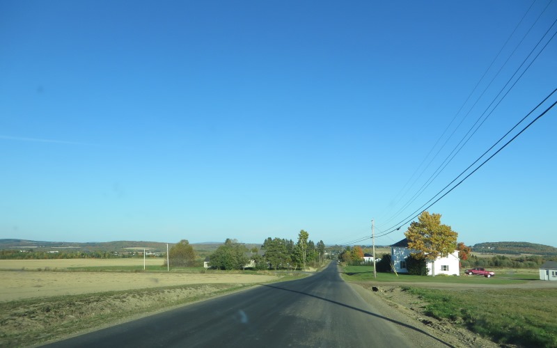
Long View on the Dudley Road toward Mapleton (2014)
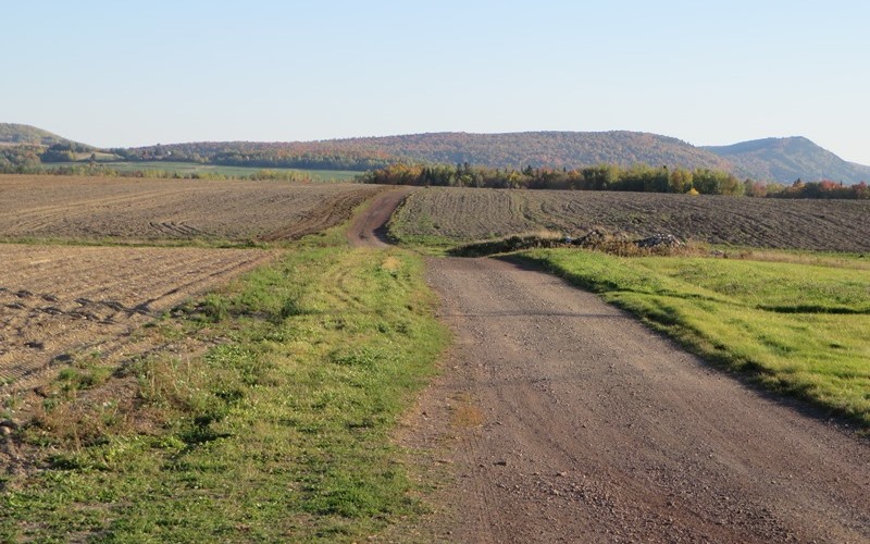
Potato Fields near the Dudley Road in Castle Hill (2014)
Form of Government: Town Meeting-Select Board-Manager.
Additional resources
Ellis, Phineas E. Call Me Phin. Caribou, Me. Custom Printers. c1977.
Lynds, Jen. “‘Call Me Phin’ reprinted, tells of life in the County.” Bangor Daily News. http://bangordailynews.com/2010/08/14/news/lsquocall-me-phinrsquo-reprintedtells-of-life-in-the-county/
Moody, Doris. [Folklore: local characters; phantom hitchhiker story; poem; jokes] Orono, Me. The Author, 1965. (Cataloger Note: Northeast Archives number 288. Fieldwork done in Perham, Washburn, Wade and Castle Hill, Maine. Material was acquired for the Northeast Archives of Folklore and Oral History, Maine Folklife Center, University of Maine, Orono. Completed for UM course: Comparative literature 180.)
Northern Maine Development Commission. A Comprehensive Plan for the Towns of Mapleton, Castle Hill and Chapman. Caribou, Me. 2009. http://www.maine.gov/dacf/municipalplanning/comp_plans/Mapleton-Castle_Hill-Chapman_2012.pdf (accessed March 4, 2014)
Potter, L. F. The Murder of Granville Hayden [manuscript] [1873?] (Cataloger Note: Accompanied by: photocopies of 3 newspaper articles, Bangor Daily News, June 17, July 18, ? 1965, by Oscar Nelder concerning the murder of Granville Hayden and lynching of Jim Cullen.) [University of Maine at Presque Isle. Library and Learning Resource Center]
Varney, George J. A Gazetteer of the State of Maine. 1886. p. 168.