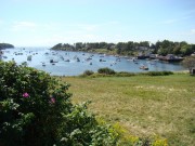
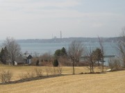
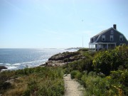
The Bay contains about 200 islands (depending on what one counts as an “island” but only about 138 “good sized” islands). The Bay is bounded by Cape Elizabeth in the south and Cape Small in the north. Halfway Rock is about half way between the two capes which are about twenty miles apart, and about midway between Portland Head Light to the south and Seguin Island Light to the north. The Bay’s approximately 200 square miles of water and islands, was once the mouth of the Androscoggin River before its outlet was blocked and it joined the Kennebec at Merrymeeting Bay.
The name has uncertain sources: Native American for “muddy” (at low tides) or “Blue Heron.” Spanish explorer Estaban Gomez may have thought it was shaped like a helmet, Spanish for helmet.
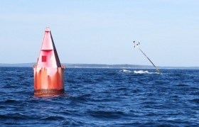
Navigation aids are critical to safe boating along the coast. Bells and gongs are colorful, pleasant sounding reminders of where you are, especially if the fog rolls in unexpectedly! The islands provide extraordinary shelter when rough weather strikes the Gulf of Maine.
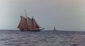
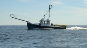
Casco Bay is heavily used by recreational boaters, touring schooners, fishing vessels, ferries to the islands, and commercial tankers. Over twenty small boat sewage “pumpout” facilities reduce sewage pollution. Stringent discharge laws prevent large passenger ships from dumping sewage and galley water.
While such pollution is a threat to the fishing industry, the invasive green crab is considered the major factor in the decline of soft shell clams along the coast. This crab arrived in the ballast of ships from Europe in the 19th century. By 1900 they were first found in Maine in Casco Bay.
Peaks Island is the most heavily populated. Eagle Island hosts Admiral Peary’s summer home. Chebeague Island recently gained independence as a separate town from Cumberland.
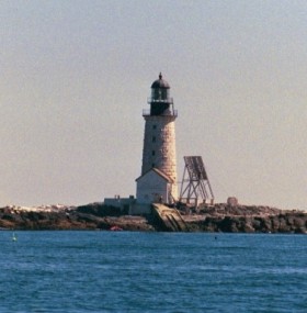
Located roughly 10 miles east of Portland Head and halfway between Cape Elizabeth and Cape Small in Phippsburg, the 76-foot granite block Halfway Rock lighthouse was erected in 1869. It contained a third order Fresnel lens, and housed its keepers in rooms inside the tower. Halfway Rock Light was one of the most difficult posts due to its treacherous location. In the winter and during storms it was inaccessible.
In 1960 a new modern house, boathouse and helicopter-landing pad replaced the old boathouse. The Fresnel lens was replaced in 1975 with an automated light. Today the lighthouse virtually stands alone on Halfway Rock, its outbuildings either damaged or destroyed by storms and deterioration due to age.
The lighthouse is currently leased from the Coast Guard by the Wells-based non-profit American Lighthouse Foundation to be maintained for future generations. The tower has fallen into serious disrepair and the interior is rapidly deteriorating. In 2012 the Coast Guard offered the structures to nearby towns. None accepted, so the Coast Guard is evaluating the bids from a 2014 public auction. More information on the lighthouse at www.mainepreservation.org. (See historic significance below.)
Because of its location almost surrounded by heavily populated areas, the Bay is vulnerable to pollution, primarily through water runoff. The Casco Baykeeper, the Friends of Casco Bay, and others monitor water quality and advocate for a clean bay. SEE Casco Bay and Climate Change.
More Videos!
Additional resources
Bachelder, Peter Dow. The Lighthouses & Lightships of Casco Bay. Cape Elizabeth, Me. Provincial Press. c1995.
Caldwell, Bill. The Islands of Casco Bay. Portland, Me. 1982.
Casco Bay Bulletin. South Portland, Me. Friends of Casco Bay. [periodical]
Edmund S. Muskie Institute of Public Affairs. The Economic Value of Casco Bay. Augusta, Me. Maine Coastal Program. 1990.
Frappier, William J. Steamboat Yesterdays on Casco Bay: the Steamboat Era in Maine’s Calendar Island Region. Toronto Stoddart. 1993.
Heinig, Christopher S. Economic Analysis of the Soft-shell Clam, Mya arenaria, Industry in Casco Bay. Portland, Me. Casco Bay Estuary Project., 1995.
MacIsaac, Kimberly E. The Casco Bay islands, 1850-2000. Charleston, S.C. Arcadia Pub. 2004.
Rowe, William Hutchinson. Shipbuilding Days in Casco Bay, 1727-1890, being footnotes to the maritime history of Maine. Freeport, Me. Bond Wheelwright Co. 1966, c1929.
*United States. Department of the Interior. National Park Service. “Halfway Rock Light Station.” https://npgallery.nps.gov/pdfhost/docs/nrhp/text/88000150.PDF (Accessed March 20, 2017)
National Register of Historic Places – Listings
Halfway Rock Light Station
[Casco Bay off Bailey Island South Harpswell] The nearly 66-foot Halfway Rock Light Station occupies a shallow rock ledge in Casco Bay. This dangerous position is in a very heavily trafficked approach to Portland. Significantly, the station maintains its integrity of design, materials, setting and association with the historic context of maritime transportation in Maine.
In 1869 the construction of the light was authorized with an appropriation of $50,000. It became operational on August 15, 1871, by which time the boathouse and slip were completed. In 1888 a bell tower was added; in 1889 a new boathouse was built. An oil house was built in 1890; a fog signal was added by 1905. The light was automated in 1975.*


