")

Location Map for Bancroft
| Year | Population |
|---|---|
| 1970 | 53 |
| 1980 | 61 |
| 1990 | 66 |
| 2000 | 61 |
| 2010 | 68 |
| Geographic Data | |
|---|---|
| N. Latitude | 45:41:10 |
| W. Longitude | 67:58:35 |
| Maine House | District 144 |
| Maine Senate | District 2 |
| Congress | District 2 |
| Area sq. mi. | (total) 40.5 |
| Area sq. mi. | (land) 40.0 |
| Population/sq.mi. | (land) 1.7 |
County: Aroostook
Total=land+water; Land=land only |
|
is a town in Aroostook County, incorporated on February 05, 1889 as a town from Bancroft Plantation, which itself was formed from the unorganized township of Baskenhegan Gore, T1 R2. The railroad has been a presence in the village for many years.
")
 N45° 40' 20.08\" W68° 1' 58.62\"")
Baskenhegan Stream flows through the town eventually emptying into Baskenhegan Lake in Brookton Township in Washington County.
Rising from Mattawamkeag Lake many miles to the north, the Mattawamkeag River flows through the town and passes the main village of Bancroft. Modest homes are seen on School House Road, near the river. The well kept one-room school is a reminder of a community institution long since shuttered.
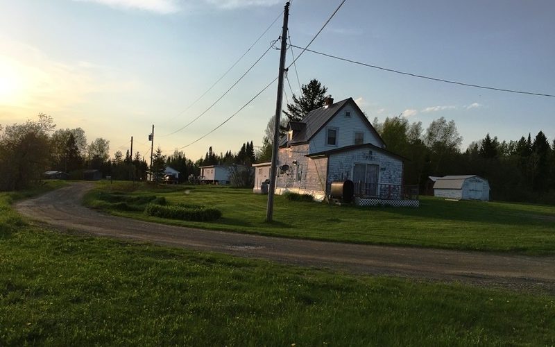
School House Road (2017)
 N45° 40' 25.48\" W68° 1' 51.37\"")
The School House (2017)
The town’s veterans memorial recalls the individuals who served in World War I, World War II, Korea and Vietnam. Presented on Memorial Day in 1998, it was a gift from “Bancroft Helping Hand.”
")
Bancroft Veterans Memorial (2017)
 N45° 40' 41.81\" W68° 1' 33.60\"")
The Mattawamkeag River (2017)
Form of Government: Town Meeting-Select Board.
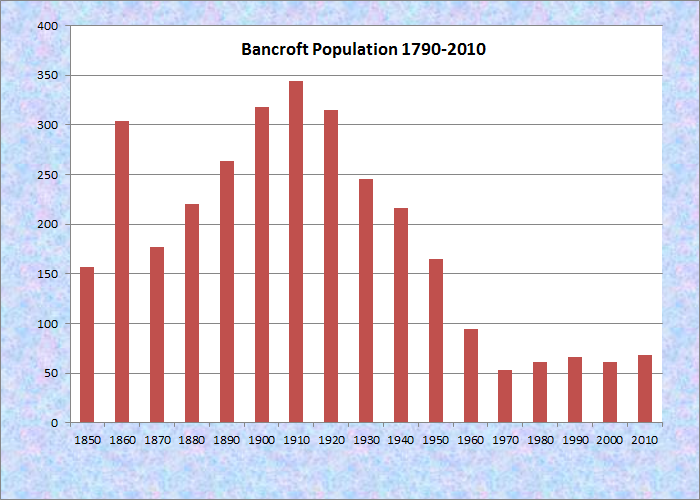
Population Trend 1850-2010